Valentine River
| Valentine River | |
| River | |
| Country | Canada |
|---|---|
| Province | Ontario |
| Region | Northeastern Ontario |
| District | Cochrane |
| Part of | James Bay drainage basin |
| Tributaries | |
| - right | Little Valentine River |
| Source | Valentine Lake |
| - location | Stoddart Township |
| - elevation | 249 m (817 ft) |
| - coordinates | 49°43′03″N 84°03′02″W / 49.71750°N 84.05056°W |
| Mouth | Lac Pivabiska |
| - location | Hanlan Township |
| - elevation | 235 m (771 ft) |
| - coordinates | 49°49′13″N 83°44′33″W / 49.82028°N 83.74250°WCoordinates: 49°49′13″N 83°44′33″W / 49.82028°N 83.74250°W |
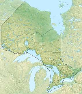 Location of the mouth of the Valentine River in Ontario | |
The Valentine River is a river in Cochrane District in northeastern Ontario, Canada.[1] It is in the James Bay drainage basin, and is a tributary of Lac Pivabiska, the source of the Pivabiska River.
Course
The Valentine River begins at Valentine Lake in geographic Stoddart Township[2] and flows northeast to take in the right tributary Little Valentine River. It heads north under Ontario Highway 11 and the Ontario Northland Railway Calstock–Cochrane branch (originally part of the National Transcontinental Railway), continues north to enter Fushimi Provincial Park, then arrives at Fushimi Lake as that lake's main tributary, where it enters geographic Bannerman Township[3] at the northeast of the lake. It leaves the park and lake at the northeast and heads east over The Chutes into Hanlan Lake, then southeast into geographic Hanlan Township[4] and past the settlement of Fontaine's Landing into Wolverine Lake. The river then continues east to its mouth at Lac Pivabiska, the source of the Pivabiska River. The Pivabiska River flows via the Missinaibi River and the Moose River to James Bay.
Tributaries
- Wolverine Creek (left)
- French Creek (right)
- Brulé Creek (right)
- Penhall Creek (right)
- Little Valentine River (right)
References
- ↑ "Valentine River". Geographical Names Data Base. Natural Resources Canada. Retrieved 2016-11-25.
- ↑ "Stoddart" (PDF). Geology Ontario - Historic Claim Maps. Ontario Ministry of Northern Development, Mines and Forestry. Retrieved 2016-11-25.
- ↑ "Bannerman" (PDF). Geology Ontario - Historic Claim Maps. Ontario Ministry of Northern Development, Mines and Forestry. Retrieved 2016-11-25.
- ↑ "Hanlan" (PDF). Geology Ontario - Historic Claim Maps. Ontario Ministry of Northern Development, Mines and Forestry. Retrieved 2016-11-25.
Other map sources:
- Map 14 (PDF) (Map). 1 : 1,600,000. Official road map of Ontario. Ministry of Transportation of Ontario. 2010-01-01. Retrieved 2016-11-25.
- Restructured municipalities - Ontario map #3 (Map). Restructuring Maps of Ontario. Ontario Ministry of Municipal Affairs and Housing. 2006. Retrieved 2016-11-25.