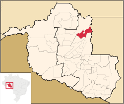
Vale do Anari
| Vale do Anari | ||
|---|---|---|
| ||
 within Rondonia State | ||
| Coordinates: 9°51′27″S 62°10′29″W / 9.85750°S 62.17472°WCoordinates: 9°51′27″S 62°10′29″W / 9.85750°S 62.17472°W | ||
| Area | ||
| • Land | 3,135.141 km2 (1,210.485 sq mi) | |
| Elevation | 140 m (460 ft) | |
| Population (2010) | ||
| • Total | 9,361 | |
| Demonym(s) | anariense | |
| Time zone | UTC-4 | |

Vale do Anari is a municipality located in the Brazilian state of Rondônia. Its population was 10,471 (2005) and its area is 3,135 km².[1]
History
The municipality was instated by law n°572 (22 June 1994), signed by governor Oswaldo Piana Filho, with its area taken from Machadinho d'Oeste municipality.
The municipality contains part of the 346,861 hectares (857,110 acres) Jaru Biological Reserve, a fully protected conservation unit created in 1984.[2] It contains the 537 hectares (1,330 acres) Seringueira Extractive Reserve, one of a number of small sustainable use units in the region whose primary product is rubber.[3] The municipality also contains the Aquariquara Extractive Reserve, also created in 1995.[4]
References
- ↑ IBGE -
- ↑ Unidade de Conservação: Reserva Biológica do Jaru (in Portuguese), MMA: Ministério do Meio Ambiente, retrieved 2016-04-27
- ↑ RESEX Seringueira (in Portuguese), ISA: Instituto Socioambiental, retrieved 2016-06-07
- ↑ RESEX Aquariquara (in Portuguese), ISA: Instituto Socioambiental, retrieved 2016-08-30
Capital: Porto Velho | ||
| Alvorada d'Oeste |  | |
| Ariquemes | ||
| Cacoal | ||
| Colorado do Oeste | ||
| Guajara-Mirim | ||
| Ji-Parana | ||
| Porto Velho | ||
| Vilhena | ||
This article is issued from Wikipedia - version of the 9/1/2016. The text is available under the Creative Commons Attribution/Share Alike but additional terms may apply for the media files.