Upper Dir District
| Upper Dir District میانہ ڈوگ ڈوگرہ دیر بالا | |
|---|---|
| District | |
| Country | Pakistan |
| Province | Khyber Pakhtunkhwa |
| Established | 1996 |
| Headquarters | Dir |
| Area | |
| • Total | 3,699 km2 (1,428 sq mi) |
| Population (2014) | |
| • Total | 899,000 |
| • Density | 194/km2 (500/sq mi) |
| Time zone | PST (UTC+5) |
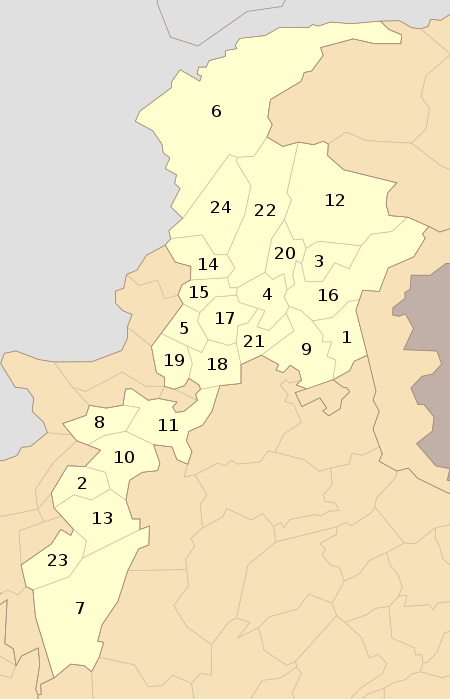
| Number of Tehsils | 6 |
Upper Dir (Pashto: دیر بالا) is one of the 26[1] districts of Khyber Pakhtunkhwa. At the time of independence, Dir was a princely state ruled by Nawab Shah Jehan Khan. It was merged with Pakistan in 1969 and later on declared as a district in 1970. In 1996, it was bifurcated into Upper and Lower Dir districts. This district is situated in the northern part of Pakistan. It borders Chitral district and Afghanistan on the north and north west and Swat district to the east, and on the south by Lower Dir District.[2]

Towns
Except for Dir and a number of rapidly growing bazaar towns along the main roads, the population is rural, scattered in more than 1200 villages in the deep narrow valleys of the Panjkora and its tributaries.
Of these, notable villages are
Division of Dir

Dir district was officially split into Upper Dir and Lower Dir in 1996. Until 2000 as funds were not available to provide the accommodation needed at Dir town by government departments at a district headquarters, both districts continued to be administered by a single deputy Commissioner stationed at Timergara in Lower Dir.
Popular places[3]
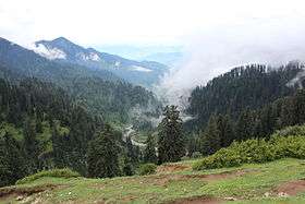
- Doog Dara
- Kumrat Valley
- Ushirai Dara
- Shahi Koto
- Nehag Dara
- Barawal
- Ganori
- Nowra
- Lowari Top
See also
References
| Wikimedia Commons has media related to Upper Dir district. |
Coordinates: 35°12′15″N 71°52′20″E / 35.20417°N 71.87222°E