U11 (Berlin U-Bahn)
The U11 line is a planned line of the Berlin U-Bahn.
It was featured in the Berlin city transport development plan (StEP) in 1995 and the zoning of 2004 and 2009[1] as a route control system.
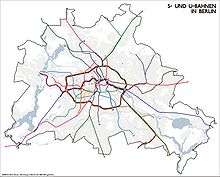
The U11 would connect the eastern districts of Berlin to Berlin Hauptbahnhof. It would comprise extend 15.8 kilometers, with 21 stations, which are:
- Berlin Hauptbahnhof (ICE, IC, RB, RE, InterConnex, Harz-Berlin-Express, S5, S7, S75, U55)
- Naturkundemuseum (U6)
- Berlin Nordbahnhof (S1, S2, S25)
- Rosenthaler Platz (U8)
- Rosa-Luxemburg-Platz (U2)
- Mollstraße
- Platz der Vereinten Nationen
- Langenbeckstraße
- Landsberger Allee (S41, S42, S8, S85, S9)
- Franz-Jacob-Straße
- Weißenseer Weg
- Vulkanstraße
- Genslerstraße
- Arendsweg
- Rhinstraße
- Bürknersfelde (possible transition to the S-Bahn)
- Marzahn (S7)
- Marzahner Promenade
- Ringenwalder Straße
- Glambecker Ring.
References
- ↑ Senatsverwaltung für Stadtentwicklung Berlin
This article is issued from Wikipedia - version of the 12/28/2014. The text is available under the Creative Commons Attribution/Share Alike but additional terms may apply for the media files.