U.S. Route 52 in North Carolina
| ||||
|---|---|---|---|---|
|
Route of US 52 in North Carolina highlighted in red | ||||
| Route information | ||||
| Maintained by NCDOT | ||||
| Length: | 150.3 mi[1][2] (241.9 km) | |||
| Existed: | 1934 – present | |||
| Major junctions | ||||
| South end: |
| |||
|
| ||||
| North end: |
| |||
| Location | ||||
| Counties: | Anson, Stanly, Cabarrus, Rowan, Davidson, Forsyth, Stokes, Surry | |||
| Highway system | ||||
| ||||


U.S. Route 52 is a north–south United States highway that runs for 150 miles (240 km) from the South Carolina state line, near McFarlan, to the Virginia state line, near Mount Airy. It serves as a strategic highway through the central North Carolina Piedmont.[3] Though an even numbered U.S. Route, it is signed north-south in North Carolina (standard convention being to label even numbered U.S. Routes with east-west designations). In some other states along its route, it is signed east-west. The North Carolina segment is signed such that U.S. 52 north corresponds to the general westward direction of the highway, and visa-versa.
Route description
US 52 enters North Carolina at Mount Airy. A bypass around Mount Airy, which carries US 52 is designated as the Andy Griffith Parkway. It goes by Pilot Mountain one of the most distinctive natural features in North Carolina. Through the Piedmont Triad region, US 52 is mostly a limited-access freeway. The route joins Interstate 85 Business into Lexington, North Carolina and shares Interstate 85 around Salisbury, North Carolina. The segment of US 52 from Interstate 40 in Winston-Salem, North Carolina to Lexington is currently being upgraded to Interstate highway standards for the future Interstate 285 corridor. The segment from northern Winston-Salem to just south of Mount Airy is expected to form part of the Interstate 74 corridor through North Carolina.
South of the Triad area after splitting from Interstate 85 in Salisbury, US 52 is typically a two-lane route linking some of the state's smaller cities and towns. Albemarle is the largest municipality along this segment of US 52 to the South Carolina state line.
Between Salisbury and Albemarle in Northern Stanly county, US 52 bisects the campus of Pfeiffer University in Misenheimer. Misenheimer may be the only municipality in America whose only traffic light is not at an intersection of two or more streets, but at a crosswalk to accommodate pedestrian traffic (the crosswalk being across US 52 connecting the two parts of Pfeiffer's campus on opposite sides of the highway).
Andy Griffith Parkway
The Andy Griffith Parkway is an 11 mile (18 km) section of U.S. Route 52 in northern Surry County, North Carolina dedicated in honor of actor Andy Griffith. U.S. Route 52 through this stretch is a limited- controlled-access four-lane divided highway. Approximately 5.5 miles (8.9 km) of the 11 mile (18 km) section passes through the corporate limits of Griffith's hometown of Mount Airy, North Carolina.[4]
Background
Due to its close proximity to Pilot Mountain State Park, in 1977 U.S. Route 52 through Surry County and Stokes County was dedicated as the Pilot Mountain Parkway by the North Carolina Department of Transportation. However, in March 2002, the North Carolina Department of Transportation was approached by a grassroots group of residents of Mount Airy that felt that a highway dedication for Griffith was long overdue.
The group proposed to rename an 11 mile (18 km) section of the Pilot Mountain Parkway running from the Interstate 74 interchange north to the Virginia state line to the Andy Griffith Parkway.The Pilot Mountain Parkway designation would remain from the Interstate 74 intersection south through Stokes County.
The group had the support of the dedication from several North Carolina state agency officials that included: Governor Mike Easley, State Treasurer Richard H. Moore and NCDOT Division 11 Board Member Sam Erby. Each of these officials played an integral role in expediting the renaming through the North Carolina Department of Transportation's Road and Bridge Naming Committee. The dedication also had the full support of Andy Griffith. The NCDOT Road and Bridge Naming Committee voted unanimously for the dedication at their July, 2002 meeting in Raleigh, North Carolina.
Dedication ceremony
A dedication ceremony was held on October 16, 2002 in the parking lot behind City Hall in Mount Airy. Andy Griffith accepted the invitation to attend the ceremony. It was Griffith’s first public appearance in his hometown in over 40 years. Also in attendance were: Griffith’s wife Cindi Griffith, Governor Mike Easley, former University of North Carolina President William C. Friday, Grandfather Mountain developer Hugh Morton, as well as many more State and local officials. More than 3000 Andy Griffith fans also attended to welcome Andy Griffith back to Mount Airy.
Dedicated and memorial names
US 52 features four additional dedicated stretches of highway.
- George S. Coble Memorial Highway – Official North Carolina name of US 52, from Old US 52 at the Davidson-Forsyth County line to US 29/70 south of Lexington.[4]
- John Gold Memorial Expressway – Official North Carolina name of US 52 within the borders of Forsyth County.[4]
- J.D. Goins Memorial Highway – Official North Carolina name of US 52, from Albemarle to NC 740.[4]
- Pilot Mountain Parkway – Official North Carolina name of US 52, it originally went from King to the Virginia state line. In 2002, it was shorten to the I-74 interchange south of Mount Airy, for the Andy Griffith Parkway.[4]
History
US 52 was established in 1934 as a replacement of US 121/NC 66 from the Virginia state line, near Mount Airy, to Lexington and replacement of US 601/NC 80 from Lexington to the South Carolina state line, near McFarlan.
In the mid-1930s, US 52 was placed on current routing between Rocky River-Norwood and Misenheimer-Gold Hill. In Wadesboro, US 52 was routed along Morgan-Washington-Martin Streets; while in Stokes County, US 52 was placed on new road between Pilot Mountain and King.
In 1941, US 52 was removed from Salisbury Road and placed on its current routing, with US 29/70, south of Lexington. Between 1945-1949, US 52 was split in downtown Winston-Salem: northbound using the original Main Street route, southbound using Liberty Street and First Street. In 1949, US 52 was placed on a new bypass east of Pilot Mountain, leaving US 52A along the main street route.
In 1952, US 52 was placed onto new northern bypass of Lexington, its old route through became part of US 29A/70A and NC 8. In 1953, US 52 was placed onto new western bypass of Mount Airy, its old route through became US 52A (today US 52 Business). In either 1956 or 1957, US 52 was placed on its current route through Wadesboro, via US 74; also around same time period, US 52 was removed from Old Fancy Gap Road near the Virginia state line.
From 1960-1972, the next series of changes were in the Winston-Salem area; starting in 1960 with US 52 was removed from Main Street and onto Old Salem Road. In 1962, US 52 northbound was changed to Main Street, Fifth Street, and Liberty Street. By 1964, US 52 was placed onto new freeway from Winston-Salem, just south of East-West Expressway, to Pilot Mountain; this replaced the old route from Stanleyville to Pilot Mountain, becoming simply Old US 52. By 1973, US 52 was completed moved onto the completed North-South Expressway in Forsyth County, completely removing US 52 from all regular roads through the county.
In 1971, US 52 was joined with I-85, from the Yadkin River to Salisbury, leaving the downtown area. In 1980, the freeway from Forsyth County extended into Davidson County at Midway. By 1982, New London was placed on a short bypass west of town. Between 1985-1987, US 52 was given its current Albemarle bypass routing; in October, 2010, the routing was rebuilt along its southern portion. Between 1991-1993, US 52 was extended further south onto new freeway from Midway to Welcome in north Davidson County; by 1995, the freeway connected with the Lexington bypass, completing US 52's move from rural road to freeway from Lexington to Mount Airy.
U.S. Route 121
| |
|---|---|
| Location: | Lexington, NC-VA state line |
| Length: | 64.0 mi[5] (103.0 km) |
| Existed: | 1926–1934 |
U.S. Route 121 (US 121) was an original US highway, established in 1926, and was completely overlapped with NC 66. Beginning north from Main Street (US 70/NC 10), in Lexington, it went through Welcome and Midway to Winston-Salem. Traversing through Winston-Salem on Waughtown Road and Main Street, it exits north along Patterson Avenue to Stanleyville. Continuing north through Rural Hall, King, and Pilot Mountain, it reached downtown Mount Airy, before continuing on north into Virginia, via Old Fancy Gap Road. By 1929, US 121 was rerouted south of Winston-Salem along Spur Street; its old alignment remained part of NC 77. In late 1934, both US 121 and NC 66 was replaced by US 52.
Future
Currently there are plans to widen US 52 between Wadesboro to NC 24/NC 27, in Albemarle, to four-lanes by around 2015 (STIP: R-2320).[6]
In the more distant future, US 52 between NC 65, in Winston-Salem, to I-74, near Mount Airy, is planned to be reconstructed to interstate-grade standards (STIP: I-4404).
In Winston-Salem, a bridge replacement (built in 1964) is currently under construction that crosses over Liberty Street and the Norfolk Southern Railroad Switching Yard. The project includes widening of Liberty Street, ramp improvements along US 52, and install new traffic signals in area. It is estimated at $19 million and to be completed on November 1, 2012.[7][8]
Upgrades of US 52 to interstate grade, between Interstate 85 and Interstate 40/US 311 are estimated to cost $8.725 million. Property acquisition will start in June, 2012, with construction scheduled for May, 2013. Once completed, US 52 will be in concurrency with Interstate 285.[9]
Junction list
| County | Location | mi[2] | km | Exit | Destinations | Notes |
|---|---|---|---|---|---|---|
| Anson | State line | 0.0 | 0.0 | South Carolina state line | ||
| Morven | 4.4 | 7.1 | ||||
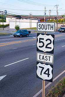
| Wadesboro | 12.2 | 19.6 | East end of US 74 overlap | |||
| 13.5 | 21.7 | South end of NC 742 overlap | ||||
| 14.6 | 23.5 | West end of US 74 overlap | ||||
| 14.9 | 24.0 | North end of NC 742 overlap | ||||
| Stanly | | 30.5 | 49.1 | |||
| | 41.5 | 66.8 | ||||
| Albemarle | 42.4 | 68.2 | East end of NC 73 overlap | |||
| 43.3 | 69.7 | West end of NC 73 overlap | ||||
| 44.7 | 71.9 | |||||
| New London | 50.4 | 81.1 | ||||
| Richfield | 53.6 | 86.3 | ||||
| Rowan | Rockwell | 63.6 | 102.4 | |||
| Salisbury | 72.0 | 115.9 | 76 | South end of I-85 overlap | ||
| Spencer | 74.9 | 120.5 | 79 | Andrews Street – Spencer, East Spencer | ||
| 76.3 | 122.8 | 81 | Long Ferry Road – Spencer | |||
| Yadkin River | 78.2 | 125.9 | Yadkin River Veterans Memorial Bridge | |||
| Davidson | | 78.7 | 126.7 | 82 | Permanently closed as of April, 2010[10][11][12][13] | |
| | 79.0 | 127.1 | 83 | Permanently closed as of May, 2013[10][12][13] | ||
| | 79.3 | 127.6 | 84 | South end of US 29 and west end of US 70 overlap | ||
| | 80.3 | 129.2 | 85 | Clark Road | Permanently closed as of November, 2012[14] | |
| | 81.4 | 131.0 | 86 | Belmont Road | ||
| Lexington | 83.3 | 134.1 | 87 | North end of I-85 and south end of I-85 Bus overlap; northbound exit and southbound entrance | ||
| 84.0 | 135.2 | 84 | To Davidson County Airport | |||
| 84.9 | 136.6 | 85 | Green Needles Road | |||
| 86.0 | 138.4 | 86 | Salisbury Road – Downtown Lexington | |||
| 87.0 | 140.0 | 87 | North end of I-85 Bus/US 29 and east end of US 70 overlap; northbound exit and southbound entrance | |||
| 88.6 | 142.6 | 89 | ||||
| Welcome | 92.2 | 148.4 | 92 | South end of NC 8 overlap | ||
| 97.3 | 156.6 | 97 | Old U.S. Hwy 52 – Midway | |||
| | 99.5 | 160.1 | 100 | Hickory Tree Road | ||
| Forsyth | Winston-Salem | 102.8 | 165.4 | 103 | South Main Street | |
| 105.1 | 169.1 | 105 | Clemmonsville Road | |||
| 106.2 | 170.9 | 107 A-B | A: B: | South end of US 311 overlap Signed as exits 107A (east) and 107B (west) | ||
| 107.0 | 172.2 | 108A | Sprague Street / Waughtown Street | To University of North Carolina School of the Arts | ||
| Salem Creek Connector | Under Construction (projected in June, 2016)[15] | |||||
| 107.8 | 173.5 | 108B | Vargrave Street | Permanently closed as of January 6, 2014[15] | ||
| 108.2 | 174.1 | 108C | Stadium Drive – Old Salem | To Winston-Salem State University | ||
| 108.5 | 174.6 | 109 A-B | A: B: | Signed as exits 109A (east) and 109B (west) | ||
| 108.9 | 175.3 | 110A | 3rd 4th 5th Streets – Downtown | Permanently closed as of February 18, 2013[16][17] | ||
| 109.3 | 175.9 | 110B | North end of US 311 overlap | |||
| 109.6 | 176.4 | 110C | Liberty Street | |||
| 109.9 | 176.9 | 110D | Northwest Boulevard | Southbound exit only | ||
| 110.6 | 178.0 | 111A | 25th Street / 28th Street | |||
| 110.9 | 178.5 | 111B | Liberty Street – Smith Reynolds Airport | Was northbound exit only; permanently closed | ||
| 111.8 | 179.9 | 112 | Akron Drive – Smith Reynolds Airport | To Coliseum and BB&T Field | ||
| 112.6 | 181.2 | 113 | Patterson Avenue | |||
| 114.2 | 183.8 | 114 | North end of NC 8 overlap | |||
| 115.5 | 185.9 | 115 | University Parkway | Signed northbound as exits 115A (north) and 115B (south) | ||
| 116.1 | 186.8 | 116 | Hanes Mill Road | |||
| Bethania | 117.5 | 189.1 | 117 | Northbound entrance and southbound exit | ||
| Future interchange (unfunded)[18] | ||||||
| Rural Hall | 118.1 | 190.1 | 118 | |||
| 119.8 | 192.8 | 120 | Westinghouse Road | |||
| King | 121.9 | 196.2 | 122 | Moore-RJR Drive | ||
| 123.0 | 197.9 | 123 | Main Street – King, Tobaccoville | |||
| Stokes | | 128.7 | 207.1 | 129 | Perch Road – Pinnacle | |
| Surry | | 130.8 | 210.5 | 131 | Pilot Knob Park Road – Pilot Mountain State Park | |
| Pilot Mountain | 133.7 | 215.2 | 134 | Double roundabout interchange | ||
| | 135.5 | 218.1 | 135 | West 52 Bypass – Pilot Mountain | Northbound entrance and left southbound exit only | |
| | 136.1 | 219.0 | 136 | Cook School Road | ||
| | 139.7 | 224.8 | 140 | |||
| | 141.0 | 226.9 | 141 | Holly Springs Church Road | To Mount Airy/Surry County Airport | |
| | 142.0 | 228.5 | ||||
| Mount Airy | 144.4 | 232.4 | ||||
| 145.6 | 234.3 | |||||
| 147.7 | 237.7 | |||||
| State line | 150.3 | 241.9 | Virginia state line | |||
1.000 mi = 1.609 km; 1.000 km = 0.621 mi
| ||||||
See also
-
 North Carolina portal
 -
 U.S. Roads portal
 - Bannered routes of U.S. Route 52
- High Rock Lake
- Pee Dee National Wildlife Refuge
- Pee Dee River
- Pilot Mountain State Park
- Rocky River
- Yadkin River
References
- ↑ American Association of State Highway and Transportation Officials, United States Numbered Highways, 1989 Edition
- 1 2 Google (April 5, 2011). "U.S. Route 52 in North Carolina" (Map). Google Maps. Google. Retrieved April 5, 2011.
- ↑ "NCDOT: Strategic Highway Corridors". Retrieved 2011-03-04.
- 1 2 3 4 5 "North Carolina Memorial Highways and other Named Facilities" (PDF). North Carolina Department of Transportation. July 15, 2004. Retrieved April 18, 2014.
- ↑ Google (July 14, 2013). "U.S. Route 121" (Map). Google Maps. Google. Retrieved July 14, 2013.
- ↑ "NCDOT - STIP: R-2320". Retrieved 2011-03-06.
- ↑ "NCDOT: US 52 Bridge Replacement Project". Retrieved 2011-11-24.
- ↑ "NCDOT: US 52 Bridge Replacement Project Map" (PDF). Retrieved 2011-11-24.
- ↑ "NCDOT: Project R-4750". Retrieved 2011-11-25.
- 1 2 "NCDOT: I-85 Corridor Improvement Project". Retrieved June 19, 2011.
- ↑ "SalisburyPost.com: Safety concerns lead to closing of Wil-Cox Bridge; no timeframe on reopening". Retrieved February 18, 2011.
- 1 2 "NC 150 Route Change (2012-03-01)" (PDF). North Carolina Department of Transportation. March 1, 2012. Retrieved May 26, 2013.
- 1 2 NC 150 Route Change (2012-01-04) (PDF) (Map). North Carolina Department of Transportation. January 4, 2012. Retrieved May 26, 2013.
- ↑ Staff (July 27, 2011). "NCDOT to close Clark Road entrance and exits ramps on I-85 north, section of Snider Kines Road in Davidson County starting Monday". Project Details. North Carolina Department of Transportation. Retrieved December 26, 2012.
- 1 2 "NCDOT News Release: Construction of Salem Creek Connector Ramps up in Winston-Salem". NCDOT. December 27, 2013. Retrieved April 18, 2014.
- ↑ "NCDOT News Release: NCDOT to Close U.S. 52; Third, Fourth, Fifth Street Ramps in Winston-Salem Starting Sunday Night". NCDOT. June 7, 2012. Retrieved August 25, 2012.
- ↑ "Ramp from Fifth Street to US 52 north closes Monday". WXII-TV. Retrieved 9 October 2014.
- ↑ "NCDOT: Winston-Salem Northern Beltway". Retrieved March 5, 2011.
External links
-
 Media related to U.S. Route 52 in North Carolina at Wikimedia Commons
 - NCRoads.com: U.S. 52
- NCRoads.com: U.S. 121
| Previous state: Virginia |
North Carolina | Next state: South Carolina |
