U.S. Route 264
| ||||
|---|---|---|---|---|
 | ||||
| Route information | ||||
| Auxiliary route of US 64 | ||||
| Maintained by NCDOT | ||||
| Length: | 215.7 mi[1] (347.1 km) | |||
| Existed: | 1932 – present | |||
| Tourist routes: |
| |||
| Major junctions | ||||
| West end: |
| |||
|
| ||||
| East end: |
| |||
| Location | ||||
| Counties: | Wake, Nash, Wilson, Greene, Pitt, Beaufort, Hyde, Dare | |||
| Highway system | ||||
| ||||

U.S. Route 264 is an east–west United States highway that runs for 215.7 miles (347.1 km) from Raleigh to Manns Harbor, entirely in the U.S. state of North Carolina.
Route description
U.S. Route 264 begins at the Raleigh Beltline (which carries US 64 and Interstate 440) and travels to the east from a directional T interchange, concurrently with both Interstate 495 and US 64 along with it on a freeway alignment. It meets the eastern terminus of Interstate 540, which features several unused stub ramps. I-495 ends at the I-540 junction, signage from I-540 east to the US 64/US 264 split designates the route as "Future I-495". The route curves to the northeast, paralleling NC 97, until it passes by Zebulon. At the north side of town, US 64 continues to the northeast, while the US 264 freeway continues east through a long wooded stretch. It curves to the south just before it meets Interstate 95/Interstate 795, just west of Wilson.
As the freeway loops south of Wilson, the short concurrency of Interstate 795 splits-off towards Goldsboro as US 264 continues east to Greenville. In Greenville, the freeway downgrades to expressway grade at the US 13/NC 11/NC 903 interchange. After completing the loop north around Greenville, it continues east, on Pactolus Highway, through a largely developed area and passes through Washington and US 17.
The route continues east on a two-lane road, cutting through mostly farmland. It begins to curve to the northeast after meeting NC 99, entering Pantego on Main Street. Within the town, it curves to the east again and then south toward Belhaven, where it bypasses north of town while US 264 Business goes through it. After Belhaven, US 264 continues eastward once again entering Hyde county, passing south of Lake Mattamuskeet through an area dominated by farmland and through the community of Engelhard. Turning north, US 264 goes through the Alligator River National Wildlife Refuge before finally reaching Manns Harbor, where US 264 ends at intersection with US 64.
Scenic byways
Pamlico Scenic Byway is an 127-mile (204 km) byway from Washington to Manns Harbor. US 264 overlap several sections of the byway. The byway is noted for its history, scenic views, and the three national wildlife refuges that the route goes through. Other roads and highways that make-up the byway are: NC 32, NC 45, NC 92, and NC 94.[2]
History

Established in 1932, US 264 started from US 64/NC 90, in Zebulon, to the community of Engelhard, in Hyde County. The route was overlapped entirely with NC 91 and was paved west of Swan Quarter. In 1934, NC 91 was removed along the route; in 1935, US 264 was paved from Swan Quarter to Engelhard.[3]
Sometime between 1948-'50, US 264 was moved south around Wilson, on Ward Boulevard; the old route became US 264 Alternate, which later became US 264 Business in 1960 till 1980-'84.[3]
Sometime between 1951-'52, US 264 was extended east from Engelhard to Manns Harbor, where it connected back with US 64. It continued east, overlapped with US 64, ending at Whalebone Junction with US 158 and NC 12.[3]
Sometime between 1953-'54, US 264 was bypassed Farmville and Greenville; the old routes became US 264 Alternate, eventually both were decommissioned by 1990. By 1958, US 264 was moved north around Swan Quarter, replaced by NC 45 and NC 94. In 1962-'63, US 264 was bypassed north around Belhaven, old route through town becoming US 264 Business.[3]
Between 1972-'78, US 264 was moved onto a Super-2 routing north of Sims, Bailey, and Middlesex. Much of the old route become US 264 Business, which is today part of US 264 Alternate. In 1979, the Super-2 was upgraded to freeway standards.[3]
Between 1987-'90, US 264 was moved onto new freeway south of Wilson; the old route along Ward Boulevard became part of the current US 264 Alternate route. Also during this time, US 264 was upgraded to freeway standards east of Farmville to Greenville. Between 1991-'93, US 264 was moved north onto new freeway, bypassing Farmville.[3]
Sometime between 1994-'99, US 264 was extended west from Zebulon, to the junction with I-440 in Raleigh. This would later change on July 8, 2005, when the Knightdale Bypass was completed.[3]
In August 2002, US 264 was truncated east at Manns Harbor.[3]
In 2004, US 264 was rerouted, between I-95 and NC 121, onto new freeway, south of Wilson. In 2007, part of this route was overlapped with I-795.[3]
Future Interstate 587
| |
|---|---|
| Location: | Zebulon–Greenville, NC |
| Length: | 56 mi (90 km) |
On September 7, 2016, Gov. Pat McCrory said he would ask for the section of US 264 between Zebulon and Greenville to be designated an interstate highway. Justification for interstate was that Greenville was the tenth largest city in the state without an interstate connecting it.[4] On November 14, AASHTO approved the Future I-587 designation; followed by FHWA approval on November 21.[5][6][7]
In January, 2013, the mayors of Greenville, Kinston, and Ayden announced that they would push to change the designation of US 264 between Wilson and Greenville to an interstate.[8][9]
Junction list
| County | Location | mi[1] | km | Exit | Destinations | Notes |
|---|---|---|---|---|---|---|
| Wake | Raleigh | 0.0 | 0.0 | 419 | South end of I-495 and west end of US 64 overlap | |
| 0.8 | 1.3 | 420 | New Hope Road | |||
| Knightdale | 3.0 | 4.8 | 422 | Hodge Road | ||
| 4.0 | 6.4 | 423 | North end of I-495 overlap | |||
| | 6.3 | 10.1 | 425 | Smithfield Road | ||
| Wendell | 8.0 | 12.9 | 427 | Taylor Road | ||
| 9.8 | 15.8 | 429 | ||||
| 10.2 | 16.4 | 430 | Rolesville Road – Rolesville | Eastbound entrance and westbound exit | ||
| 13.0 | 20.9 | 432 | Lizard Lick Road – Wendell | |||
| Zebulon | 16.2 | 26.1 | 435 | |||
| 17.2 | 27.7 | 19 | East end of US 64 overlap | |||
| 18.0 | 29.0 | 20 | ||||
| 19.5 | 31.4 | 21 | ||||
| Nash | Middlesex | 24.1 | 38.8 | 27 | ||
| Bailey | 28.3 | 45.5 | 30 | |||
| Wilson | Sims | 31.8 | 51.2 | 34 | Green Pond Road – Sims | |
| | 33.7 | 54.2 | 36 | Signed as exits 36A (west) and 36B (east) | ||
| | 35.8 | 57.6 | 38 | North end of I-795 overlap; signed as exits 38A (south) and 38B (north) | ||
| | 37.6 | 60.5 | 40 | |||
| | 39.3 | 63.2 | 42 | Downing Street – Wilson | ||
| | 40.2 | 64.7 | 43C | South end of I-795 overlap; eastbound exit and westbound entrance | ||
| Wilson | 41.1 | 66.1 | 43 | Signed as exits 43A (south) and 43B (north) | ||
| 47.3 | 76.1 | 46 | Black Creek Road | |||
| | 46.8 | 75.3 | 47 | Old Stantonburg Road | ||
| | 48.6 | 78.2 | 49 | |||
| | 50.0 | 80.5 | 51 | |||
| | 52.4 | 84.3 | 53 | |||
| Greene | | 58.5 | 94.1 | 59 | ||
| | 59.5 | 95.8 | 60 | Eastbound exit and westbound entrance | ||
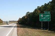
| Pitt | Farmville | 62.7 | 100.9 | 63 | ||
| 66.0 | 106.2 | 66 | ||||
| Greenville | 70.4 | 113.3 | 71 | Mozingo Road | ||
| 73.0 | 117.5 | 73 | Stantonsburg Road – Greenville Downtown | Signed as exits 73A (west) and 73B (downtown) | ||
| 74.7 | 120.2 | 75 | ||||
| 77.2 | 124.2 | 77 | ||||
| 80.0 | 128.7 | 80 | ||||
| 83.3 | 134.1 | |||||
| | 90.3 | 145.3 | ||||
| Beaufort | Washington | 99.4 | 160.0 | |||
| 100.7 | 162.1 | West end of NC 92 overlap | ||||
| | 107.1 | 172.4 | ||||
| | 110.0 | 177.0 | East end of NC 92 overlap | |||
| Pantego | 126.2 | 203.1 | North end of NC 99 overlap | |||
| Belhaven | 129.9 | 209.1 | South end of NC 99 overlap | |||
| | 132.3 | 212.9 | ||||
| Hyde | | 139.2 | 224.0 | North end of NC 45 overlap | ||
| | 154.4 | 248.5 | South end of NC 45 overlap | |||
| | 156.5 | 251.9 | South end of NC 94 overlap | |||
| | 163.5 | 263.1 | North end of NC 94 overlap | |||
| Dare | Manns Harbor | 215.7 | 347.1 | |||
1.000 mi = 1.609 km; 1.000 km = 0.621 mi
| ||||||
Bannered routes
Middlesex-Greenville alternate route
| |
|---|---|
| Location: | Middlesex-Greenville, North Carolina |
| Length: | 64.3 mi[10] (103.5 km) |
| Existed: | 1984–present |
Established around 1984, US 264 Alternate was a renumbering of the Middlesex business loop, which followed the original alignment of US 264 from Middlesex to Wilson. In 2004, it was extended east to Greenville, absorbing US 264 alternate between Farmville and Greenville.[11]
| County | Location | mi[10] | km | Destinations | Notes | |||
|---|---|---|---|---|---|---|---|---|
| Wake | Zebulon | 0.0 | 0.0 | Brief overlap with NC 39 | ||||
| Johnston |
No major junctions | |||||||
| Nash | Middlesex | 4.5 | 7.2 | |||||
| Bailey | 9.4 | 15.1 | ||||||
| Wilson | | 15.0 | 24.1 | |||||
| Wilson | 16.3 | 26.2 | ||||||
| 21.0 | 33.8 | East end of NC 42 overlap | ||||||
| 21.8 | 35.1 | West end of NC 42 overlap | ||||||
| 23.3 | 37.5 | South end of US 301 overlap | ||||||
| 25.0 | 40.2 | North end of US 301 and NC 58 overlap | ||||||
| 26.5 | 42.6 | South end of NC 58 overlap | ||||||
| | 31.5 | 50.7 | ||||||
| Saratoga | 31.5 | 50.7 | ||||||
| Greene | Walstonburg | 39.3 | 63.2 | South end of NC 91 overlap | ||||
| | 40.1 | 64.5 | North end of NC 91 overlap | |||||
| | 41.6 | 66.9 | South end of NC 121 overlap | |||||
| | 42.1 | 67.8 | North end of NC 121 overlap | |||||
| Pitt | Farmville | 45.5 | 73.2 | |||||
| | 49.4 | 79.5 | South end of US 13 overlap | |||||
| | Proposed interchange (unfunded).[12][13] | |||||||
| Greenville | 56.2 | 90.4 | North end of US 13 overlap | |||||
| 58.0 | 93.3 | North end of NC 43 overlap | ||||||
| 58.0 | 93.3 | South end of NC 43 overlap | ||||||
| 62.5 | 100.6 | East end of NC 33 overlap | ||||||
| 64.3 | 103.5 | West end of NC 33 overlap | ||||||
1.000 mi = 1.609 km; 1.000 km = 0.621 mi
| ||||||||
Middlesex business loop
| |
|---|---|
| Location: | Middlesex, North Carolina |
| Length: | 15.0 mi[14] (24.1 km) |
| Existed: | 1978–1984 |
Established by 1978, it was a renumbering of mainline US 264, which was moved onto new routing north of Bailey, Middlesex, and Sims. Originally, US 264 business ran from NC 581 to near Interstate 95; it was extended west to NC 39 in 1979. In 1984, the entire route was redesignated to US 264 Alternate.[3]
Wilson alternate route
| |
|---|---|
| Location: | Wilson, North Carolina |
| Length: | 2.0 mi[15] (3.2 km) |
| Existed: | 1950–1960 |
Established around 1950, it was a renumbering of mainline US 264 through downtown Wilson, via Raleigh Road and Nash Street. It was renumbered in 1960 to US 264 Business.[11]
Wilson business loop
| |
|---|---|
| Location: | Wilson, North Carolina |
| Length: | 2.0 mi[15] (3.2 km) |
| Existed: | 1960–1984 |
Established in 1960 as renumbering of US 264 Alternate, it remained unchanged till 1984, when it was decommissioned.[3]
Farmville alternate route
| |
|---|---|
| Location: | Farmville, North Carolina |
| Length: | 8.3 mi[16] (13.4 km) |
| Existed: | 1954–1990 |
Established around 1954 as a renumbering of mainline US 264, it traversed through downtown Farmville, via Wilson Street and Moye-Turnage Road. It was decommissioned by 1990 when US 264 bypassed north of Farmville and its former alignment south of Farmville became its alternate route. NC 121 replaced the eastern half of the former route from US 264 Alt to Main Street.[11]
Wilson–Greenville alternate route
| |
|---|---|
| Location: | Wilson–Greenville, NC |
| Length: | 37.8 mi[17] (60.8 km) |
| Existed: | 1988–2003 |
Established around 1990 as a renumbering of mainline US 264; which traversed from Farmville to Greenville. In 2002, it was extended west of Farmville to Wilson, replacing part of NC 121 and NC 91. In 2004, it was absorbed by the Middlesex-Greenville alternate route.[18][19][20][21]
Greenville alternate route
| |
|---|---|
| Location: | Greenville, North Carolina |
| Length: | 6.2 mi[22] (10.0 km) |
| Existed: | 1954–1960 |
Established by 1954 as a renumbering of mainline US 264, it traversed through downtown Greenville via Dickenson Avenue and East 10th Street. In 1960, it was renumbered as US 264 Business.[11]
Greenville business loop
| |
|---|---|
| Location: | Greenville, North Carolina |
| Length: | 6.2 mi[22] (10.0 km) |
| Existed: | 1960–1990 |
Established in 1960 as a renumbering of US 264 Alternate, it remained unchanged till 1990, when it was decommissioned.[3]
Belhaven alternate route
| |
|---|---|
| Location: | Belhaven, North Carolina |
| Length: | 2.9 mi[23] (4.7 km) |
| Existed: | 1957–1960 |
U.S. Route 64 Alternate (US 64A) was established around 1954-1957 as a renumbering of mainline US 264, it traversed through downtown Belhaven, via Main Street and Pamlico Street. In 1960, it was renumbered as US 264 Business.[11]
Belhaven business loop
| |
|---|---|
| Location: | Belhaven, North Carolina |
| Length: | 2.9 mi[23] (4.7 km) |
| Existed: | 1960–present |
U.S. Route 64 Business (US 64 Bus) was established in 1960, the 2.9-mile (4.7 km) route follows the original US 264 alignment through downtown Belhaven, via Main Street and Pamlico Street.[3]
The entire route is in Beaufort County.
| Location | mi[23] | km | Destinations | Notes | |
|---|---|---|---|---|---|
| Belhaven | 0.0 | 0.0 | |||
| | 2.9 | 4.7 | |||
| 1.000 mi = 1.609 km; 1.000 km = 0.621 mi | |||||
Manns Harbor–Manteo Bypass
| |
|---|---|
| Location: | Manns Harbor–Manteo, NC |
| Length: | 5.9 mi[24] (9.5 km) |
| Existed: | 1999–2003 |
U.S. Route 264 Bypass (US 264 By-pass) was established in 1999 as a new primary routing bypassing Manns Harbor and Manteo, while also providing direct access between Nags Head and the mainland. Its main feature is the Virginia Dare Memorial Bridge, which is a divided four-lane bridge crossing over the Croatan Sound. Sharing a complete concurrency with US 64 Bypass throughout its existence, it was removed in 2003 when US 264's eastern terminus was relocated further west.[25][26]
See also
- Alligator River National Wildlife Refuge
- Intracoastal Waterway
- Lake Mattamuskeet
- Mattamuskeet National Wildlife Refuge
- North Carolina Bicycle Route 2
- Pamlico Sound
- Swanquarter National Wildlife Refuge
- Tar River
References
- 1 2 Google (February 9, 2011). "US 264" (Map). Google Maps. Google. Retrieved February 9, 2011.
- ↑ "NCDOT: Scenic Byways". Retrieved February 9, 2011.
- 1 2 3 4 5 6 7 8 9 10 11 12 13 "NCRoads.com Annex: U.S. 264". Retrieved February 9, 2011.
- ↑ "North Carolina seeks interstate designation for US 264". Winston-Salem Journal. Associated Press. September 8, 2016. Retrieved September 8, 2016.
- ↑ Vitale, Marty (November 14, 2016). "Special Committee on U.S. Route Numbering" (PDF) (Report). Boston, MA: American Association of State Highway and Transportation Officials. p. 1. Retrieved November 24, 2016.
- ↑ "FHWA Approval Letter" (PDF) (PDF). U.S. Congressman G.K. Butterfield. November 21, 2016. Retrieved November 24, 2016.
- ↑ "Governor McCrory Announces Designation for U.S. 264 to Greenville" (Press release). North Carolina Department of Transportation. November 21, 2016. Retrieved November 24, 2016.
- ↑ Staff (January 4, 2013). "Highway 264 Could Become Interstate". Washington, NC: WITN-TV. Retrieved January 19, 2012.
- ↑ Staff (January 4, 2013). "City leaders discuss transportation needs in ENC". Greenville, NC: WNCT-TV. Retrieved October 1, 2013.
- 1 2 Google (January 21, 2013). "US 264 Alternate" (Map). Google Maps. Google. Retrieved January 21, 2013.
- 1 2 3 4 5 "NCRoads.com Annex: U.S. 264-A". Retrieved January 19, 2013.
- ↑ Staff. "NCDOT Project R-2250". North Carolina Department of Transportation. Retrieved January 23, 2013.
- ↑ Staff. "NCDOT: Greenville Southwest Bypass". North Carolina Department of Transportation. Retrieved January 23, 2013.
- ↑ Google (January 19, 2013). "US 264 Bus - Middlesex" (Map). Google Maps. Google. Retrieved January 19, 2013.
- 1 2 Google (January 19, 2013). "US 264 Alt/Bus - Wilson" (Map). Google Maps. Google. Retrieved January 19, 2013.
- ↑ Google (January 19, 2013). "US 264 Alt - Farmville" (Map). Google Maps. Google. Retrieved January 19, 2013.
- ↑ Google (January 19, 2013). "US 264 Alt - Farmville-Greenville" (Map). Google Maps. Google. Retrieved January 19, 2013.
- ↑ "US Route Changes (1988-07-11)" (PDF). North Carolina Department of Transportation. July 11, 1988. Retrieved March 25, 2014.
- ↑ "US Route Changes (1992-08-21)" (PDF). North Carolina Department of Transportation. August 21, 1992. Retrieved March 25, 2014.
- ↑ "US Route Changes (1999-06-25)" (PDF). North Carolina Department of Transportation. June 25, 1999. Retrieved March 25, 2014.
- ↑ "US Route Changes (2003-02-17)" (PDF). North Carolina Department of Transportation. February 17, 2003. Retrieved March 25, 2014.
- 1 2 Google (January 19, 2013). "US 264 Alt/Bus - Greenville" (Map). Google Maps. Google. Retrieved January 19, 2013.
- 1 2 3 Google (February 9, 2011). "US 264 Bus - Belhaven" (Map). Google Maps. Google. Retrieved February 9, 2011.
- ↑ Google (June 6, 2014). "US 64 Bypass - Manns Harbor–Manteo, North Carolina" (Map). Google Maps. Google. Retrieved June 6, 2014.
- ↑ "Route Change (1999-06-25)" (PDF). North Carolina Department of Transportation. June 25, 1999. Retrieved June 6, 2014.
- ↑ "Route Change (2003-09-15)" (PDF). North Carolina Department of Transportation. September 15, 2003. Retrieved June 6, 2014.
External links
 Media related to U.S. Route 264 at Wikimedia Commons