U.S. Route 23 in Ohio
| ||||
|---|---|---|---|---|
|
Route of US 23 highlighted in red | ||||
| Route information | ||||
| Maintained by ODOT | ||||
| Length: | 234.83 mi[1] (377.92 km) | |||
| Existed: | 1926 – present | |||
| Major junctions | ||||
| South end: |
| |||
|
| ||||
| North end: |
| |||
| Location | ||||
| Counties: | Scioto, Pike, Ross, Pickaway, Franklin, Delaware, Marion, Wyandot, Seneca, Sandusky, Wood, Lucas | |||
| Highway system | ||||
| ||||


U.S. Route 23 (US 23) is a United States Numbered Highway that runs from Jacksonville, Florida, to Mackinaw City, Michigan. In the US state of Ohio, it is a major north–south state trunkline highway that runs from the Kentucky border at Portsmouth, Ohio to the Michigan border at Sylvania, Ohio.
History
Before the establishment of the United States Numbered Highways system in 1926, the route of what would eventually become US 23 was numbered as SR 4 from Portsmouth to Marion; SR 22 from Marion to Carey; SR 63 from Carey to Fostoria; SR 199 from Fostoria to Millbury; and SR 2 from Millbury to Toledo.[2][3] Over the years, portions of US 23 have been realigned to divided highway, freeway, or expressway portions. Among these are a bypass of Circleville built in 1958;[4] the Marion-to-Carey expressway routing, on which work began in 1962;[5] and a bypass of Chillicothe, on which work began in 1966.[6]
When first established, US 23 followed its current routing from Fostoria to Woodville, then continued north along present-day Fostoria Road into Millbury, and northwest along present-day Ohio State Route 51 (Woodville Road) into downtown Toledo. There, it followed Broadway Street, Starr Avenue, and Main Street to the Cherry Street Bridge (now the Martin Luther King Bridge) across the Maumee River. The route then followed Cherry Street (present-day SR 120) to Detroit Avenue (US 24), before turning west onto Laskey Road and north onto Lewis Avenue.[3] Only a year later, the Fostoria-to-Toledo routing was shifted westerly, taking a northwest-southeast route that was originally designated SR 63 between Fostoria and Perrysburg, then East River Road into Toledo. It crossed the Maumee River via the Fassett Street Bridge, then followed South, Sumner, Logan, Summit, and Huron streets to rejoin its original routing. The Fostoria-to-Millbury routing was designated SR 199, and the Millbury-to-Toledo routing became SR 102,[7] which in turn became present-day SR 51 in 1955.[8] By 1940, US 23 was shifted westerly again in Toledo, taking the Anthony Wayne Bridge to Summit Street, then to Jefferson Avenue and Collingwood Boulevard before rejoining the previous routing.[9]
US 23 was realigned c. 1960 to follow Monroe Street northwesterly out of Toledo, joining with the first constructed segment of its current freeway routing in Sylvania.[10][11] The freeway was extended southerly to US 20 (Central Avenue) by 1964.[12] By 1969, the entire western freeway bypass of Toledo was complete, carrying the current routings of both US 23 and I-475. In addition, US 23 and SR 199 were swapped north of Fostoria in 1969, with US 23 reverting to its pre-1927 routing between Fostoria and Woodville, then becoming concurrent with US 20 from there to Perrysburg; the 1927-1969 routing of US-23 between Fostoria and Perrysburg thus became part of SR 199.[13]
Route description
The route crosses over the Ohio River via the U.S. Grant Bridge into the city of Portsmouth. Through downtown Portsmouth, it follows parallel one-way streets with northbound traffic on Gay Street and southbound on Chillicothe Street. These roads merge into Scioto Trail, which becomes a divided highway north of Rosemount, and again north of Lucasville, through Piketon to just south of Waverly.[14]
Within Waverly, the route becomes concurrent with SR 104, in addition to a four-block concurrency with SR 335 that ends in downtown Waverly. The concurrency with State Route 104 ends just south of Chillicothe, Ohio, at which point US 23 becomes an expressway.[14] The route bypasses Chillicothe to the east, including a short concurrency with US 35 before once again becoming a divided highway near Kingston. It continues as such through Circleville to the southern edge of Columbus, at the southern junction of Interstate 270.[14]
Columbus

In downtown Columbus, the route is applied to a one-way pair. It first jogs easterly via Livingston Avenue (north) and Fulton Street (south) before continuing northerly with northbound traffic on Fourth Street and southbound traffic on Third Street, which becomes Summit Street north of Fifth Avenue. The one-way pair ends at Hudson Street on the border of the SoHud and Glen Echo neighborhoods, with both directions of US 23 jogging westerly onto Hudson Street before continuing northerly on Indianola Avenue, closely paralleling Interstate 71. The route then moves westerly again via Morse Road, then north again onto High Street on the north edge of the East Beechwold neighborhood. North of the northern junction with Interstate 270, High Street becomes Columbus Pike.
The section immediately north of the northern junction with Interstate 270 was upgraded with a northbound-only set of express lanes which passes under Dimension Drive, Campus View Boulevard, Radio City Boulevard, and Flint Road, with the former alignment of US 23 providing access to those roads. This configuration, known as the "Trench", opened to traffic in September 2015, and its construction coincides with a reconfiguration of the I-270 exit.[15]
North of Columbus
In Lewis Center, US 23 once again becomes an expressway, and remains as such until Carey, except for a small portion north of Delaware.[14] Between Marion and Carey, all junctions with other routes are exits, except for SR 529 east of Marion and SR 294 east of Harpster. The route becomes concurrent with US 42 along an eastern bypass of Delaware, then bypasses Waldo and Marion to the east. It bypasses Upper Sandusky to the east and north, mostly in concurrency with US 30.[14] The route then departs the expressway at Carey, becoming concurrent with SR 103 while the expressway continues westerly as SR 15. Within Carey, the concurrency with State Route 103 ends, and a concurrency with SR 199 begins. The two co-signed routes continue as a rural highway to Fostoria, Ohio.[14]
Within Fostoria, US 23 becomes concurrent with SR 18 while turning westerly along Lytle Street, then northerly along a short, unnamed expressway in concurrency with SR 12. At the northern end of the expressway, State Route 12 departs while US 23, still concurrent with State Routes 18 and 199, continues westerly along Tiffin Street, then northerly along County Line Street. State Routes 18 and 199 both depart within Fostoria city limits, while US 23 continues northerly and becomes Fostoria Road. Northeast of Bradner, the route has a junction with US 6.
Northwest of Woodville, the route becomes concurrent with US 20, with both routes continuing northwesterly to Perrysburg.[14] There, US 23 begins a brief wrong-way concurrency with I-75, then departs for a concurrency with Interstate 475, the western bypass of the Toledo metropolitan area. US 23 and I-475 are concurrent for the latter route's entire north-south portion, until I-475 departs in Sylvania to become an east-west aligned route. US 23 then continues northerly into Michigan as a freeway.[14]
Major intersections
| County | Location | mi[1] | km | Exit | Destinations | Notes |
|---|---|---|---|---|---|---|
| Greenup | South Portsmouth | Continuation into Kentucky | ||||
| Ohio River | 0.00 | 0.00 | U.S. Grant Bridge; Kentucky–Ohio state line | |||
| Scioto | Portsmouth | 0.45 | 0.72 | Eastern end of SR 73; southern terminus of SR 104 | ||
| 1.06– 1.13 | 1.71– 1.82 | Eastbound US 52 follows 11th Street; westbound follows 12th Street | ||||
| Lucasville | 11.43 | 18.39 | Eastern end of SR 348; western end of SR 728 | |||
| Interchange | ||||||
| Pike | Scioto Township | 20.63 | 33.20 | — | American Centrifuge Facility | Half-folded diamond interchange; access to Portsmouth Gaseous Diffusion Plant |
| Seal Township | Former diamond interchange; replaced by existing interchange following SR 32 realignment | |||||
| 23.08 | 37.14 | — | Diamond interchange | |||
| Waverly | 28.53 | 45.91 | Southern end of SR 104 overlap | |||
| 29.17 | 46.94 | Southern end of SR 335 overlap | ||||
| 29.52 | 47.51 | Northern end of SR 335 overlap | ||||
| Ross | Franklin Township | 35.63 | 57.34 | |||
| Scioto Township | 41.40 | 66.63 | — | Northern end of SR 104 overlap; US 23 Business not signed southbound | ||
| 43.22 | 69.56 | — | Northbound access to eastbound US 35 and from westbound US 35 to southbound US 23 | |||
| 43.70 | 70.33 | — | Southbound exit and northbound entrance; eastern end of US 35 overlap | |||
| 44.98 | 72.39 | — | ||||
| 46.02 | 74.06 | — | Northbound exit and southbound entrance; western end of US 35 overlap | |||
| Springfield Township | 48.78 | 78.50 | — | US 23 Business not signed northbound | ||
| Green Township | 50.78 | 81.72 | — | |||
| Pickaway | Pickaway Township | 57.24 | 92.12 | |||
| Circleville | 63.92 | 102.87 | — | Five-ramp partial cloverleaf; northbound exit via Mound Street | ||
| South Bloomfield | 72.14 | 116.10 | Southern end of SR 316 overlap | |||
| 72.42 | 116.55 | Northern end of SR 316 overlap | ||||
| 72.75 | 117.08 | |||||
| Harrison Township | 76.24 | 122.70 | ||||
| Franklin | Hamilton Township | 80.37 | 129.34 | |||
| 83.36– 83.39 | 134.15– 134.20 | Exit 52 on I-270 | ||||
| Columbus | 86.28 | 138.85 | ||||
| 89.04 | 143.30 | Southern end of US 33 overlap | ||||
| 89.13 | 143.44 | No access to northbound I-71; exit 100B on I-70 | ||||
| 89.32– 89.41 | 143.75– 143.89 | Southern end of US 62 and SR 3 concurrencies | ||||
| 89.75 | 144.44 | Northern end of US 62 overlap | ||||
| 89.95– 90.04 | 144.76– 144.91 | Northern end of US 33 and SR 3 concurrencies | ||||
| 90.66 | 145.90 | — | Northbound-to-eastbound ramp also connects to northbound I-71; I-670 exit 4 | |||
| Worthington | 99.66 | 160.39 | ||||
| Columbus | 101.23 | 162.91 | Exit 23 on I-270; south end of northbound-only express lanes | |||
| Northwoods Boulevard | North end of northbound-only express lanes | |||||
| Delaware | Orange Township | 104.36 | 167.95 | |||
| Delaware | 111.74 | 179.83 | ||||
| 113.36– 113.60 | 182.44– 182.82 | Southern end of US 42 overlap; northbound US 23 to southbound US 42 access via S. Sandusky Street | ||||
| 114.86– 115.09 | 184.85– 185.22 | — | Interchange; northern end of US 42 overlap; William Avenue signed northbound only, Central Avenue signed southbound only | |||
| 115.96 | 186.62 | — | N. Sandusky Street | Southbound exit and northbound entrance | ||
| Marlboro Township | 124.39 | 200.19 | ||||
| Marion | Waldo Township | 124.75 | 200.77 | Secondary cutoff to SR 229; no entrances to US 23 | ||
| 126.35 | 203.34 | — | Access to SR 47 and SR 423 | |||
| Marion Township | 134.56 | 216.55 | — | |||
| 135.57 | 218.18 | — | ||||
| 137.14 | 220.71 | — | Marion-Williamsport Road | |||
| Grand Prairie Township | 140.64 | 226.34 | — | |||
| 143.52 | 230.97 | — | ||||
| Wyandot | Pitt Township | 148.00 | 238.18 | Intersection | ||
| 151.68 | 244.11 | — | ||||
| Crane Township | 153.81– 153.86 | 247.53– 247.61 | — | Southern end of US 30 overlap | ||
| Upper Sandusky | 155.48 | 250.22 | — | CR 330 (Wyandot Avenue) – Upper Sandusky | ||
| 158.17 | 254.55 | — | ||||
| 159.42 | 256.56 | — | ||||
| Salem Township | 159.82– 160.54 | 257.21– 258.36 | — | Northern end of US 30 overlap; left exit and entrance northbound | ||
| Crawford Township | 167.353– 167.62 | 269.329– 269.76 | — | US 23 departs freeway, which continues to the west as SR 15; eastern terminus of SR 15; southern end of SR 103 overlap | ||
| Carey | 168.82 | 271.69 | Northern end of SR 103 overlap; southern end of SR 199 overlap | |||
| Seneca | Loudon Township | 178.20 | 286.79 | |||
| Fostoria | 182.99– 183.00 | 294.49– 294.51 | Southern end of SR 18 overlap | |||
| 183.51 | 295.33 | Southern end of SR 12 overlap | ||||
| 183.81 | 295.81 | Northern end of SR 12 overlap | ||||
| 184.33 | 296.65 | Northern end of SR 18 overlap | ||||
| Seneca–Wood county line | 185.26 | 298.15 | Northern end of SR 199 overlap | |||
| Wood–Sandusky county line | Montgomery–Freedom– Madison–Scott township quadripoint | 196.95 | 316.96 | |||
| Freedom–Madison township line | 199.95 | 321.79 | Western end of SR 600 | |||
| 202.81 | 326.39 | |||||
| Troy–Woodville township line | 204.40 | 328.95 | Southern end of SR 582 overlap | |||
| 204.44 | 329.01 | Northern end of SR 582 overlap | ||||
| 205.95 | 331.44 | Southern end of US 20 overlap | ||||
| Wood | Troy Township | 208.25 | 335.15 | 81B | Pemberville Road | |
| 208.82 | 336.06 | 81A | To Ohio Turnpike (I-80/I-90); connected to exit 81B eastbound | |||
| 211.10 | 339.73 | Western end of SR 163 | ||||
| Perrysburg | 217.18 | 349.52 | 193 | Northern end of US 20 overlap; southern end of I-75 overlap; exit 193 on I-75 | ||
| 219.03 | 352.49 | 192 | Northern end of I-75 overlap; southern end of I-475 overlap; I-475 exits 0A-B | |||
| 219.40 | 353.09 | 2 | ||||
| Lucas | Maumee | 222.74 | 358.47 | 4 | ||
| 224.72 | 361.65 | 6 | Salisbury Road runs west, Dussel Drive runs east; added 1989[16] | |||
| Springfield Township | 226.89 | 365.14 | 8 | Signed as exits 8A (east) and 8B (west) southbound | ||
| Sylvania Township | 231.81 | 373.06 | 13 | |||
| 231.98 | 373.34 | 14 | Northern end of US 23 overlap; signed as exit 232 southbound | |||
| Sylvania | 234.18 | 376.88 | 234 | Southern end of US 223 overlap | ||
| 234.83 | 377.92 | Continuation into Michigan | ||||
1.000 mi = 1.609 km; 1.000 km = 0.621 mi
| ||||||
References
- 1 2 "DESTAPE". Ohio Department of Transportation. July 3, 2014. Retrieved September 29, 2014: Scioto, Pike, Ross, Pickaway, Franklin, Delaware, Marion, Wyandot, Seneca, Sandusky, Wood, Lucas.
- ↑ Map of Ohio showing state routes (Map). Ohio Department of Transportation. 1925.
- 1 2 Map of Ohio showing state routes (Map). Ohio Department of Transportation. 1926.
- ↑ Map of Ohio showing state routes (Map). Ohio Department of Transportation. 1958.
- ↑ Map of Ohio showing state routes (Map). Ohio Department of Transportation. 1962.
- ↑ Map of Ohio showing state routes (Map). Ohio Department of Transportation. 1966.
- ↑ Map of Ohio showing state routes (Map). Ohio Department of Transportation. 1927.
- ↑ Map of Ohio showing state routes (Map). Ohio Department of Transportation. 1955.
- ↑ Map of Ohio showing state routes (Map). Ohio Department of Transportation. 1940.
- ↑ Map of Ohio showing state routes (Map). Ohio Department of Transportation. 1959.
- ↑ Map of Ohio showing state routes (Map). Ohio Department of Transportation. 1961.
- ↑ Map of Ohio showing state routes (Map). Ohio Department of Transportation. 1964.
- ↑ Map of Ohio showing state routes (Map). Ohio Department of Transportation. 1969.
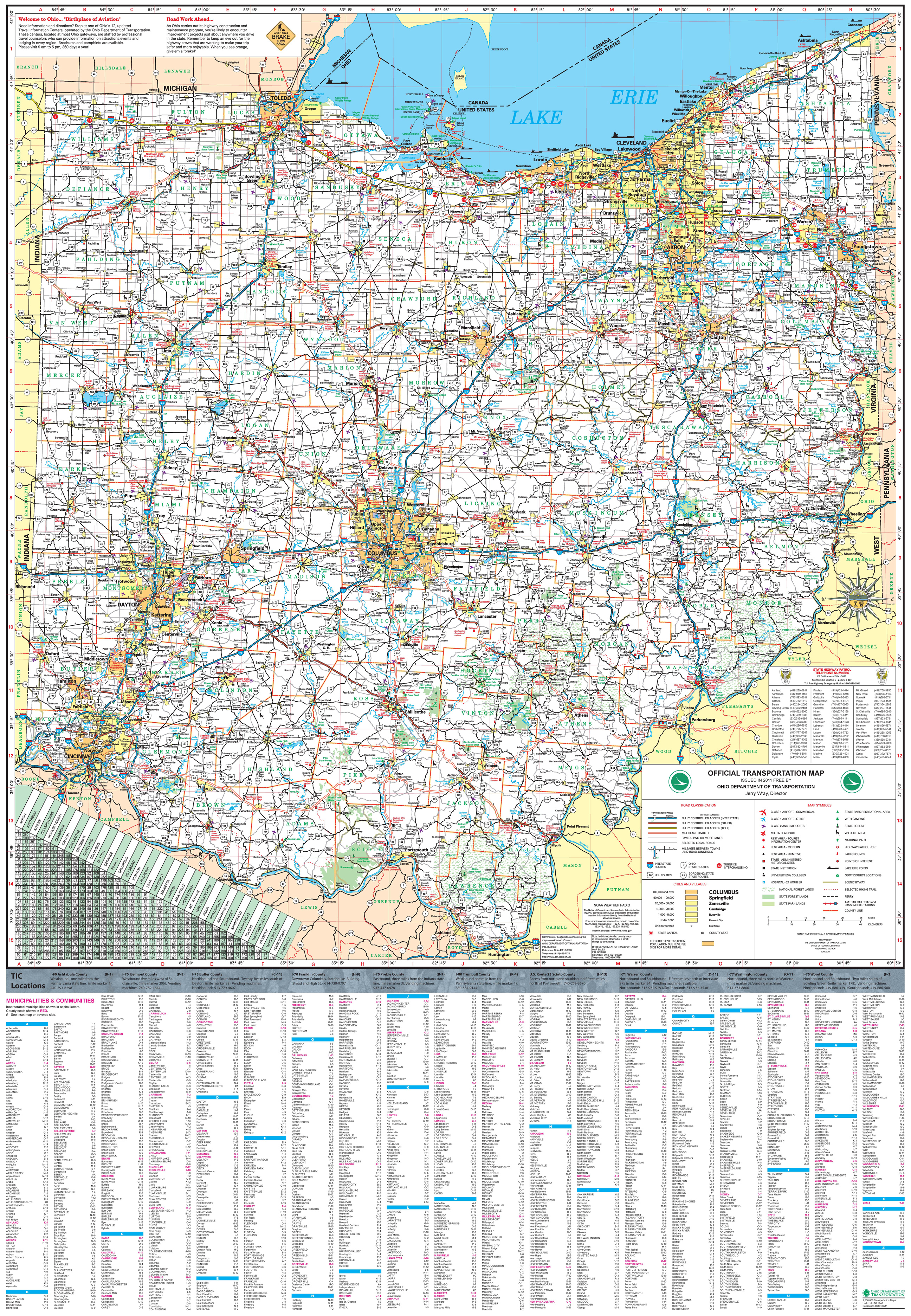
- 1 2 3 4 5 6 7 8 Official Transportation Map (Map). Ohio Department of Transportation. 2011.
- ↑ Rouan, Rick (September 8, 2015). "Rt. 23 trench to open to traffic this week". The Columbus Dispatch. dispatch.com. Retrieved 25 May 2016.
- ↑ McLaughlin, Mary-Beth (June 8, 2003). "Maumee Turned Risk Into Riches at Arrowhead Park". The Blade. Toledo, OH. Retrieved June 16, 2008.
| Previous state: Kentucky |
Ohio | Next state: Michigan |