Tyre, New York
| Tyre, New York | |
|---|---|
| Town | |
 Tyre, New York Location within the state of New York | |
| Coordinates: 42°59′N 76°48′W / 42.983°N 76.800°W | |
| Country | United States |
| State | New York |
| County | Seneca |
| Settled | 1794 |
| Established | March 26, 1829[1] |
| Government | |
| • Type | Town Board |
| • Supervisor | Ronald F. McGreevy |
| • Clerk | Elizabeth Sutterby |
| • Court |
Justice Larry Mills Justice Kathy Jans-Duffy |
| Area | |
| • Total | 33.1 sq mi (85.8 km2) |
| • Land | 30.1 sq mi (78.1 km2) |
| • Water | 3.0 sq mi (7.7 km2) |
| Elevation | 433 ft (132 m) |
| Population (2010) | |
| • Total | 981 |
| • Density | 32.6/sq mi (12.6/km2) |
| Time zone | Eastern (EST) (UTC-5) |
| • Summer (DST) | EDT (UTC-4) |
| Area code(s) | 315 |
| FIPS code | 36-75902 |
| GNIS feature ID | 0979567 |
| Website | http://www.tyreny.com/ |
Tyre is a town in Seneca County, New York, United States. The population was 981 at the 2010 census. The town is named after the Lebanese city of Tyre.
The Town of Tyre is located in the northeastern part of the county, northeast of Geneva, New York. It has a hamlet, also called Tyre. Government offices for the Town of Tyre are located in the new town hall on New York State Route 318 just west of the hamlet of Magee, New York.[2]
There is no post office in the Town of Tyre. The primary postal district covering the area is ZIP Code 13148 for Seneca Falls.[3] A small section of addresses west of N.Y. Route 414 to the town border have a ZIP Code of 13165 for Waterloo.[4]
History
The region was in the Central New York Military Tract, reserved for veterans, but a reservation was established at the northern end of Cayuga Lake for natives who returned to the area. A tract at the hamlet of Tyre was granted to Revolutionary War Colonel James Livingston. The first outside settler, Ezekiel Crane, arrived about 1794.[5] Other early settlers were Asherr Halsey, Lewis Winans, Asa Smith and Caleb Woodworth. James Magee, a prominent physician for many years, came in 1811.
The town was created from the eastern part of the Town of Junius in 1829.[1]
The town is part of the Erie Canalway National Heritage Corridor.[6] Erie Canal Lock 25 is located off Mays Point Road (CR 105A) in the hamlet of Mays Point. It was built around 1912, and has a lift of 6 feet (1.83 m) to the west.[7]
The Hiram Lay Cobblestone Farmhouse was listed on the National Register of Historic Places in 2009.[8]
Geography
According to the United States Census Bureau, the town has a total area of 33.1 square miles (86 km2) of which 30.1 square miles (78 km2) is land and 3.0 square miles (7.8 km2) (8.97%) is water.
The north town line is the border of Wayne County, and the east town line, partly marked by the Seneca River, is the border of Cayuga County.
A large eastern part of the town is in the Montezuma Marsh.
The Erie Canal and the Cayuga-Seneca Canal (Seneca River) pass through Tyre.
New York State Thruway (Interstate 90) crosses the town, passing through the Montezuma Marsh. New York State Route 89 and New York State Route 414 are north-south highways in the town, and New York State Route 318 is an east-west highway. New York State Route 31 crosses the northeast corner of the town.
Demographics
| Historical population | |||
|---|---|---|---|
| Census | Pop. | %± | |
| 1830 | 1,482 | — | |
| 1840 | 1,506 | 1.6% | |
| 1850 | 1,356 | −10.0% | |
| 1860 | 1,437 | 6.0% | |
| 1870 | 1,280 | −10.9% | |
| 1880 | 1,168 | −8.7% | |
| 1890 | 991 | −15.2% | |
| 1900 | 954 | −3.7% | |
| 1910 | 900 | −5.7% | |
| 1920 | 798 | −11.3% | |
| 1930 | 743 | −6.9% | |
| 1940 | 724 | −2.6% | |
| 1950 | 729 | 0.7% | |
| 1960 | 815 | 11.8% | |
| 1970 | 837 | 2.7% | |
| 1980 | 887 | 6.0% | |
| 1990 | 870 | −1.9% | |
| 2000 | 899 | 3.3% | |
| 2010 | 981 | 9.1% | |
| Est. 2014 | 979 | [9] | −0.2% |
At the 2010 census,[11] there were 981 people, 356 households and 263 families residing in the town. The population density was 32.6 per square mile (12.6/km²). The racial makeup of the town was 97.6% White, 0.0% Black or African American, 0.2% Native American, 0.3% Asian, 0.0% Pacific Islander, 0.5% from other races, and 1.4% from two or more races. Hispanic or Latino of any race were 1.4% of the population.
There were 356 households of which 29.5% had children under the age of 18 living with them, 56.7% were married couples living together, 8.7% had a female householder with no husband present, and 26.1% were non-families. 19.7% of all households were made up of individuals and 8.2% had someone living alone who was 65 years of age or older. The average household size was 2.76 and the average family size was 3.14.
In the town the population was spread out with 29.5% under the age of 20, 5.6% from 20 to 24, 21.1% from 25 to 44, 30.3% from 45 to 64, and 13.3% who were 65 years of age or older. The median age was 40.0 years. For every 100 females there were 101.9 males. For every 100 females age 18 and over, there were 101.1 males.
The median income for a household in the town was $43,750, and the median income for a family was $64,250. Males had a median income of $42,679 versus $31,125 for females. The per capita income for the town was $24,383. About 6.3% of families and 12.6% of the population were below the poverty line, including 16.1% of those under age 18 and 15.2% of those age 65 or over.
Housing
There were 419 housing units at an average density of 13.9 per square mile (5.4/km²). 15.0% of housing units were vacant.
There were 356 occupied housing units in the town. 303 were owner-occupied units (85.1%), while 53 were renter-occupied (14.9%). The homeowner vacancy rate was 1.3% of total units. The rental unit vacancy rate was 3.6%.[11]
Communities and locations in the Town of Tyre
- Black Brook – A stream flowing past Tyre village into Montezuma Marsh.
- Clyde River – A stream entering the Montezuma Marsh near the north town line.
- Evans Corner – A hamlet at the north town line on NY-89.
- Magee – A location south of the Thruway at the intersection of NY-414 and NY-318.
- Malcom – A location on NY-414 near the north town line.
- Mays Point – A hamlet on NY-89 north of the Thruway by the Erie Canal.
- Montezuma National Wildlife Refuge – A federal conservation area encompassing part of the Montezuma Marsh.
- Munsons Corner – A hamlet on the north town line on County Road 101.
- Tyre – The hamlet of Tyre is located next to Montezuma Marsh, north of the Thruway on County Road 101.
- Armitage Farm and Armitage Bridge – A farm next to the bridge.
Casino
The town is the site of a new casino called delLago Resort & Casino.[12] Lago was one of three projects selected by the New York State Gaming Facility Location Board on December 17, 2014 for possible licensure by the New York State Gaming Commission.[13][14]
References
- 1 2 New York Roots - The History of New York State by Dr. James Sullivan (Book VII, Chapter IV - Seneca County), Retrieved Jun. 3, 2015.
- ↑ Town of Tyre, New York, Retrieved Jun. 11, 2015.
- ↑ United States Postal Service (Seneca Falls, New York Post Office), Retrieved Jun. 3, 2015.
- ↑ United States Postal Service (Waterloo, New York Post Office), Retrieved Jun. 3, 2015.
- ↑ Town of Tyre, New York - A Brief History of Tyre, Retrieved Jun. 3, 2015.
- ↑ National Park Service - Erie Canalway National Heritage Corridor Brochure, New York, Retrieved Jun. 11, 2015.
- ↑ NY Canals (Index of Locks), Retrieved Jun. 11, 2015.
- ↑ National Park Service (2010-07-09). "National Register Information System". National Register of Historic Places. National Park Service.
- ↑ "Annual Estimates of the Resident Population for Incorporated Places: April 1, 2010 to July 1, 2014". Retrieved June 4, 2015.
- ↑ "Census of Population and Housing". Census.gov. Retrieved June 4, 2015.
- 1 2 "American FactFinder". United States Census Bureau. Retrieved 2008-01-31.
- ↑ http://dellagoresortandcasino.com/
- ↑ http://www.gaming.ny.gov/pdf/12.17.14.GFLBSelection.pdf
- ↑ http://www.gaming.ny.gov/pdf/02.27.15.GFLBFinalAppendicesWebSmall.pdf
External links
Coordinates: 42°59′N 76°48′W / 42.983°N 76.800°W
Municipalities and communities of Seneca County, New York, United States | ||
|---|---|---|
| City | 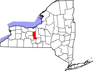 | |
| Towns | ||
| Villages | ||
| CDP | ||
| Hamlets |
| |
| Footnotes | ‡This populated place also has portions in an adjacent county or counties | |