Tyendinaga Mohawk Territory
- For the Township, see Tyendinaga, Ontario
- This article is about the Indian reserve, for more information on the First Nation, see Mohawks of the Bay of Quinte First Nation.
| Tyendinaga Mohawk Territory Kenhtè:ke | |
|---|---|
| Indian reserve | |
| Tyendinaga Mohawk Territory Indian Reserve | |
|
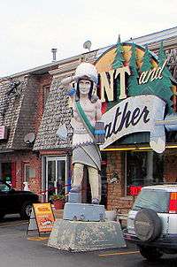
Novelty statue at the Mohawk Plaza on Highway 49 | |
 Tyendinaga Mohawk Territory | |
| Coordinates: 44°11.5′N 77°08′W / 44.1917°N 77.133°WCoordinates: 44°11.5′N 77°08′W / 44.1917°N 77.133°W | |
| Country |
|
| Province |
|
| County | Hastings |
| First Nation | Mohawks of the Bay of Quinte |
| Settled | 1784 |
| Formed | 1793 (official deed) |
| Government | |
| • Chief | Donald Maracle |
| • Federal riding | Prince Edward—Hastings |
| • Prov. riding | Prince Edward—Hastings |
| Area[1] | |
| • Land | 71.06 km2 (27.44 sq mi) |
| Population (2011)[2] | |
| • Total | 8,006 members / 2,124 on reserve |
| • Density | 29.9/km2 (77/sq mi) |
| Time zone | EST (UTC-5) |
| • Summer (DST) | EDT (UTC-4) |
| Postal Code | K0K |
| Area code(s) | 613 |
| Website | www.mbq-tmt.org |
Tyendinaga Mohawk Territory is the main First Nation reserve of the Mohawks of the Bay of Quinte First Nation. The territory is located in Ontario east of Belleville, Ontario.
The territory was organized in 1793 to settle the Mohawks who were expelled from the United States after the United States War of Independence. The Mohawks had fought on the side of the British and as a consequence had lost their home territory in the present State of New York. Some lands were severed in 1837 to create the townsite of Deseronto, Ontario. The severance may not have been done legally and is the basis of a land claim by the First Nation.
The main facilities of the reserve are located along York Road, where the band administration building, Quinte Mohawk School, and Kanhiote Public Library are located.
The territory is connected to Ontario Highway 401 by Ontario Highway 49 which runs north-south through the reserve, south to Prince Edward. Tyendinaga Mohawk Airfield general aviation airport is located just west of 49, just north of the Bay of Quinte.
References
- ↑ "Tyendinaga Mohawk Territory community profile". 2006 Census data. Statistics Canada. Retrieved 2011-02-24.
- ↑ Indian and Northern Affairs Canada - First Nation Profiles: Mohawks of the Bay of Quinte Registered Population
| Wikimedia Commons has media related to Tyendinaga Mohawk Territory. |
 |
Tyendinaga | | ||
| Belleville | |
Deseronto | ||
| ||||
| | ||||
| Bay of Quinte Prince Edward |
| Cities |  | |
|---|---|---|
| Towns | ||
| Townships | ||
| First Nations | ||
| Indian reserves | ||
| ||