Turka, Ukraine
| Turka Турка | |||
|---|---|---|---|
|
Turka Panoramic View | |||
| |||
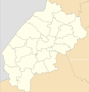 Turka Location of Turka | |||
| Coordinates: 49°09′27″N 23°01′21″E / 49.15750°N 23.02250°ECoordinates: 49°09′27″N 23°01′21″E / 49.15750°N 23.02250°E | |||
| Country | Ukraine | ||
| Oblast | Lviv Oblast | ||
| Raion | Turkivskyi Raion | ||
| First mentioned | 1431 | ||
| Government | |||
| • Mayor | Yuri Kasyuhnych | ||
| Elevation | 557 m (1,827 ft) | ||
| Population (2013) | |||
| • Total | 7,143 | ||
| Area code(s) | +380 | ||
| Website | http://www.turka.com.ua/ | ||


Turka (Ukrainian: Турка, Турка над Стрийом (old), Polish: Turka, Turka nad Stryjem(old), German: Turka, French: Tourka, Yiddish — טורקא) — is a city located at the confluence of the Stryi River and the Yablunka River (Ukrainian: Яблунька) in Lviv Oblast (region) of western Ukraine (in the Carpathian Mountains). It is the administrative center of Turka Raion. Population: 7,143 (2013 est.)[1].
Name
The name Turka originates from Ukrainian word, тур (English: tur, meaning aurochs or urus (Latin: Bos primigenius), the ancestor of domestic cattle — a type of huge wild cattle which inhabited in the surrounding forests (it survived in Europe until 1627).[2] In another version the city's name derives from the Ukrainian name of the gate-towers,"Turia" (Ukrainian: Tурія), "Turja" (Ukrainian: Тур'я), "Turnia"(Ukrainian: Турня), which stood at the entrance to an ancient settlement. Origin of name in no way is linked to the Turks.
Location
The city is located in the south Lviv Oblast, in the Carpathian Mountains, on the left bank of the Stryi River, with its tributaries, the Yablunka River (Ukrainian: Яблунька) and Litmyr River (Ukrainian: Літмир), and between the mountains Shymenka (Ukrainian: Шименка), Kychera (Ukrainian: Кичера), Vinets' (Ukrainian: Вінець) and Osovnya (Ukrainian: Осовня).
City is located 137 km from Lviv, 107 km from Uzhhorod, 75 km from Drohobych, at an altitude of 557 meters above sea level.
The location of initial settlement outpost, from which arose Turka, was determined by the so-called "Path of Rus" - Neolithic trade route that connected through the Turka Western Europe to Hungary, Moldova and the Balkan countries.
History
On June 27, 1431, King Władysław II Jagiełło presented Turka to a man named Vancza Valachus. This was confirmed in 1444 by King Władysław III of Poland, and by Sigismund I the Old in 1517. In 1730 Turka received Magdeburg rights, and three years laters, a Roman Catholic parish was opened here. Until the Partitions of Poland, Turka remained in Kingdom of Poland’s Przemyśl Land, Ruthenian Voivodeship. From 1772 to 1918 the town belonged to Austrian Galicia.
In the Second Polish Republic, Turka was the seat of a county in Lwów Voivodeship. It was home to a county court, private high school and tax office. In 1921, Turka had the population of 10 030, including 4 201 Jews. At that time, its starosta was Tadeusz Zawistowski, and the mayor was Michał Grudziński.
Following the September 1939 Invasion of Poland, Turka was occupied by the Soviet Union. In June 1941, the town was captured by the Wehrmacht, and its Jewish population perished in the Holocaust. The area of Turka also witnessed mass murders of Poles, carried out by Ukrainian nationalists (see Massacres of Poles in Volhynia and Eastern Galicia). After World War II, the town was reattached to the Soviet Ukraine, and its Polish community was expelled to the so-called Recovered Territories.
Administrative status
Turka is the administrative center of the Turkivskyi Raion (districts) and the unofficial capital of Boykos country (Ukrainian: Бойківщина).
Demography
The population is 7306 people in 1114 homes (2006) 99% of the population are Ukrainian.
Dynamics of population in the past:
- 1880 — 4685 inhabitants (1786 Rusyns, 537 Poles 2356 German; of them: 1837 Greek-Catholic, 450 Catholics 2398 Jews).[3]
- 1916 — 6080 inhabitants (including - 3000 Jews)[4]
- 1921 — 10 030 inhabitants (including - 4201 Jews).[5]
- 1989 — 7982 inhabitants (3992 men., 3990 female)[6]
- 2001 — 7440 inhabitants[7]
- 2006 — 7306 inhabitants[8]
Sights
- Church of the transfer of the relics of St. Nicholas, Turka (1776)
- Church of St. Nicholas, Turka (1739)
- Assumption of the Blessed Virgin Mary Church, Turka (1750)
- Protection of the Blessed Virgin Mary Church, Turka (1780)
- Church of Saints Peter and Paul, Turka (2003)
- Assumption Church, Turka (1778)
- Synagogue, Turka (19th century)
- Old Jewish Cemetery, Turka (19th century)
- Market Square, Turka
- Folk Museum of Boykos (Ukrainian: Бойківщина)
- Museum of Boykos books
Notable people born in Turka
- Abba Hushi (1898—1969) — Israeli politician, mayor of Haifa (1951–1969)
- Zygmunt Albert (1908—2001) — Polish doctor, pathologist, Professor of Medicine, President of Wrocław Medical University (1950–1954)
- Ihor Gerych (1961) — Ukrainian surgeon, Professor of Medicine, Нead of the regional ministries of health of Lviv Oblast (2005–2009)
- Melnyk Myhailo (1889—1944) — Ukrainian military and political leader
- Ira Moskowitz (1912—2001) — American Graphic Artist
- Stepan Popel (1907—1987) — Ukrainian and American chess player, multiple chess champion of Lviv, Paris and eventually, of the Ukrainians in North America (United States and Canada)
- Karl Schein (1911—1973) — Polish and Israeli surgeon, Professor of Medicine, Chief surgeon of Polish army, director of the medical clinic in Haifa.
- Yuriy Tarnawsky (1934) — Ukrainian poet and novelist,one of the founding members of the New York Group, a Ukrainian émigré avant-garde group of writers, and co-founder and co-editor of the journal Novi Poeziyi (New Poetry; 1959–1972).
- Marian Promiński (1908—1971) — Polish poet, novelist, essayist, film critic, dramaturge, translator of Anglo-Saxon literature.
- Ivan Fedevych (1883—1939) — Ukrainian social and political leader, a Greek Catholic priest.
- Myron Utrysko (1908–1988) — Ukrainian social and political leader.
- Teodor Rożankowśkyj (1875—1970) — Ukrainian political and military leader, a lawyer, the first commander of the Legion of Ukrainian Sich Riflemen.
- Myron Yusypovych (1957) — Ukrainian artist chief conductor of the Symphony Orchestra K&K Phіlharmonіker of agency Da Capo Musіkmarketіng Gmbh, Austria, director of choir K&K Opernchor, Honored Artist of Ukraine
- Adam Karpinski (1897–1939) — Polish alpinist, a mechanical engineer, aircraft designer, pilot.
References
- ↑ "Чисельність наявного населення України (Actual population of Ukraine)" (in Ukrainian). State Statistics Service of Ukraine. Retrieved 21 January 2015.
- ↑ Unofficial site of Turka (in Ukrainian)
- ↑ Turka in «Geographical Dictionary of the Kingdom of Poland (1880)
- ↑ The American Jewish Year Book, 5677, September 28, 1916, to September 16, 1917, Edited by Cyrus Adler for the American Jewish Committee, Philadelphia,The Jewish Publication Society of America
- ↑ Turka (Ukraina) (in Polish)
- ↑ Central Statistics Office in Lviv region(in Ukrainian)
- ↑ Registration card of Turka in the Parliament of Ukraine (in Ukrainian)
- ↑ Hyda J. "Turka - a New Capital Boikivshchyna" Tourism guide (Uzhgorod:Patent, 2006)(in Ukrainian)
External links
- Turka history and photos (in Ukrainian)
- Turka history (in Ukrainian)
- Turka in Geographical Dictionary of the Kingdom of Poland (1889)
- Memorial Book of the Community of Turka on the Stryj and Vicinity (Turka, Ukraine)
- Turka: slideshow
- Turka: history slideshow (1900-1935)
- Turka: Congress of Boykos (slideshow)
- Turka: Xsmas song (slideshow)
- Turka: City tour (slideshow)
- Turka: Homemade machine "Dyha" (slideshow)
- Turka, Ukraine | By Ukraine Channel
- Turka: photos