Tulagi
| Tulagi | |
|---|---|
|
Rainbow over Tulagi Island | |
 Location in the Nggela Islands | |
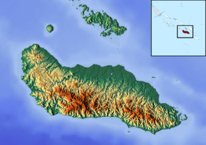 Tulagi Tulagi is north of Guadalcanal Island | |
| Coordinates: 09°06′S 160°09′E / 9.100°S 160.150°E | |
| Country | Solomon Islands |
| Province | Central |
| Island group | Nggela (Florida) Islands |
| Population (2009 census) | |
| • Total | 1,251 |
| Climate | Af |

Tulagi, less commonly known as Tulaghi, is a small island (5.5 km by 1 km) in Solomon Islands, just off the south coast of Ngella Sule. The town of the same name on the island (pop. 1,750) was the capital of the British Solomon Islands Protectorate from 1896 to 1942 and is today the capital of the Central Province. The capital of what is now the state of Solomon Islands moved to Honiara, Guadalcanal, after World War II.
The island was originally chosen by the British as a comparatively isolated and healthier alternative to the disease-ridden larger islands of the Solomon Islands archipelago.
Climate
| Climate data for Tulagi | |||||||||||||
|---|---|---|---|---|---|---|---|---|---|---|---|---|---|
| Month | Jan | Feb | Mar | Apr | May | Jun | Jul | Aug | Sep | Oct | Nov | Dec | Year |
| Average high °C (°F) | 31 (88) |
31 (88) |
31 (88) |
31 (88) |
31 (87) |
30 (86) |
30 (86) |
30 (86) |
30 (86) |
31 (87) |
31 (88) |
32 (89) |
31 (87) |
| Average low °C (°F) | 24 (76) |
24 (76) |
24 (76) |
24 (76) |
24 (76) |
24 (75) |
24 (75) |
23 (74) |
24 (76) |
24 (76) |
24 (76) |
24 (76) |
24 (76) |
| Average precipitation mm (inches) | 363 (14.3) |
401 (15.8) |
64 (2.5) |
50 (2) |
206 (8.1) |
173 (6.8) |
193 (7.6) |
221 (8.7) |
200 (8) |
221 (8.7) |
250 (10) |
264 (10.4) |
2,563 (100.9) |
| Source: Weatherbase [1] | |||||||||||||
History
The first recorded sighting by Europeans was by the Spanish expedition of Álvaro de Mendaña on 16 April 1568. More precisely the sighting was due to a local voyage done by a small boat, in the accounts the brigantine Santiago, commanded by Maestre de Campo Pedro Ortega Valencia and having Hernán Gallego as pilot.[2][3]
World War II
The Japanese occupied Tulagi on May 3, 1942, with the intention of establishing a seaplane base nearby (see Japanese Tulagi landing). The ships in Tulagi harbor were raided by planes from USS Yorktown the following day in a prelude to the Battle of the Coral Sea.
U.S. forces, primarily the 1st Marine Raiders, landed on August 7 and captured Tulagi as part of Operation Watchtower after a day of hard fighting.
After its capture by Naval and Marine forces, the island hosted a fleet of PT boats for a year which included John F. Kennedy's PT-109, as well as other ancillary facilities. A small 20-bed dispensary was operated on Tulagi until its closure in 1946. The island also formed part of Purvis Bay, which hosted many US Navy ships during 1942 and 1943.
Postwar
The present-day Tulagi has a fishing fleet.
Scuba diving
Tulagi offers some excellent scuba diving. The wrecks of USS Aaron Ward, USS Kanawha, and HMNZS Moa are close by, and the wrecks of Ironbottom Sound are not much further off. The Ward is considered to be one of the world's great wreck dives; the hull lies on a sandy bottom at 70 metres (230 feet), which is about 20 metres (66 feet) deeper than one can safely dive on compressed air. The Ward lies upright and intact, the deck replete with artifacts.
Tulagi is developing a tourism industry based on scuba.
References
- ↑ "Weatherbase: Historical Weather for Tulagi, Solomon Islands". Weatherbase. 2011. Retrieved on November 24, 2011.
- ↑ Sharp, Andrew The discovery of the Pacific Islands Oxford, 1960, p.45.
- ↑ Brand, Donald D. The Pacific Basin: A History of its Geographical Explorations The American Geographical Society, New York, 1967, p.133.
Coordinates: 9°06′S 160°09′E / 9.100°S 160.150°E