Truskmore
| Truskmore | |
|---|---|
| Trosc Mór | |
 Truskmore seen from Gleniff Horseshoe Drive | |
| Highest point | |
| Elevation | 647 m (2,123 ft) [1][2] |
| Prominence | 560 m (1,840 ft) [1] |
| Listing | Hewitt, Marilyn |
| Coordinates | 54°22′27″N 8°22′18″W / 54.374208°N 8.371639°WCoordinates: 54°22′27″N 8°22′18″W / 54.374208°N 8.371639°W |
| Naming | |
| Translation | big cod (Irish) |
| Geography | |
 Truskmore Location in Ireland | |
| Location | border of County Sligo and County Leitrim, Republic of Ireland |
| Parent range | Dartry Mountains |
| OSI/OSNI grid | G758473 |

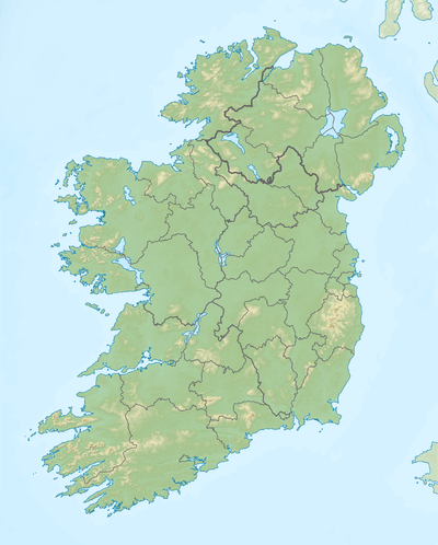
Truskmore (Irish: Trosc Mór, meaning "big cod")[3] is a 647 m (2,123 ft) mountain on the border of County Sligo and County Leitrim in Ireland. It is the highest peak of the Dartry Mountains and the highest in County Sligo.[1] Truskmore is the highest point on a large plateau stretching across northeast Sligo and northwest Leitrim.[4] The edges of this plateau is marked by high cliffs—these include Ben Bulbin (526m), Benwiskin (514m), Slievemore (597m) and Kings Mountain (462m).[1] The peak of Truskmore is in County Sligo, a short distance from the border with County Leitrim. However, the mountain itself is within both counties.[4]
Transmission site
The Truskmore television transmitter opened on 1 February 1962 and was the second of the original five main Telefis Éireann transmitters to go on air after Kippure (December 1961). Initially its transmissions were only in 405 lines on VHF channel 11, with 625 lines transmissions beginning in November 1963. The new RTÉ Radio VHF FM radio service was added in 1966 and UHF television transmission began in 1996 with the advent of Teilifís na Gaeilge. In 2009 a new 175m mast was erected in preparation for the change over to digital television transmission and the original 1961 mast removed. Since the national shut down of the analogue television networks on 24 October 2012,[5] Truskmore now broadcasts the Irish DTT service Saorview and the national FM radio channels to the North West of Ireland, including a large area of the West of Northern Ireland. The site is owned and operated by 2RN, a subsidiary[6] of the Irish public service broadcaster RTÉ.
Current transmissions
Digital Television
| Frequency | UHF | kW | Multiplex | Pol |
|---|---|---|---|---|
| 730 MHz | 53 | 160 | Saorview 1 | H |
| 762 MHz | 57 | 160 | Saorview 2 | H |
Analogue FM radio
| Frequency | kW | Service |
|---|---|---|
| 88.2 MHz | 125 | RTÉ Radio 1 |
| 97.8 MHz | 125 | RTÉ lyric fm |
| 90.4 MHz | 125 | RTÉ 2fm |
| 92.6 MHz | 125 | RTÉ Raidió na Gaeltachta |
| 100.0 MHz | 125 | Today FM |
| 102.5 MHz | Ocean FM | |
| 104.4 MHz | iRadio | |
| 107.4 MHz | Newstalk |
List of Truskmore DTT relay transmitters
| Relay transmitter | County | Mux 1 | Mux 2 | kW | Pol |
|---|---|---|---|---|---|
| Aranmore | Donegal | 47 | 44 | 4 | V |
| Castlebar | Mayo | 22 | 25 | 2 | H |
| Dooncarton | Mayo | 27 | 32 | 0.5 | V&H |
| Glencolumcille | Donegal | 45 | 36 | 0.2 | H |
| Glenties | Donegal | 46 | 50 | 0.1 | H |
Gallery
 Top of transmission mast
 View from approach road
 Old mast (replaced 2009)
See also
References
- 1 2 3 4 Truskmore MountainViews. Retrieved: 2012-05-06.
- ↑ Truskmore Peakbagger. Retrieved: 2012-05-06.
- ↑ Placenames Database of Ireland
- 1 2 Ordnance Survey Ireland - Online map viewer
- ↑ The Irish Times. "Analogue consigned to broadcasting history". The Irish Times. Retrieved 2016-01-23.
- ↑ RTÉ NL. "About RTÉ NL" (PDF). RTÉ. Retrieved 2012-10-29.
![]() Media related to Truskmore at Wikimedia Commons
Media related to Truskmore at Wikimedia Commons
Mountains and hills of Connacht | ||
|---|---|---|
| Achill Island | 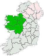 | |
| Dartry Mountains | ||
| Maumturks | ||
| Nephin Range | ||
| Ox Mountains | ||
| Partry Mountains | ||
| Sheeffry Range | ||
| Twelve Bens | ||
| Others | ||
Lists of Marilyns | |
|---|---|