Tribune, Kansas
| Tribune, Kansas | |
|---|---|
| County seat | |
|
Greeley County courthouse (2010) | |
 Location within Greeley County and Kansas | |
 KDOT map of Greeley County (legend) | |
| Coordinates: 38°28′13″N 101°45′16″W / 38.47028°N 101.75444°WCoordinates: 38°28′13″N 101°45′16″W / 38.47028°N 101.75444°W | |
| Country | United States |
| State | Kansas |
| County | Greeley |
| Area[1] | |
| • Total | 0.74 sq mi (1.92 km2) |
| • Land | 0.74 sq mi (1.92 km2) |
| • Water | 0 sq mi (0 km2) |
| Elevation | 3,612 ft (1,101 m) |
| Population (2010)[2] | |
| • Total | 741 |
| • Estimate (2015)[3] | 793 |
| • Density | 1,000/sq mi (390/km2) |
| Time zone | Mountain (MST) (UTC-7) |
| • Summer (DST) | MDT (UTC-6) |
| ZIP code | 67879 |
| Area code(s) | 620 |
| FIPS code | 20-71450 [4] |
| GNIS feature ID | 0471491 [5] |
| Website | City Website |

Tribune is a city in and the county seat of Greeley County, Kansas, United States.[6] As of the 2010 census, the city population was 741.[7]
History
Tribune was founded in 1886. The railroad depot was built in 1887, at which time Tribune was designated county seat.[8] The city is named after the New York Tribune, of which Horace Greeley of Chappaqua, New York was the editor.[9] Greeley encouraged western settlement with the motto "Go West, young man".[10]
As of January 1, 2009, the City of Tribune and Greeley County have operated as a unified government.[11] The resulting government consists of a five-member commission with two members elected by city residents, two by rural residents, and one at-large.[12] Similar to Wyandotte County, the only other consolidated city-county in the state, part of the county was not included: Horace decided against consolidation.[13]
Geography
Tribune is located at 38°28′13″N 101°45′16″W / 38.47028°N 101.75444°W (38.470288, -101.754489).[14] According to the United States Census Bureau, the city has a total area of 0.74 square miles (1.92 km2), all land.[1]
Climate
According to the Köppen Climate Classification system, Tribune has a semi-arid climate, abbreviated "BSk" on climate maps.[15]
Demographics
| Historical population | |||
|---|---|---|---|
| Census | Pop. | %± | |
| 1890 | 90 | — | |
| 1900 | 62 | −31.1% | |
| 1910 | 158 | 154.8% | |
| 1920 | 243 | 53.8% | |
| 1930 | 436 | 79.4% | |
| 1940 | 607 | 39.2% | |
| 1950 | 1,010 | 66.4% | |
| 1960 | 1,036 | 2.6% | |
| 1970 | 1,013 | −2.2% | |
| 1980 | 955 | −5.7% | |
| 1990 | 918 | −3.9% | |
| 2000 | 835 | −9.0% | |
| 2010 | 741 | −11.3% | |
| Est. 2015 | 793 | [3] | 7.0% |
| U.S. Decennial Census | |||

2010 census
As of the census[2] of 2010, there were 741 people, 327 households, and 204 families residing in the city. The population density was 1,001.4 inhabitants per square mile (386.6/km2). There were 385 housing units at an average density of 520.3 per square mile (200.9/km2). The racial makeup of the city was 92.2% White, 0.1% African American, 0.8% Native American, 0.3% Asian, 5.5% from other races, and 1.1% from two or more races. Hispanic or Latino of any race were 13.0% of the population.
There were 327 households of which 22.9% had children under the age of 18 living with them, 56.6% were married couples living together, 4.0% had a female householder with no husband present, 1.8% had a male householder with no wife present, and 37.6% were non-families. 35.5% of all households were made up of individuals and 17.5% had someone living alone who was 65 years of age or older. The average household size was 2.19 and the average family size was 2.84.
The median age in the city was 49.1 years. 19.3% of residents were under the age of 18; 6.1% were between the ages of 18 and 24; 17.3% were from 25 to 44; 31% were from 45 to 64; and 26.2% were 65 years of age or older. The gender makeup of the city was 47.0% male and 53.0% female.
2000 census
As of the census[4] of 2000, there were 835 people, 356 households, and 232 families residing in the city. The population density was 1,117.0 people per square mile (429.9/km²). There were 425 housing units at an average density of 568.5 per square mile (218.8/km²). The racial makeup of the city was 94.37% White, 0.12% African American, 0.36% Native American, 0.12% Asian, 0.24% Pacific Islander, 3.59% from other races, and 1.20% from two or more races. Hispanic or Latino of any race were 6.35% of the population.
There were 356 households out of which 28.9% had children under the age of 18 living with them, 57.9% were married couples living together, 5.1% had a female householder with no husband present, and 34.8% were non-families. 31.7% of all households were made up of individuals and 16.6% had someone living alone who was 65 years of age or older. The average household size was 2.27 and the average family size was 2.87.
In the city the population was spread out with 23.6% under the age of 18, 6.1% from 18 to 24, 24.1% from 25 to 44, 22.2% from 45 to 64, and 24.1% who were 65 years of age or older. The median age was 43 years. For every 100 females there were 89.8 males. For every 100 females age 18 and over, there were 82.3 males.
The median income for a household in the city was $32,969, and the median income for a family was $46,563. Males had a median income of $30,132 versus $16,458 for females. The per capita income for the city was $20,020. About 7.0% of families and 9.6% of the population were below the poverty line, including 8.3% of those under age 18 and 9.4% of those age 65 or over.
See also
References
- 1 2 "US Gazetteer files 2010". United States Census Bureau. Retrieved 2012-07-06.
- 1 2 "American FactFinder". United States Census Bureau. Retrieved 2012-07-06.
- 1 2 "Annual Estimates of the Resident Population for Incorporated Places: April 1, 2010 to July 1, 2015". Retrieved July 2, 2016.
- 1 2 "American FactFinder". United States Census Bureau. Retrieved 2008-01-31.
- ↑ "US Board on Geographic Names". United States Geological Survey. 2007-10-25. Retrieved 2008-01-31.
- ↑ "Find a County". National Association of Counties. Retrieved 2011-06-07.
- ↑ "2010 City Population and Housing Occupancy Status". U.S. Census Bureau. Retrieved March 27, 2011.
- ↑ Blackmar, Frank Wilson (1912). Kansas: A Cyclopedia of State History, Volume 2. Standard Publishing Company. p. 820.
- ↑ Kansas State Historical Society (1916). Biennial Report of the Board of Directors of the Kansas State Historical Society. Kansas State Printing Plant. p. 198.
- ↑ Josiah Busnell Grinnell (1891). Men and Events of Forty Years. Boston: D. Lothrop. p. 87. Retrieved 2009-02-13.
- ↑ http://www.greeleycounty.org/?page_id=947
- ↑ Greeley County residents pass unification, Garden City Telegram, 2007-11-07. Accessed 2007-11-08.
- ↑ TRIBUNE | City and county to unify, The Kansas City Star, 2007-11-07. Accessed 2007-11-08.
- ↑ "US Gazetteer files: 2010, 2000, and 1990". United States Census Bureau. 2011-02-12. Retrieved 2011-04-23.
- ↑ Climate Summary for Tribune, Kansas
Further reading
- History of the State of Kansas; William G. Cutler; A.T. Andreas Publisher; 1883. (Online HTML eBook)
- Kansas : A Cyclopedia of State History, Embracing Events, Institutions, Industries, Counties, Cities, Towns, Prominent Persons, Etc; 3 Volumes; Frank W. Blackmar; Standard Publishing Co; 944 / 955 / 824 pages; 1912. (Volume1 - Download 54MB PDF eBook),(Volume2 - Download 53MB PDF eBook), (Volume3 - Download 33MB PDF eBook)
External links
| Wikimedia Commons has media related to Tribune, Kansas. |
- City
- Schools
- USD 200, local school district
- Maps
- Tribune City Map, KDOT
Municipalities and communities of Greeley County, Kansas, United States | ||
|---|---|---|
| Cities | 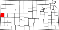 | |
| Unincorporated community | ||
| Townships | ||