Tourism in Albania


Tourism in Albania is characterized by archaeological heritage from Illyrian, Greek, Roman and Ottoman times, unspoiled beaches, mountainous topography, delicious traditional Albanian cuisine, Cold War era artifacts, unique traditions and hospitality, low prices, and the wild and peculiar atmosphere of the countryside. Lonely Planet ranked Albania as the no. 1 destination to be visited in 2011.[1] The New York Times ranked Albania fourth among 52 destinations to be visited in 2014.[2] Although still underdeveloped, Albania is set to prime its debut on the world scene as it celebrates a century of independence.[3] A Huffington Post article outlined 10 reasons for visiting Albania in 2013.[4] Recently, Albania has been officially dubbed as "Go Your Own Way". Previously, it was dubbed as "A New Mediterranean Love" and "Europe's Last Secret".[5]
The bulk of international tourists going to Albania are mostly ethnic Albanians from Kosovo, Macedonia, Montenegro, Greece, Italy, and from the larger Albanian diaspora.[6] Foreign tourists mostly come from Central and Eastern Europe, particularly from Poland, Slovakia, Hungary, and the Czech Republic. Tourists also come from Western European countries such as Germany, Belgium, Netherlands, France, UK, Scandinavia, and others including the United States, Turkey and countries in Asia.[7] Tourism in Albania is a growing sector with more tourists visiting the country every year. Greek tourists in the countries have increased since the economic crisis namely for seasonal work in the Albanian coast, during the summer months.
Contrary to general perception, Albania is a very safe country[8] with warm and helping people as reflected in the traditional Albanian expression Buke, Kripe e Zemer (Bread, Salt and Heart). To better enjoy ones's stay and for useful information, first time travelers to Albania are strongly encouraged to consult online/print publications, travel forums and blogs on specific tips and itinerary, or can simply book a tour with a local tour operator. Some travelers include Albania as part of the wider Balkan tour package. Visitors with campervans and backpackers prefer resting at hostels or guesthouses, camping in the countryside, and along the coast. Organized groups visit the numerous archaeological sites, historic towns, or rest at seaside resorts of Durres and Shengjin. A growing trend has become canyon rafting, bird-watching, cycling, mountain biking, hiking, and off-road touring in the countryside. Other travelers enjoy exploring the trendy area of Blloku, Tirana's entertainment district which transfers along the Albanian Riviera during the peak summer months. The adventurous Albanian railway system has been described by many travel guides as a tourist attraction and a de facto panoramic journey. Car rental agencies, tour operators, and tourist information centers have opened branches in the capital and other towns. Dental tourism has become popular as local dentists offer services with much lower prices. Local delicious cuisine can be tasted at traditional Albanian restaurants located in emerging agrotourism areas, near tourist attractions, and in scenic spots throughout the country.
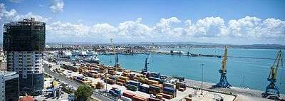
However, tourism is hampered by local management issues such as poor road and public utilities infrastructure, unregulated waste disposal, illegal construction and hunting, uncertain land ownership, and an unqualified hospitality sector. These are due to Albania's long isolation, but are being dealt with and improvement is being seen constantly. Most main and coastal roads, some mountainous ones, and water supply and treatment facilities have been recently reconstructed mainly through IPA pre-accession funds to the European Union. The private sector and foreign donors are heavily investing in accommodation and renovations at historical sites, while seasonal charter flights and all year round cruises are making their presence known in Tirana Airport and Albania's main sea ports. Others are expressing interest or investing in building tourist resorts, yacht marinas, or in the attractive real estate market.[9]
Towns and archaeological sites
Stemming from a rich history of civilizations, Albania holds a mix of interesting artifacts. Since 2013, town centers in Albania are being redesigned and facades painted to reflect a more Mediterranean look. The most visited towns are:
- Durrës Amphitheatre
- One over one window town of Berat
- Old port city of Durrës (Dyrrhachium)


_-_Monument_of_Agonothetes.JPG)
- Stone city of Gjirokastër
- Krujë, the balcony over the Adriatic sea
- Shkodër, the city that is home, among others to the Rozafa Castle
- Tirana, the capital with a vibrant nightlife
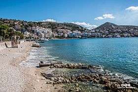
- Beach city of Vlorë (the city of olives and grapes)
- Lezha, the historic diplomatic capital of Albania
- Poet's city of Pogradec
- Honeymooners' city of Sarandë
- Year round festive city of Korcë
The most visited archaeological sites are:
World heritage sites of Albania
| # | Image | Name | UNESCO data |
|---|---|---|---|
| 1 |  |
Butrint | 1996 |
| 2 |  |
Historic Centres of Berat and Gjirokastër | 2005 |
Tentative List
- Durrës Amphitheatre
- Royal Tombs of Selca e Poshtme,
- Natural and Cultural Heritage of the Ohrid Region (Albania)
- Apollonia
Natural attractions and emerging agritourism areas
Northern Albania
Northern Albania is known for its alpine mountainous landscape, conservative highlands, historic regions, large hydroelectric reservoirs, traditional inns and camping areas, and where the southern most glaciers of Europe are located. Some increasingly popular features include:
- Theth and Valbona Valley national parks in the Albanian Alps, part of the Prokletije or Accursed Mountains range in Northern Albania. Kelmend region and Shkrel are located southwest of Vermosh, the northernmost point of Albania.
- Lake Komani Ferry, a unique journey amidst spectacular mountain views
- Emerging agritourism areas of Puka, panoramic Ulëz Lake and nearby Vau i Dejes, Barbullush and Fishte villages in Zadrima region near Lezhe, and Katund i Vjeter in Mirdita region near Rubik
- Shishtavec near Kukes, and alpine area of Nikaj-Mertur in Lekbibaj region near Bajram Curri
- Fishing village of Shiroka, Zogaj, and Grile/Omaraj along Shkodër Lake


Coastal western lowland of Albania
The western lowland of Albania alternates between archaeological sites, castles, long stretches of curative sandy beaches, and lagoon areas perfect for bird-watching. In total, the coastline of Albania stretches over 476 km (296 mi)[11] and is administered by the AKB National Coastal Agency . Some emerging coastal areas include:
- Curative beaches of coastal Shengjin near Lezhe, and Velipoja close to Ada Bojana near the Montenegrin border
- Coastal areas of Lalzi Bay north of Durrës near Rodon Cape, Golem Beach south of Durres, and General's Beach near Kavaje
- Kune-Vain Lagoon near Lezhe, and Karavasta Lagoon near Divjake along the Adriatic Sea
- Picturesque areas of Fushe-Kuqe and Shenkoll near the Kune-Vain-Tale Lagoon Area
- Protected coastal area of Pishe-Poro in the Vjosa River Delta near Narta Lagoon featuring bird-watching, sand dunes and medicinal herbs
- Krujë is called by the locals as the Adriatic Balcony from the stunning view that offers day and night


Central Albania
Central Albania alternates between hilly and mountainous topography, ancient castles and rich culinary traditions of rural Tirana, Elbasan, and Gramsh.
- Tirana suburban areas of Berzhite and Petrela along Rruga e Elbasanit (SH3), and panoramic villages of Mount Dajt east of the capital
- Belsh Lakes near Belsh, Elbasan District
- Emerging agritourism villages of Gjinar near Elbasan, and Rovje in Gramsh District
- Alpine Shebenik-Jabllanice National Park home to the Balkan lynx near Librazhd

Southern and Southeastern Albania
Southern and Southeastern Albania are mostly mountainous and known for UNESCO World Heritage Sites, Orthodox monasteries, Albanian Renaissance figures, and long stretches of shingle and sandy beaches along the Albanian Riviera and Lake Ohrid.
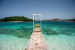
- Albanian Riviera, the coastal area stretching from Vlorë to Saranda along the Ionian Sea.
- Naturally occurring phenomenon of the Blue Eye Spring near Sarande in extreme Southern Albania
- Radhime coastal stretch south of Vlora, and Tragjas near Orikum emerging agriturism area
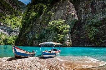
- The 20 km long Osum Canyon, the largest in Albania located near Corovode in Skrapar District, and the Sotira Waterfall in Gramsh District near Tomorri Mountain
- Nivica and Progonat Canyons near Tepelene and the Langarica Canyon in Përmet
- Shelegur protected mountain area near Leskovik, Erseke
- Historic Moscopole, and alpine Dardhë, Vithkuq, and Boboshticë villages near Korcë
- Albanian stretch of Ohrid Lake in Hudenisht stretching from Qafë Thanë/Kjafasan, Pogradec to Tushemisht. Drilon Swans Park is located east of Pogradec.
- Area of Përmet in southeastern Albania, and Libohovë village near Gjirokastër
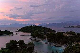


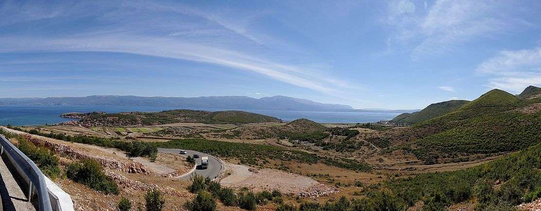
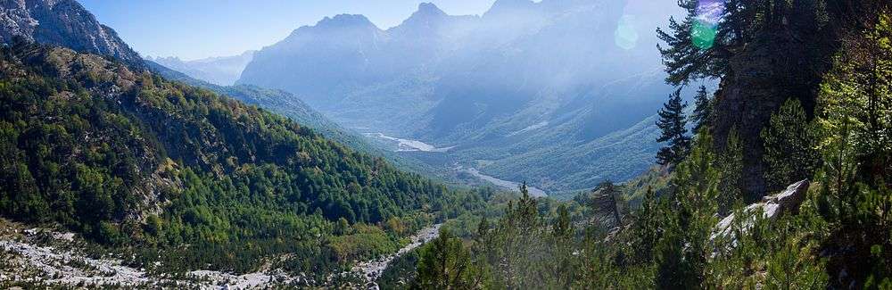
Panoramas


.JPG)


National Parks in Albania
| Name | Image | Location | Area | Established | Description |
|---|---|---|---|---|---|
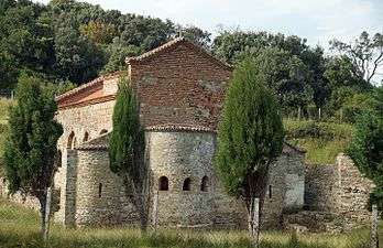
| Butrint | | Sarandë 39°46′N 20°02′E / 39.76°N 20.03°E | 9,424.4 hectares (94.244 km2) | 1966 | Inhabited since prehistoric times, Butrint has been the site of a Greek colony, a Roman city and a bishopric. Following a period of prosperity under Byzantine administration, then a brief occupation by the Venetians, the city was abandoned in the late Middle Ages after marshes formed in the area. The present archaeological site is a repository of ruins representing each period in the city’s development.[12] |
| Llogara |  | Vlorë 40°13′N 19°34′E / 40.22°N 19.56°E | 1,010 hectares (10.1 km2) | 1966 | The Park is known for its vibrant flora and fauna with over 100 different types of wild animals and birds including: deer, wild cats, foxes, etc. The mixture of refreshing high altitude mountain air and the proximity to the sea make it a very attractive destination for tourists. The area is also important for the growth of eco-tourism, picnic, hiking and air sports. |
| Karaburun-Sazan | | Vlorë 40°27′N 19°19′E / 40.45°N 19.31°E | 12,428 hectares (124.28 km2) | 2010 | The only marine park in Albania. Consists of surrounding sea water, 1 nautical mile from the shores of the Karaburun Peninsula and Sazan Island. |
| Divjakë-Karavasta | 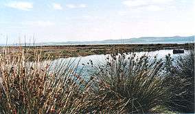 | Divjakë 40°56′N 19°30′E / 40.93°N 19.50°E | 22,230 hectares (222.3 km2) | 2008 | The largest lagoon in Albania and one of the largest in the Adriatic Sea. It is separated from the Adriatic Sea by a large strip of sand. The lagoon is part of the Divjakë-Karavasta National Park. It was chosen as an area of international importance, protected by the Ramsar Convention of 29 November 1995. |
| Mount Dajt |  | Tiranë 41°24′N 19°55′E / 41.40°N 19.92°E | 29,384.18 hectares (293.8418 km2) | 1966 | Dajti National Park is located 26 km east of the capital, Tirana. It's accessible all year round and can be reached on foot or via cable cars. |
| Lurë |  | Dibër 41°46′N 20°11′E / 41.76°N 20.19°E | 1,280 hectares (12.8 km2) | 1966 | This national park is home to many rare species of wildlife. The twelve glacial lakes of Lurë that were formed during the Würm glacial period are an identifying attraction. |
| Lake Prespa |  | Pustec 40°47′N 20°53′E / 40.79°N 20.88°E | 27,750 hectares (277.5 km2) | 1999 | Prespa Lakes are the highest tectonic lakes in the Balkans, standing at an elevation of 853 m (2,798 ft). |
| Theth | 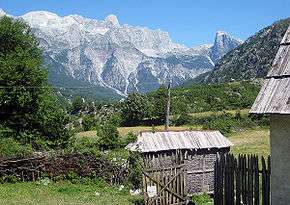 | Shkodër 42°25′N 19°47′E / 42.41°N 19.78°E | 2,630 hectares (26.3 km2) | 1966 | Theth is a national park in the extreme north of the country, designated by government decree in 1966.[13] It covers an area of 2,630 hectares and is located along the Theth River. The main attractions in the park are the Grunas Waterfall and the Lock-in Tower.[13] |
| Valbonë Valley | | Tropojë 42°26′N 19°56′E / 42.43°N 19.93°E | 8,000 hectares (80 km2) | 1996 | Designated in 1996, the park covers 8,000 hectares including the Valbona Valley and the Valbona River[14] and lies between high and craggy peaks bordering Theth, Gashi River, Plava and Gucia (Montenegro), all strictly protected natural areas. |
| Fir of Hotovë-Dangëlli |  | Përmet 40°18′N 20°24′E / 40.30°N 20.40°E | 34,361.1 hectares (343.611 km2) | 2008 | This park contains the largest area of Bulgarian Fir in the Balkans. Other tree species include maple, black hornbeam, ilex, red and black juniper, raspberry etc. |
| Shebenik-Jabllanicë |  | Librazhd 41°13′N 20°27′E / 41.22°N 20.45°E | 33,927.7 hectares (339.277 km2) | 2008 | The park is one of Albania’s newest, created in 2008. Within the park region dwell a number of different species that are fast becoming rare in Albania, including the brown bear, gray wolf and the endangered Balkan Lynx.[15] |
| Shtamë Pass | 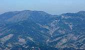 | Krujë 41°31′N 19°53′E / 41.52°N 19.89°E | 2,000 hectares (20 km2) | 1996 | The majority of the park is mostly undeveloped mountain land with forests, in which pine trees, and oak dominate. |
| Fir of Drenova | 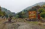 | Korçë 40°34′N 20°50′E / 40.57°N 20.83°E | 1,380 hectares (13.8 km2) | 1966 | The park has a particular importance on the trans-boundary exchanges of flora and fauna elements. It represents a key habitat and bio corridor for large vertebrates, such as the bear (Ursus arctos), wolf (Canis lupus), roe deer (Capreolus capreolus); a habitats variety of: natural subalpine and alpine pastures, beech forest (Fagus syvaticus), pine (Pinus sp.), fir (Abies sp.) and hazelnut (Corrilus avellana). |
| Mount Tomorr | .jpg) | Berat 40°42′N 20°08′E / 40.70°N 20.14°E | 24,723.1 hectares (247.231 km2) | 1996 | In the classical period, Mount Tomorr was originally known as Mount Amyron who was a central feature in the region of Dassaretis, which was named after its inhabitants the Dexari, a tribe of Epirus belonging to the Chaonian people.[16] |
| Zall-Gjoçaj | Mat 41°43′N 20°11′E / 41.71°N 20.19°E | 140 hectares (1.4 km2) | 1996 | Zall-Gjoçaj National Park is a wonderful park 40 km northeast of the town of Burrel. Featuring a variety of springs and ravines, it is resplendent in natural beauty. |
Climate

Albania has a Mediterranean climate with each season offering distinct, yet pleasant weather. Some features of the climate vary by region: The coastal areas have a Central Mediterranean climate with mild, wet winters and hot, dry summers. The alpine areas have a Central Continental climate with cold, snowy winters and temperate summers. The lowlands have mild winters, averaging about 7 °C, and summer temperatures average 24 °C. Lowland rainfall ranges from 1,000 mm to more than 1,500 mm annually, with greater rainfall in the north. Nearly 95% of rainfall occurs in the winter and rainfall in the upland mountain ranges is heavier. Despite the rain, Albanians enjoy a great deal of sunshine, second only to Spain in average annual sunny days. The overall climate is pleasant and favors outdoor activity.
Flora and Fauna

Although a small country, Albania is distinguished for its rich biological diversity. The variation of geomorphology, climate and terrain create favorable conditions for a number of endemic and sub-endemic species with 27 endemic and 160 subendemic vascular plants present in the country. The total number of plants is over 3250 species, approximately 30% of the entire flora species found in Europe.
Over a third of the territory of Albania – about 10,000 square kilometres (3,861 square miles);– is forested and the country is very rich in flora. About 3,000 different species of plants grow in Albania, many of which are used for medicinal purposes. Phytogeographically, Albania belongs to the Boreal Kingdom, the Mediterranean Region and the Illyrian province of the Circumboreal Region. Coastal regions and lowlands have typical Mediterranean macchia vegetation, whereas oak forests and vegetation are found on higher elevations. Vast forests of black pine, beech and fir are found on higher mountains and alpine grasslands grow at elevations above 1800 meters.
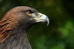
Some of the most significant bird species found in the country include the golden eagle – known as the national symbol of Albania[17] – vulture species, capercaillie and numerous waterfowl. The Albanian forests still maintain significant communities of large mammals such as the brown bear, gray wolf, chamois and wild boar. The north and eastern mountains of the country are home to the last remaining Balkan lynx – a critically endangered population of the Eurasian lynx.
Panoramic routes
Due to the varying geographic elevation, Albania features endless panoramic routes with the main being:
 Vlora-Saranda route in Southwestern Albania along the Albanian Riviera starting from coastal Vlorë into Llogara Pass and along the Ceraunian Mountains
 Rreshen-Kalimash motorway connecting Albania with Kosovo between mountains along the Fan River Valley in Northern Albania
 - SH78 Jergucat-Delvine along Muzina Pass overlooking the Dropulli Plain in Southern Albania
- SH75 Korçë-Ersekë-Përmet
- Ancient Via Egnatia along modern SH3
References
- ↑ 400,000 More Tourists Visited Albania in 2008 "From BalkanTravellers.com http://www.suite101.com/content/lonely-planet-albania---in-from-the-cold-in-2011-a303777" Check
|url=value (help). BalkanTravellers. External link in|title=(help) - ↑ "52 Places to Go in 2014". The New York Times. 10 January 2014.
- ↑ Richardson, Whit (22 October 2012). "The Place: Albania Steps Into the Spotlight". National Geographic.
- ↑ Giray, Leyla (27 December 2012). "10 Reasons 2013 Is The Time To Visit Albania". The Huffington Post.
- ↑ Albanie. Retrieved 16 June 2015.
- ↑ http://www.mtkrs.gov.al/web/Treguesit_statistikore_te_turizmit_30_1.php
- ↑ Turizmi ne Shqiperi: Reklama per Evropen Lindore, Shqiperia.com
- ↑ Fidler, Stephen (30 May 2008). "Balkans 'safer' than west Europe". Financial Times.
- ↑ Satterlee, Saundra (2 Nov 2015). "Albania property: a hidden gem opening up to the world". The Telegraph.
- ↑ UNESCO World Heritage Centre
- ↑ R. Eftimi. "SOME CONSIDERATIONS ON SEAWATER-FRESHWATER RELATIONSHIP IN ALBANIAN COASTAL AREA" (PDF). ITA Consult.
- ↑ http://whc.unesco.org/en/list/570
- 1 2 Thethi-Guide. "Historia e Parkut Kombetar Theth" (in Albanian). Retrieved 28 July 2010.
- ↑ Albanian National Agency of Tourism. "Valbona Valley National Park" (in Albanian). Retrieved 28 July 2010.
- ↑ "Proclamation of the natural ecosystem of Shebenik – Jabllanica as a "National Park"". Cat Specialist Group.
- ↑ Hammond 1994, pp. 422–423; Hammond & Griffith 1972, p. 94.
- ↑ Streissguth, Thomas (2010). Albania in Pictures. Twenty-First Century Books. ISBN 978-0-7613-4629-6.
See also
- Transport in Albania
- Architecture of Albania
- History of Albania
- Geography of Albania
- Cuisine of Albania
- Visa policy of Albania
- List of castles in Albania
- List of national parks of Albania
- Albanian Tourism Association
External links
- Albania Tourism Official Portal
- Dear Albania Documentary Trailer from Albanian-American actress Eliza Dushku
