Tortorella
For other uses, see Tortorella (disambiguation).
| Tortorella | |
|---|---|
| Comune | |
| Comune di Tortorella | |
 | |
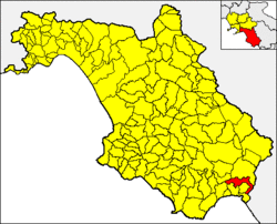 Tortorella within the Province of Salerno | |
 Tortorella Location of Tortorella in Italy | |
| Coordinates: 40°8′33.61″N 15°36′23.47″E / 40.1426694°N 15.6065194°ECoordinates: 40°8′33.61″N 15°36′23.47″E / 40.1426694°N 15.6065194°E | |
| Country | Italy |
| Region | Campania |
| Province / Metropolitan city | Province of Salerno (SA) |
| Frazioni | Caselle |
| Area | |
| • Total | 49 km2 (19 sq mi) |
| Elevation | 582 m (1,909 ft) |
| Population (31 December 2011)[1] | |
| • Total | 563 |
| • Density | 11/km2 (30/sq mi) |
| Demonym(s) | Tortorellesi |
| Time zone | CET (UTC+1) |
| • Summer (DST) | CEST (UTC+2) |
| Postal code | 84030 |
| Dialing code | 0973 |
| Patron saint | Saint Vitus |
| Saint day | 15 June |
| Website | Official website |
Tortorella is a town and comune of the province of Salerno, Campania, in south-western Italy. As of 2011 its population was of 563.[1]
Geography
Located in southern Cilento, 11 km far from the Cilentan Coast, Tortorella is a hill town located in the middle of a large forest area part of Cilento and Vallo di Diano National Park. Nearest settlements are Casaletto Spartano and Battaglia.
The bordering municipalities are Casaletto Spartano, Morigerati, Santa Marina, Sapri, Torraca, Vibonati and Rivello (PZ), this one in Basilicata region. The only hamlet (frazione) is the village of Caselle.
Demographics

See also
References
External links
![]() Media related to Tortorella at Wikimedia Commons
Media related to Tortorella at Wikimedia Commons
This article is issued from Wikipedia - version of the 10/8/2014. The text is available under the Creative Commons Attribution/Share Alike but additional terms may apply for the media files.