Tootal, Broadhurst and Lee Building, Manchester
| Churchgate and Lee House | |
|---|---|
 Churchgate and Lee House | |
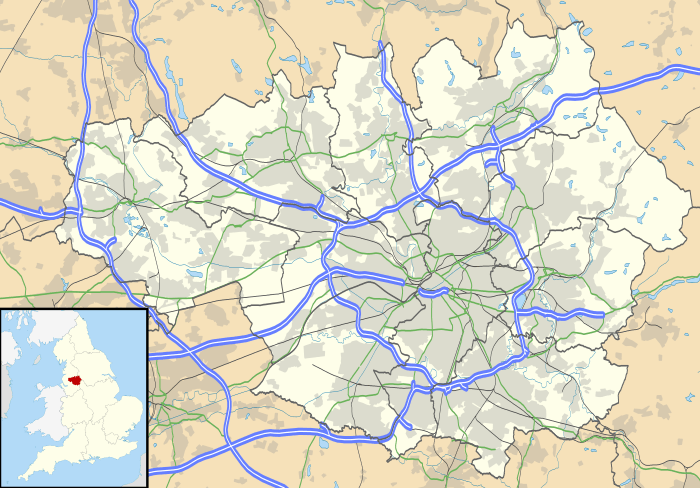 Location within Greater Manchester | |
| Former names | Tootal, Broadhurst and Lee Building |
| General information | |
| Type | Commercial Office |
| Town or city | Manchester |
| Country | England |
| Coordinates | 53°28′31″N 2°14′32″W / 53.4752°N 2.2422°W |
| Construction started | 1896 |
| Inaugurated | 1898 |
| Renovated | 2015 |
| Owner | Helical Bar PLC |
| Technical details | |
| Floor count | 6 |
| Design and construction | |
| Architect | J. Gibbons Sankey |
| Main contractor | Capital Properties (UK) Ltd |
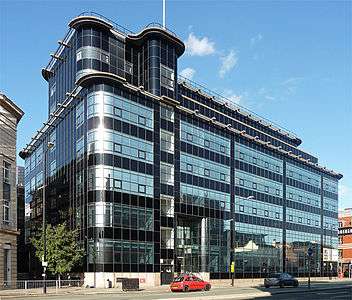
The Tootal, Broadhurst and Lee Building (subsequently Churchgate House) at No. 56 Oxford Street, in Manchester, England, is a late Victorian warehouse and office block built in a neo-Baroque style for Tootal Broadhurst Lee, a firm of textile manufacturers. It was designed by J. Gibbons Sankey and constructed between 1896 and 1898.[1] It has been designated a Grade II* listed building.[2]
Nikolaus Pevsner's The Buildings of England describes the warehouse as "large, in red brick stripped with orange terracotta, but comparatively classical".[1] It has a "massive central round-headed doorway with banded surround and cartouche dated 1896, set in (an) architrave of coupled banded columns and (a) broken pediment".[2]
The interior has been redesigned, but a First World War memorial by Henry Sellers has been retained, being "marble, with a niche from which the figure (has been) stolen".[3]
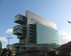
Behind it and not visible from the street is Lee House, the stub of what would have been the tallest building in Europe at 217 ft., a 17-storey warehouse of the same firm (planned 1928; part completed 1931).[4] Both Churchgate House and Lee House are on the north bank of the Rochdale Canal; Great Bridgewater Street is immediately to the north of them.
See also
Notes
- 1 2 The Buildings of England: Lancashire- Manchester and the South East, p. 321
- 1 2 Tootal, Broadhurst and Lee Building 56 - Manchester - Greater Manchester - England | British Listed Buildings
- ↑ Pevsner Architectural Guides: Manchester, p. 182
- ↑ Sharp, Dennis, et al. (1969) Manchester. London: Studio Vista; p. 33
References
- Hartwell, Clare; Hyde, Matthew & Pevsner, Nikolaus, The Buildings of England: Lancashire: Manchester and the South East (2004) Yale University Press
- Hartwell, Clare, Pevsner Architectural Guides: Manchester (2002) Yale University Press
- British Listed Buildings
- Churchgate & Lee House Website
Coordinates: 53°28′31″N 2°14′32″W / 53.4752°N 2.2422°W