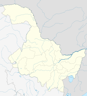
Tonghe County
| Tonghe County 通河县 | |
|---|---|
| County | |
 Tonghe Location in Heilongjiang | |
| Coordinates: 45°59′24″N 128°44′46″E / 45.990°N 128.746°ECoordinates: 45°59′24″N 128°44′46″E / 45.990°N 128.746°E[1] | |
| Country | People's Republic of China |
| Province | Heilongjiang |
| Sub-provincial city | Harbin |
| Divisions |
6 towns 2 townships |
| Seat | Tonghe (通河镇) |
| Area[2] | |
| • Total | 5,675.5 km2 (2,191.3 sq mi) |
| Elevation | 107 m (351 ft) |
| Population (2010)[3] | |
| • Total | 210,650 |
| • Density | 37/km2 (96/sq mi) |
| Time zone | China Standard (UTC+8) |
| Postal code | 1509XX |
| Area code(s) | 0451 |
| Harbin district map | |
Tonghe County (simplified Chinese: 通河县; traditional Chinese: 通河縣; pinyin: Tōnghé Xiàn; literally: "pass river") is under the administration of Harbin, the capital of Heilongjiang province, People's Republic of China, located on the northern (right) bank of the Songhua River. It is 161 kilometres (100 mi) to the east of central Harbin, bordering Yilan County to the east, Fangzheng County to the south, Mulan County to the west, as well as the prefecture-level city of Yichun to the north.
Geography and climate
Tonghe County has a monsoon-influenced humid continental climate (Köppen Dwa/Dwb), with long, very dry, bitterly cold winters, very warm and humid summers, and short, rather dry spring and autumn in between. Its location in the Songhua River Valley at an elevation of 107 m (351 ft) allows for cool air to pool in and around the county seat, depressing temperatures slightly as compared to Harbin. The monthly 24-hour average temperature ranges from −20.9 °C (−5.6 °F) in January to 22.1 °C (71.8 °F) in July, and the annual mean is +2.58 °C (36.6 °F). Close to 65% of the annual precipitation occurs from June to August. With monthly percent possible sunshine ranging from 46% in July to 66% in February, the area receives 2,413 hours of bright sunshine annually, with the latter half of winter being especially sunny.
| Climate data for Tonghe County (1971–2000) | |||||||||||||
|---|---|---|---|---|---|---|---|---|---|---|---|---|---|
| Month | Jan | Feb | Mar | Apr | May | Jun | Jul | Aug | Sep | Oct | Nov | Dec | Year |
| Average high °C (°F) | −13.9 (7) |
−8.4 (16.9) |
1.4 (34.5) |
12.5 (54.5) |
20.1 (68.2) |
24.8 (76.6) |
27.4 (81.3) |
25.6 (78.1) |
20.1 (68.2) |
11.0 (51.8) |
−1.2 (29.8) |
−11.2 (11.8) |
9.0 (48.2) |
| Average low °C (°F) | −27.1 (−16.8) |
−23 (−9) |
−12.1 (10.2) |
−1 (30) |
5.6 (42.1) |
13.2 (55.8) |
17.3 (63.1) |
15.4 (59.7) |
7.2 (45) |
−1.4 (29.5) |
−12.6 (9.3) |
−22.9 (−9.2) |
−3.4 (25.8) |
| Average precipitation mm (inches) | 3.1 (0.122) |
3.8 (0.15) |
8.9 (0.35) |
25.1 (0.988) |
58.9 (2.319) |
91.1 (3.587) |
166.0 (6.535) |
129.8 (5.11) |
63.3 (2.492) |
35.7 (1.406) |
10.7 (0.421) |
6.6 (0.26) |
603.0 (23.74) |
| Average precipitation days (≥ 0.1 mm) | 6.2 | 5.3 | 6.0 | 8.9 | 12.4 | 14.4 | 13.9 | 13.5 | 11.7 | 9.0 | 7.2 | 7.9 | 116.4 |
| Average relative humidity (%) | 75 | 74 | 67 | 62 | 63 | 75 | 81 | 84 | 78 | 71 | 73 | 76 | 73.3 |
| Mean monthly sunshine hours | 169.8 | 192.0 | 239.3 | 222.1 | 240.9 | 225.7 | 215.7 | 203.7 | 213.7 | 189.4 | 159.2 | 141.0 | 2,412.5 |
| Percent possible sunshine | 61 | 66 | 65 | 55 | 53 | 48 | 46 | 47 | 57 | 56 | 56 | 53 | 54 |
| Source: China Meteorological Administration | |||||||||||||
Administrative divisions
There are six towns and two townships in the county:[4]
Towns (镇)
- Tonghe (通河镇)
- Wuyapao (乌鸦泡镇)
- Qinghe (清河镇)
- Nonghe (浓河镇)
- Fengshan (凤山镇)
- Xiangshun (祥顺镇)
Townships (乡)
- Sanzhan Township (三站乡)
- Fulin Township (富林乡)
Demographics
The population of the district was 234,662 in 1999.[5]
Transport
References
- ↑ Google (2014-07-02). "Tonghe" (Map). Google Maps. Google. Retrieved 2014-07-02.
- ↑ Harbin Statistical Yearbook 2011 (《哈尔滨统计年鉴2011》). Accessed 8 July 2014.
- ↑ 2010 Census Harbin primary statistics report (《哈尔滨市2010年第六次全国人口普查主要数据公报》). Accessed 8 July 2014.
- ↑ 2011年统计用区划代码和城乡划分代码:通河县 (in Chinese). National Bureau of Statistics of the People's Republic of China. Retrieved 2013-02-10.
- ↑ National Population Statistics Materials by County and City - 1999 Period, in China County & City Population 1999, Harvard China Historical GIS
External links
- (Chinese) Government site - Google translation
