Tōkamachi, Niigata
| Tōkamachi 十日町市 | |||
|---|---|---|---|
| City | |||
|
Tōkamachi City Hall | |||
| |||
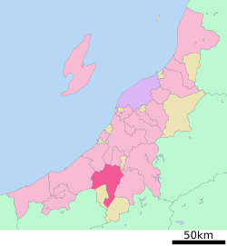 Location of Tōkamachi in Niigata | |||
 Tōkamachi
| |||
| Coordinates: 37°7′39.1″N 139°45′20.6″E / 37.127528°N 139.755722°ECoordinates: 37°7′39.1″N 139°45′20.6″E / 37.127528°N 139.755722°E | |||
| Country | Japan | ||
| Region | Chūbu (Kōshin'etsu) (Hokuriku) | ||
| Prefecture | NIigata | ||
| Area | |||
| • Total | 590.39 km2 (227.95 sq mi) | ||
| Population (June 2016) | |||
| • Total | 54,104 | ||
| • Density | 91.6/km2 (237/sq mi) | ||
| Time zone | Japan Standard Time (UTC+9) | ||
| Symbols | |||
| • Tree | Fagus crenata | ||
| • Flower | Lilium | ||
| • Bird | Swan | ||
| Phone number | 025-757-3111 | ||
| Address | 3-3 Chitose, Tokamachi-shi, Niigata-ken 948-8501 | ||
| Website |
www | ||


Tōkamachi (十日町市 Tōkamachi-shi) is a city located in southwest Niigata Prefecture, in the Hokuriku region of Japan. As of 1 June 2016, the city had an estimated population of 54,1043 and a population density of 91.6 persons per km². Its total area was 590.39 square kilometres (227.95 sq mi), including the post-creation undefined boundary areas. The city's mayor is Yoshifumi Sekiguchi, who was elected in May 2009.[1] Tokamachi derives its name from the fact that on the tenth day of the month, the town's local market was held. Similarly, nearby Muikamachi had its own local market held on the sixth day of the month.[2]
Geography
Tōkamachi is located in an inland region of southwest Niigata Prefecture. Parts of the city are within the borders of the Jōshin'etsu-kōgen National Park.
Surrounding municipalities
Climate
Winter is cold and wet. An average of three meters of snow hit the city during this season. Tōkamachi, like much of Japan is located in a temperate marine climate zone which provides plenty of wet weather. Although the temperature does not often drop below 0 °C (32 °F), snow is in abundance. Because Tōkamachi lies in a valley, wind patterns bring in clouds from both the sea of Japan as well as the Pacific ocean. The mountains surrounding the city (though not terribly high in altitude) act as any other mountains that affect rain and snow patterns providing a barrier for cloud patters. This causes a great deal of the built up precipitation to drop on the city. The Tōkamachi area receives the most snow of any area on the main island of Honshu.
| Climate data for Tokamachi, Niigata (1981-2010) | |||||||||||||
|---|---|---|---|---|---|---|---|---|---|---|---|---|---|
| Month | Jan | Feb | Mar | Apr | May | Jun | Jul | Aug | Sep | Oct | Nov | Dec | Year |
| Average high °C (°F) | 3.0 (37.4) |
3.7 (38.7) |
7.4 (45.3) |
15.3 (59.5) |
21.8 (71.2) |
25.2 (77.4) |
28.4 (83.1) |
30.4 (86.7) |
25.6 (78.1) |
19.5 (67.1) |
13.1 (55.6) |
6.5 (43.7) |
16.66 (61.98) |
| Daily mean °C (°F) | −0.2 (31.6) |
0.0 (32) |
2.7 (36.9) |
9.0 (48.2) |
15.5 (59.9) |
19.9 (67.8) |
23.5 (74.3) |
24.9 (76.8) |
20.5 (68.9) |
14.1 (57.4) |
8.0 (46.4) |
2.6 (36.7) |
11.71 (53.08) |
| Average low °C (°F) | −3.0 (26.6) |
−3.4 (25.9) |
−1.2 (29.8) |
3.6 (38.5) |
10.0 (50) |
15.6 (60.1) |
19.8 (67.6) |
20.9 (69.6) |
16.6 (61.9) |
9.8 (49.6) |
3.9 (39) |
−0.4 (31.3) |
7.68 (45.83) |
| Average precipitation mm (inches) | 415.2 (16.346) |
268.4 (10.567) |
179.4 (7.063) |
102.1 (4.02) |
106.3 (4.185) |
141.2 (5.559) |
209.9 (8.264) |
156.1 (6.146) |
171.5 (6.752) |
164.9 (6.492) |
231.9 (9.13) |
349.1 (13.744) |
2,496 (98.268) |
| Average snowfall cm (inches) | 417 (164.2) |
308 (121.3) |
175 (68.9) |
39 (15.4) |
1 (0.4) |
0 (0) |
0 (0) |
0 (0) |
0 (0) |
0 (0) |
12 (4.7) |
212 (83.5) |
1,164 (458.4) |
| Mean monthly sunshine hours | 55.9 | 79.4 | 111.6 | 166.5 | 192.4 | 150.7 | 153.4 | 192.5 | 125.7 | 125.8 | 98.7 | 71.3 | 1,523.9 |
| Source: Japan Meteorological Agency | |||||||||||||
History
The area of present-day Tōkamachi was part of ancient Echigo Province. The modern town of Tōkamachi was established on September 24, 1897. It was elevated to city status on March 31, 1954, by merging with the neighbouring villages of Nakajo, Kawaji and Rokka. The village of Yoshida (from Nakauonuma District) was annexed on December 1, 1954 followed by the village of Shimojo (from Nakauonuma District) on February 1, 1955. On April 1, 1962 - Tōkamachi absorbed the village of Mizusawa (from Nakauonuma District). The Chūetsu earthquake of October 23, 2004 caused only minor damage to the city. On April 1, 2005 Tōkamachi absorbed the towns of Matsudai and Matsunoyama (both from Higashikubiki District); the town of Kawanishi, and the village of Nakasato (both from Nakauonuma District) to create the new and expanded city of Tōkamachi.
Education
Tōkamachi has 19 public elementary schools and ten public middle schools. There are five public high schools operated by the Niigata Prefectural Board of Education, and also three special education schools.
Transportation
Railway
- JR East – Iiyama Line
- Echigo-Tazawa - Echigo-Mizusawa - Doichi - Tōkamachi - Uonuma-Nakajō - Gejō
- Hokuetsu Express Hokuhoku Line
Highway
- Japan National Route 117
- Japan National Route 252
- Japan National Route 253
- Japan National Route 353
- Japan National Route 403
- Japan National Route 405
Sister cities
International
 Como, Italy, signed in 1975
Inside Japan
- Sapporo, Hokkaido
- Yokohama, Kanagawa
- Shibushi, Kagoshima
- Wako, Saitama
- (All signed on August 27, 2004)
Local attractions

- Tokamachi is home to the Tokamachi Snow Festival, which takes place every February.
- Tokamachi also hosts the Echigo-Tsumari Art Triennial

Notable people
- Genichi Taguchi, engineer and statistician
- Shuichi Shigeno, manga artist and creator of Initial D
- Maiko Yuki, adult video actress
References
- ↑ 市長プロフィール [Mayor's profile] (in Japanese). City of Tokamachi. Retrieved 2014-03-25.
- ↑ 市長への便り(平成25年7月) [Mayor answers questions related to name of city] (in Japanese). City of Tokamachi. Retrieved 2014-03-25.
External links
| Wikimedia Commons has media related to Tokamachi, Niigata. |
| Wikivoyage has a travel guide for Tokamachi. |
- Official website (Japanese)