Tingambato
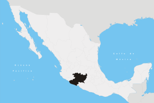
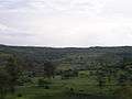
Tingambato is a municipality in the north-central part of the Mexican state of Michoacán. Its municipal seat is the city of the same name. The municipality has an area of 188.77 square kilometres (0.32% of the surface of the state) and is bordered by the north by the municipalities of Nahuatzén and Erongarícuaro, to the east by Pátzcuaro and Salvador Escalante, to the south by Ziracuaretiro, and to the west by Uruapan. The municipality had a population of 12,630 inhabitants according to the 2005 census.[1] Its municipal seat is the city of the same name.
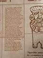
The word Tingambato is of Chichimeca origin and it means "Hill of mild climate".[2] The story of the region can be traced 1,300 years to the arrival of the Purépecha monarchy to the region.
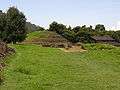
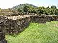
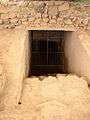
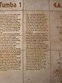
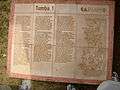
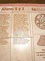
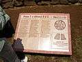
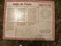
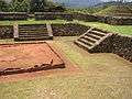
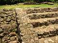
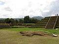
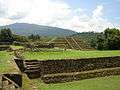
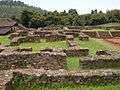
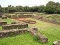
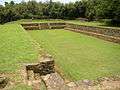
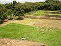
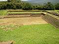
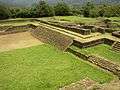
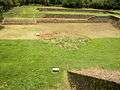
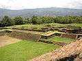
The site had two period of construction. In AD 450-600 ceremonial buildings with Teotihuacan-style taluds were built. In the second stage (AD 600-950) a ball court was also built in the Teotihuacan style. One tomb contains 6 men who provide evidence of dental mutilation.[3]
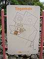
Gallery
References
- ↑ "2005 Census". INEGI: Instituto Nacional de Estadística, Geografía e Informática. Retrieved 2007-10-04.
- ↑ Municipios de Michoacán Portal de los municipios: Tingambato. Retrieved on October 4, 2007.
- ↑ Ancient Mexico and Central America
Coordinates: 19°30′N 101°51′W / 19.500°N 101.850°W