Thorhild County
| Thorhild County | |
|---|---|
| Municipal district | |
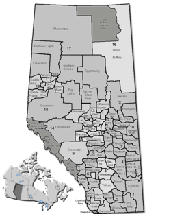 Location of Thorhild County in Alberta | |
| Coordinates: 54°09′12″N 113°07′34″W / 54.15333°N 113.12611°WCoordinates: 54°09′12″N 113°07′34″W / 54.15333°N 113.12611°W | |
| Country |
|
| Province |
|
| Region | Central Alberta |
| Census division | No. 13 |
| Established | 1955 |
| Incorporated | 1955 |
| Government[1] | |
| • Reeve | Wayne Croswell |
| • Governing body | Thorhild County Council |
| • Office location | Thorhild |
| Area (2011)[2] | |
| • Total | 2,000.05 km2 (772.22 sq mi) |
| Population (2011)[2] | |
| • Total | 3,417 |
| • Density | 1.7/km2 (4/sq mi) |
| • Dwellings | 1,510 |
| Time zone | MST (UTC-7) |
| Area code(s) | 780 |
| Website |
thorhildcounty |
Thorhild County is a municipal district located in the central part of northern Alberta, Canada in Census Division 13. It was incorporated in 1955. It changed its name from the County of Thorhild No. 7 to Thorhild County on March 20, 2013.[3]
The administrative offices of Thorhild County are in the Hamlet of Thorhild.
Demographics
In the 2011 Census, Thorhild County had a population of 3,417 living in 1,458 of its 1,807 total dwellings, a -3.7% change from its 2006 adjusted population of 3,547. With a land area of 2,000.05 km2 (772.22 sq mi), it had a population density of 1.7/km2 (4.4/sq mi) in 2011.[2]
In 2006, Thorhild County had a population of 3,042 living in 1,510 dwellings, a 2.5% decrease from 2001. The county has a land area of 1,998.38 km2 (771.58 sq mi) and a population density of 1.5/km2 (3.9/sq mi).[4]
As of 2001, 3,120 people were living in 1,515 dwellings, a 1.4% increase in population since 1996. With a land area of 1,997.97 km², Beaver county had a population density of 1.6 /km².[5]
Communities and localities
|
The following urban municipalities are surrounded by Thorhild County:[6]
The following hamlets are located within Thorhild County:[6] |
The following localities are located within Thorhild County:[7]
|
See also
References
- ↑ "Municipal Officials Search". Alberta Municipal Affairs. December 16, 2016. Retrieved December 18, 2016.
- 1 2 3 "Population and dwelling counts, for Canada, provinces and territories, and census subdivisions (municipalities), 2011 and 2006 censuses (Alberta)". Statistics Canada. 2012-02-08. Retrieved 2012-02-08.
- ↑ "O.C. 59/2013". Government of Alberta. March 20, 2013. Retrieved March 21, 2013.
- ↑ Statistics Canada. "Canada 2006 Census: County of Thorhild No. 7 - Community Profile". Retrieved 2007-06-11.
- ↑ County of Thorhild Community Profile - Statistics Canada. 2002. 2001 Community Profiles. Released June 27, 2002. Last modified: 2005-11-30. Statistics Canada Catalogue no. 93F0053XIE
- 1 2 "Specialized and Rural Municipalities and Their Communities" (PDF). Alberta Municipal Affairs. 2012-03-01. Retrieved 2012-08-12.
- ↑ "Standard Geographical Classification (SGC) 2006, Economic Regions: 4813036 - Thorhild County No. 7, geographical codes and localities, 2006". Statistics Canada. 2010-03-05. Retrieved 2012-08-12.
External links
 |
Athabasca County | Athabasca County | | |
| Westlock County | |
Smoky Lake County | ||
| ||||
| | ||||
| Sturgeon County | Sturgeon County | Lamont County |