Ironbridge Gorge
| Ironbridge Gorge | |
|---|---|
| Name as inscribed on the World Heritage List | |
|
| |
| Type | Cultural |
| Criteria | i, ii, iv, vi |
| Reference | 371 |
| UNESCO region | Europe and North America |
| Inscription history | |
| Inscription | 1986 (10th Session) |


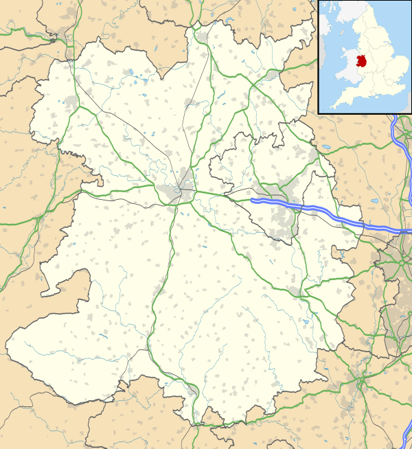
The Ironbridge Gorge is a deep gorge, containing the River Severn in Shropshire, England. It was first formed by a glacial overflow from the long drained away Lake Lapworth, at the end of the last ice age. The deep exposure of the rocks cut through by the gorge exposed commercial deposits of coal, iron ore, limestone and fireclay, which enabled the rapid economic development of the area during the early Industrial Revolution.[1][2]
Originally called the Severn Gorge, the gorge now takes its name from its famous Iron Bridge, the first iron bridge of its kind in the world, and a monument to the industry that began there. The bridge was built in 1779 to link the industrial town of Broseley with the smaller mining town of Madeley and the growing industrial centre of Coalbrookdale.
There are two reasons the site was so useful to the early industrialists. The raw materials, coal, iron ore, limestone and clay, for the manufacture of iron, tiles and porcelain are exposed or easily mined in the gorge. The deep and wide river allowed easy transport of products to the sea.
Formation
The gorge carries the River Severn south towards the Bristol Channel. It was formed during the last ice age when the output from the previously north flowing river became trapped in a lake (Lake Lapworth) created when the Irish Sea ice sheet dammed the river. The level of the lake rose until it was able to flow over the hills to the south. This flow eroded a path through the hills forming the gorge and permanently diverting the Severn southwards.
The Gorge parish
The Gorge is a civil parish of Telford and Wrekin borough. It covers the part of Ironbridge Gorge that falls within the Telford and Wrekin Council area, which is most of it, and includes settlements such as Ironbridge, Coalbrookdale and Coalport (but not Buildwas or Broseley) and part of Jackfield. It is divided into three parish wards: Lightmoor, Ironbridge, and Coalport & Jackfield. The parish council has its offices and holds its meetings at the Maws Craft Centre in Jackfield.[3]
The population of this civil parish at the 2011 census was 3,275.[4]
Conservation in the Gorge
Green Wood Centre is a national leading body on the revival of the coppicing industry and has spent over twenty years training new coppice and woodland workers.
Severn Gorge Countryside Trust manages most of the woodland, grassland and other countryside within the Ironbridge Gorge World Heritage Site, around 260 hectares (640 acres) in all. Working with Severn Gorge Countryside Trust is BTCV's Green Gym which assist them on woodland work.
Severn Gorge Countryside Trust and The Green Wood Centre run a joint volunteer project enabling local people to work local land in activities such as coppicing, scrub removal, deer fencing, step building and woodland management. Areas where you'll be able to see the kind of work done are Benthall Edge, Lloyds Coppice and Captain's coppice. All within walking distance of the Ironbridge.
Photos
 |
 |
|
| Downstream from the ironbridge | Redressing the bridge | Aerial view |
See also
References
- ↑ Pannett, David (2008). "The Ice Age Legacy in North Shropshire" (PDF). Proceedings of the Shropshire Geological Society. 13: 86–91. ISSN 1750-855X.
- ↑ Wills, L.J. (1924). "The Development of the Severn Valley in the Neighbourhood of Iron-Bridge and Bridgnorth". Quarterly Journal of the Geological Society. 80: 274–308. doi:10.1144/GSL.JGS.1924.080.01-04.15.
- ↑ "Welcome". The Gorge Parish Council. 2014-02-04. Retrieved 2014-05-22.
- ↑ "Civil Parish population 2011". Retrieved 25 November 2015.
External links
| Wikimedia Commons has media related to Ironbridge Gorge. |
- Ironbridge Gorge Visitor Information
- Telford Culture Zone
- Tourism Website for Ironbridge
- Ironbridge Gorge.com
- Ironbridge Pub Locations
- Ironbridge Gorge Tourism website
- ITV Local footage at Ironbridge Gorge
- Photo of the Gorge from the air
- The Ironbridge Gorge by Virtual Shropshire
- World Heritage Site information from UNESCO
- Map of UNESCO World Heritage Site
- Ironbridge Archaeology
- Green Wood Centre
- Severn Gorge Countryside Trust
- Green Gym
- Landslides in the Ironbridge Gorge by the British Geological Survey
Coordinates: 52°37′36″N 2°28′48″W / 52.6266°N 2.48°W
