Texas State Highway 14
| ||||
|---|---|---|---|---|
 | ||||
| Route information | ||||
| Maintained by TxDOT | ||||
| Length: | 60.148 mi[1] (96.799 km) | |||
| Existed: | 1917 – present | |||
| Major junctions | ||||
| South end: |
| |||
|
| ||||
| North end: |
| |||
| Location | ||||
| Counties: | Robertson, Falls, Limestone, Freestone, Navarro | |||
| Highway system | ||||
| ||||

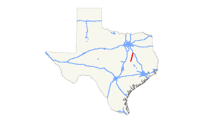
State Highway 14 (SH 14) is a state highway in the east central region of the U.S. state of Texas. The highway runs from SH 6 south of Bremond to Interstate 45 in Richland.[1]
Route description
State Highway 14 begins at an intersection with SH 6 about 3 miles southwest of Bremond. The route travels northeastward through Bremond, mainly through farmland in central Texas, passing through the western edge of Kosse and through Groesbeck. It then passes through Mexia, intersecting SH 171 and US 84. It reaches its northern terminus at Interstate 45 on the north side of Richland. The entire route closely parallels the original Southern Pacific (now Union Pacific) railway lines.
History
SH 14 was one of the original twenty six state highways proposed in 1917, known as the Dallas-Houston Highway. From 1917 the routing mostly followed present day I-45 from Dallas to Richland. From there, the highway turned southwest toward Bremond. In 1919, plans for SH 14 were extended southeast to Bryan via Franklin. In 1926, U.S. Highway 75 was overlaid on the northern half of SH 14. The section from Bremond to Bryan was transferred to SH 6 in the 1926 plans. By 1936, SH 14 extended north to Gunter, replacing SH 116. By 1939, the portion from Dallas to Gunter was transferred to SH 289 and the section that US 75 overlaid was cancelled. The highway has had the same routing since.
Major intersections
| County | Location | mi | km | Destinations | Notes | |||
|---|---|---|---|---|---|---|---|---|
| Robertson | | |||||||
| Bremond | ||||||||
| south end of FM 2413 overlap | ||||||||
| north end of FM 2413 overlap | ||||||||
| Falls |
No major junctions | |||||||
| Limestone | Kosse | |||||||
| Thornton | south end of FM 1246 overlap | |||||||
| north end of FM 1246 overlap | ||||||||
| | ||||||||
| Groesbeck | ||||||||
| south end of FM 1245 overlap | ||||||||
| north end of FM 1245 overlap | ||||||||
| | ||||||||
| | ||||||||
| | ||||||||
| Mexia | ||||||||
| Freestone | Wortham | |||||||
| Navarro | Currie | |||||||
| Richland | ||||||||
| | I-45 exit 219A; no access from I-45 north to SH 14 south | |||||||
| 1.000 mi = 1.609 km; 1.000 km = 0.621 mi | ||||||||
References
- 1 2 Transportation Planning and Programming Division (n.d.). "State Highway No. 14". Highway Designation Files. Texas Department of Transportation. Retrieved June 8, 2014.