Tetnuldi
| Tetnuldi | |
|---|---|
 Tetnuldi rising above the village Latali | |
| Highest point | |
| Elevation | 4,858 m (15,938 ft) |
| Prominence | 672 m (2,205 ft) |
| Coordinates | 43°01′52″N 42°59′35″E / 43.03113°N 42.99319°ECoordinates: 43°01′52″N 42°59′35″E / 43.03113°N 42.99319°E |
| Geography | |
|
Tetnuldi Location of Tetnuldi within the Caucasus mountains | |
| Location | Svaneti, Georgia |
| Parent range | Caucasus Mountains |
| Climbing | |
| Easiest route | basic snow/ice climb |
| Tetnuldi | |
|---|---|
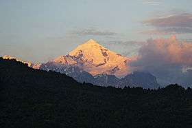 View from Mestia | |
| Elevation | 4,858 metres (15,938 ft) |
| Prominence | 672 metres (2,205 ft) |
Tetnuldi (Georgian: თეთნულდი) is a prominent peak in the central part of the Greater Caucasus Mountain Range, located in the Svaneti region of Georgia. According to most sources, Tetnuldi is the 10th highest peak of the Caucasus. The slopes of the mountain are glaciated generally above the 3,000 metre (9,840 ft) line. The most prominent glacier of the mountain is called Adishi.
It was first climbed by Douglas Freshfield in 1896. The first ascent of the north face was completed by Michael S. Taylor and John R. Jenkins.
New ski resort in Tetnuldi was opened during 2015-2016 winter season.[1]
References
| Wikimedia Commons has media related to Tetnuldi. |
Georgian State (Soviet) Encyclopedia. 1983. Book 4. pp. 637.
This article is issued from Wikipedia - version of the 5/4/2016. The text is available under the Creative Commons Attribution/Share Alike but additional terms may apply for the media files.