Tepalcatepec (municipality)
| Tepalcatepec Municipality | |
|---|---|
| Municipality | |
|
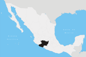
Tepalcatepec Municipality Location of Tepalcatepec in Mexico | |
| Coordinates: 19°11′N 102°51′W / 19.183°N 102.850°WCoordinates: 19°11′N 102°51′W / 19.183°N 102.850°W | |
| Country |
|
| State | Michoacán |
| Established | June 22, 1877 |
| Municipal seat | Tepalcatepec |
| Government | |
| • Municipal president | Aurelio Arreguin Madriiz (PRD) |
| Area | |
| • Total | 780.22 km2 (301.24 sq mi) |
| Elevation | 370 m (1,210 ft) |
| Population (2010) | |
| • Total | 24,678[1] |
| Time zone | CST (UTC-6) |
| • Summer (DST) | CDT (UTC-5) |
Tepalcatepec is a municipality in the Mexican state of Michoacan.
Political entity
The municipality is located in the west of the state, 267 kilometres from the state capital of Morelia. It has a 780.22 km² (square kilometers) surface, and represents the 1.33% of the State territory. Borders with the state of Jalisco, Buenavista, Aguililla and Coalcomán. It has a population of about 24,678 people. The actual municipal president is Aurelio Arreguin Madriiz (2015-2018).[2]
Geography and environment
It has an average altitude of 370 meters above sea level. Notable elevations include the hills called Sierra Madre del Sur, Tepalcatepec depression and the hills of Cabeza de Vaca, the Chuta, the Cocina and the Romera. Its hydrography is constituted by the rivers Tepalcatepec, las Mesas, Pinolapa, Colomititán and Los Otates. And its climate is tropical and dry steppe with summer rains . It has an annual rainfall of 822.0 mm, and temperatures ranging between 12.0 and 44.5 degrees Celsius.
The ecosystem is dominated by tropical deciduous forest with tepeguaje, ceiba, zapote, guaje and mando. And the thorn forest with amolé, cardones, teteches, viejitos and huisaches. The forest surface timber is occupied by oak and pine, thickets and non-timber species characteristic of lowland . The municipality also has deposits of iron, barite and silver.[2]
History
The meaning of Tepalcatepec is "hill of piece of clay". This municipality territory goes over hundreds of years before the Chichimecas tribe . After the Spanish conquest, it was given to Alonso Avalos as an entrusts, but he went to Spain and never came back.
At the beginning it only had 685 people, and belonged to the town of Coahuayana. In the XVII century it was a political party of Indians, and the town was managed by a priest and had 19 neighbors, belonged Chilatán and Alima neighborhoods, as well as the town of Santa Ana and the Xilotlán. On December 10, 1831, it was given the title of town that belonged to Apatzingan, and on June 22, 1877, it was established as a town. Miguel Baca Valencia (1884-1953) was a soldier that was president of the town. He defended the people of the Cristero movement attacks.[2]
References
- ↑ "Buenavista, Michoacán de Ocampo" (PDF). Informe Anual Sobre La Situación de Pobreza y Rezago Social. SEDESOL. Retrieved October 14, 2015.
- 1 2 3 "Tepalcatepec".