Telford, Pennsylvania
| Borough of Telford | ||
| Borough | ||
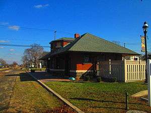 The former Reading Railroad and SEPTA station in Telford. | ||
|
||
| Country | United States | |
|---|---|---|
| State | Pennsylvania | |
| Counties | Bucks, Montgomery | |
| Elevation | 423 ft (128.9 m) | |
| Coordinates | 40°19′29″N 75°19′41″W / 40.32472°N 75.32806°WCoordinates: 40°19′29″N 75°19′41″W / 40.32472°N 75.32806°W | |
| Area | 1.0 sq mi (2.6 km2) | |
| - land | 1.0 sq mi (3 km2) | |
| - water | 0.0 sq mi (0 km2), 0% | |
| Population | 4,872 (2010) | |
| Density | 4,872.0/sq mi (1,881.1/km2) | |
| Settled | 1719 | |
| - Incorporated | 1886 | |
| Mayor | David S. Snook | |
| Timezone | EST (UTC-5) | |
| - summer (DST) | EDT (UTC-4) | |
| ZIP Code | 18969 | |
| Area code | 215 | |
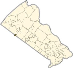 Location of Telford in Bucks County
| ||
 Location of Telford in Pennsylvania
| ||
 Location of Pennsylvania in the United States
| ||
| Website: http://www.telfordborough.com | ||

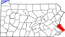
Telford is a borough in Bucks and Montgomery Counties in the U.S. state of Pennsylvania. The population was 4,872 at the time of the 2010 census.[1] Of this, 2,665 were in Montgomery County, and 2,207 were in Bucks County.
History
Originally inhabited by the Lenape people, the area surrounding Telford began to be settled in 1719 by Mennonites from the Palatinate of the Rhine. In 1857, the town known as County Line (the area had previously been known as Hendrick’s Blacksmith) changed its name to Telford after the North Pennsylvania Railroad Company named their new station located there after the civil engineer Thomas Telford.
The Borough of Telford was incorporated by decree of the Court of Quarter Sessions of Bucks County of November 10, 1886.[2] A decade later, The Borough of West Telford was incorporated by decree of the Court of Quarter Sessions of Montgomery County of December 27, 1897.[3] In 1934, the respective boroughs entered into an agreement for consolidation,[4] and an election was held on this question on November 6, 1934. The voters of both boroughs approved the agreement, and on January 11, 1935, Governor Gifford Pinchot issued letters patent consolidating the two boroughs into the current Borough of Telford.[5]
Geography
Telford is located at 40°19′29″N 75°19′41″W / 40.32472°N 75.32806°W (40.324786, -75.328045),[6] elevation 449 feet (136.9 m).
According to the United States Census Bureau, the borough has a total area of 1.0 square miles (2.6 km²). None of the area is covered with water.
Transportation
Pennsylvania Route 563 and 309 both pass near Telford. Main Street, one of the main roads in the borough, runs along the Bucks-Montgomery County line.
A rail line that was formerly the Reading Company's Bethlehem Branch runs north-south through Telford connecting to Perkasie, Quakertown, and Bethlehem to the north and Souderton, Hatfield, and Lansdale to the south. The line was used by the SEPTA Bethlehem Line until 1981. The tracks are still used for the transport of freight between Lansdale and Quakertown, and beyond. The line is used for occasional scenic rail trips, and resumption of passenger service to Quakertown is being considered. Telford is also the via point location for Pennsylvania Northeastern Railroad out of Lansdale and East Penn Railroad out of Quakertown.
SEPTA bus route 132 starts in Telford and ends in Montgomeryville.
Demographics
| Historical population | |||
|---|---|---|---|
| Census | Pop. | %± | |
| 1890 | 125 | — | |
| 1900 | 181 | 44.8% | |
| 1910 | 207 | 14.4% | |
| 1920 | 313 | 51.2% | |
| 1930 | 412 | 31.6% | |
| 1940 | 1,747 | 324.0% | |
| 1950 | 2,042 | 16.9% | |
| 1960 | 2,763 | 35.3% | |
| 1970 | 3,409 | 23.4% | |
| 1980 | 3,507 | 2.9% | |
| 1990 | 4,238 | 20.8% | |
| 2000 | 4,680 | 10.4% | |
| 2010 | 4,872 | 4.1% | |
| Est. 2014 | 4,870 | [7] | 0.0% |
| Sources:[8][9][10] | |||
As of the census[9] of 2000, 4,681 people, 1,930 households, and 1,200 families resided in the borough. The population density was 4,618.2 people per square mile (1,789.1/km²). The 1,977 housing units averaged 1,950.9 per square mile (755.8/km²). The racial makeup of the borough was 92.48% White, 1.30% Black, 0.02% Native American, 3.76% Asian, 0.02% Pacific Islander, 1.13% from other races, and 1.28% from two or more races. Hispanics or Latinos of any race were 3.61% of the population.
Of the 1,930 households, 29.4% had children under the age of 18 living with them, 51.1% were married couples living together, 8.2% had a female householder with no husband present, and 37.8% were not families. About 33.3% of all households were made up of individuals, and 17.4% had someone living alone who was 65 years of age or older. The average household size was 2.34 and the average family size was 3.00.
In the borough, the population was distributed as 23.0% under the age of 18, 6.6% from 18 to 24, 33.2% from 25 to 44, 19.2% from 45 to 64, and 18.0% who were 65 years of age or older. The median age was 37 years. For every 100 females, there were 88.2 males. For every 100 females age 18 and over, there were 84.5 males.
The median income for a household in the borough was $45,451, and for a family was $56,809. Males had a median income of $38,750 versus $28,387 for females. The per capita income for the borough was $22,075. About 2.5% of families and 4.7% of the population were below the poverty line, including 4.3% of those under age 18 and 5.3% of those age 65 or over.
In 2008, the median household income was estimated at $58,350 (it was $45,451 in 2000).
In 2008, the estimated house or condo value was $256,582 (compared to $130,300 in 2000). In 2008, the per capita income was $28,979.
Politics and government
The borough is represented by the following officials:
U.S. House of Representatives
Pennsylvania State Senate
Pennsylvania House of Representatives
Famous residents
- Eric Kratz, professional baseball player, Pittsburgh Pirates, was born in Telford in 1980.
- Jon Anspach, the man, the myth, the legend
References
- ↑ "Race, Hispanic or Latino, Age, and Housing Occupancy: 2010 Census Redistricting Data (Public Law 94-171) Summary File (QT-PL), Telford borough, Pennsylvania". U.S. Census Bureau, American FactFinder 2. Retrieved August 11, 2011.
- ↑ Miscellaneous Docket 2, Pages 67-70, 72-73. Clerk of Courts of Bucks County, Pa. (Doylestown, Pa.). Available at the Mercer Museum (Doylestown, Pa.)
- ↑ Miscellaneous Book 43, Pages 198-201 (recorded December 28, 1897). Recorder of Deeds of Montgomery County, Pa. (Norristown, Pa.).
- ↑ Ordinance 45, Borough of West Telford (Pa.). Souderton [Pa.] Independent, Thursday, September 13, 1934, p. 10.
- ↑ Charter Book 3, Pages 3-4 (recorded November 2, 1938). Recorder of Deeds of Montgomery County, Pa. (Norristown, Pa.).
- ↑ "US Gazetteer files: 2010, 2000, and 1990". United States Census Bureau. 2011-02-12. Retrieved 2011-04-23.
- ↑ "Annual Estimates of the Resident Population for Incorporated Places: April 1, 2010 to July 1, 2014". Retrieved June 4, 2015.
- ↑ "Census of Population and Housing". U.S. Census Bureau. Retrieved 11 December 2013.
- 1 2 "American FactFinder". United States Census Bureau. Retrieved 2008-01-31.
- ↑ "Incorporated Places and Minor Civil Divisions Datasets: Subcounty Resident Population Estimates: April 1, 2010 to July 1, 2012". Population Estimates. U.S. Census Bureau. Retrieved 11 December 2013.