Tannersville, Pennsylvania
| Tannersville, Pennsylvania | |
|---|---|
| Unincorporated community | |
|
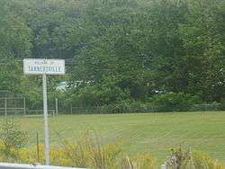
Sign for Tannersville along PA 715 | |
 Tannersville | |
| Coordinates: 41°2′24″N 75°18′21″W / 41.04000°N 75.30583°WCoordinates: 41°2′24″N 75°18′21″W / 41.04000°N 75.30583°W | |
| Country | United States |
| State | Pennsylvania |
| County | Monroe |
| Township | Pocono |
| Elevation | 892 ft (272 m) |
| Time zone | Eastern (EST) (UTC-5) |
| • Summer (DST) | EDT (UTC-4) |
| ZIP code | 18372 |
| Area code(s) | 570 and 272 |
| GNIS feature ID | 1189263[1] |
The village of Tannersville, in Pocono Township, Pennsylvania, is the site of the popular Camelback Ski Area and Camelbeach Waterpark. It is in the Eastern Standard time zone. Elevation is 883 feet (269 m). As of 2000, the population of Tannersville (ZIP Code 18372) was 2,784. The community is served by the 629 exchange in Area Code 570.
Tannersville was founded in approximately 1750 by John Larner, formerly of Philadelphia. Tannersville, according to one historian, was first called Pocono Point. Many Indian trails were later widened for stagecoach use, and later evolved into highways. Two of the most famous of these are Lackawanna Trail (now Rt. 611) through Tannersville and Sullivan's Trail. Learned's Tavern (which most recently was under the name The 1740 Alpine Inn, and which burned down in 2000, was established along the Lackawanna Trail, and in 1779, was the last building on the frontier. On June 18, 1779, General John Sullivan and his soldiers camped at the Learn's or Learned's Tavern. They then cut a road (now Sullivan's Trail) through the wilderness. Tannersville also consists of The Crossings Premium Outlets, a major tourist attraction.
References
External links
 Tannersville travel guide from Wikivoyage
Municipalities and communities of Monroe County, Pennsylvania, United States | ||
|---|---|---|
| Boroughs | 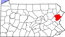 | |
| Townships | ||
| CDPs | ||
| Unincorporated communities |
| |
| Footnotes | ‡This populated place also has portions in an adjacent county | |