Tanggulashan
| Tanggula 唐古拉镇 · གདང་ལ་གྲོང་རྡལ། | |
|---|---|
| Town | |
|
| |
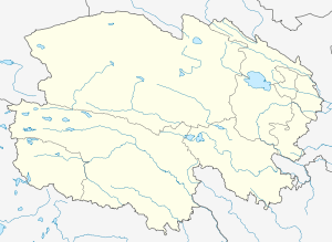 Tanggula Location in Qinghai | |
| Coordinates: 34°13′53″N 92°26′33″E / 34.23139°N 92.44250°ECoordinates: 34°13′53″N 92°26′33″E / 34.23139°N 92.44250°E | |
| Country | China |
| Province | Qinghai |
| Autonomous prefecture | Haixi |
| County-level city | Golmud |
| Area | |
| • Total | 47,540.08 km2 (18,355.33 sq mi) |
| Elevation | 4,535 m (14,879 ft) |
| Population (2006) | |
| • Total | 1,286 |
| Includes only those with Hukou permits | |
| Time zone | China Standard (UTC+8) |
| Postal code | 632801101 |

| Tanggulashan / Danglarong | |||||||
| Chinese name | |||||||
|---|---|---|---|---|---|---|---|
| Chinese | 唐古拉山 | ||||||
| |||||||
| Tibetan name | |||||||
| Tibetan | གདང་ལ་གྲོང། | ||||||
| |||||||
| Tanggula / Dangla | |||||||
| Chinese name | |||||||
|---|---|---|---|---|---|---|---|
| Chinese | 唐古拉 | ||||||
| |||||||
| Tibetan name | |||||||
| Tibetan | གདང་ལ་གྲོང། | ||||||
| |||||||
Tanggulashan Town ("Tanggula Mountains Town"), officially called Tanggula Town, is a town in the southwest of Qinghai province, China. It forms the southern exclave of the county-level city of Golmud, in Haixi Mongol and Tibetan Autonomous Prefecture. Before the local administrative reform of 2005, it was known as Tanggula Township (唐古拉乡).
Geography

Tanggula Town is an administrative unit that occupies 47,540 square kilometres (18,360 sq mi) in the southwestern corner of Qinghai province. It borders on the Tibetan Autonomous Region in the south and west, and on Qinghai's Yushu Tibetan Autonomous Prefecture in the east and north. The western "panhandle" of Yushu Prefecture separates Tanggula Town from the rest of Haixi Prefecture, making it an exclave of Golmud City and of the Haixi Mongol and Tibetan Autonomous Prefecture.
Tanggula Town is around 500 kilometres (310 mi) away (straight-line distance) both from the central city of Golmud and from the town of Gyêgu, the seat of Yushu Prefecture, but it has practical road (and rail) connection only with the former.
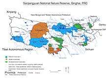
The Tanggula settlement, also known as Tuotuehe, is located at 4,535 metres (14,879 ft) above sea level in the central part of Tanggula Mountains, as the town's name indicates.[1] The most famous local feature is the Geladaindong Peak (at 6,621 metres (21,722 ft) elevation), near which the source of the Yangtze River is considered to be located. The area around the peak is protected as part of the Sanjiangyuan National Nature Reserve.
Tanggula Town is administratively divided into 7 village-level units ("administrative villages" (xingzhengcun) and "communities" (xingzhengshe)).[1] The region is sparsely populated, with the registered population of 1,286 (year 2006) and the present population estimated at about 1,900. Most of these people live in several small villages located along the Golmud-Lhasa highway and railway corridor (China National Highway 109 and Qinghai-Tibet Railway).
188 local residents are members of the Communist Party of China.[1]
The main settlement, and the one that is marked on the maps at "Tanggula Town" (or, earlier, "Tanggula Township"; presumably, the place where is local government is based) is located near the highway and railway crossing of the Tuotuo River, which is one of the headwaters of the Yangtze. This settlement is served by the Tuotuohe railway station.[2] Other settlements in the same highway/railway corridor, further south, are Tongtian Heyan ("Tongtian Riverside"), Yanshiping, Wenquan, and Tanggula Bingzhan ("Tanggula Military Post").[3]
At Tanggula Pass on the southern border of the province, the railway leaves Qinghai for Tibet, and therefore the Tanggula Railway Station, which is located a short distance south of the pass, is actually outside of Tanggula Town, and is already within the Tibetan Autonomous Region.
Climate
| Climate data for Tanggulashan (4,535m) | |||||||||||||
|---|---|---|---|---|---|---|---|---|---|---|---|---|---|
| Month | Jan | Feb | Mar | Apr | May | Jun | Jul | Aug | Sep | Oct | Nov | Dec | Year |
| Average high °C (°F) | −6 (21) |
−4 (24) |
0 (32) |
5 (41) |
8 (46) |
12 (53) |
14 (57) |
13 (55) |
10 (50) |
4 (39) |
−1 (30) |
−5 (23) |
4.2 (39.3) |
| Average low °C (°F) | −24 (−11) |
−21 (−5) |
−17 (1) |
−12 (10) |
−6 (21) |
−1 (30) |
1 (33) |
1 (33) |
−1 (30) |
−10 (14) |
−19 (−2) |
−23 (−9) |
−11 (12.1) |
| Average precipitation cm (inches) | 0 (0) |
0.3 (0.1) |
0.3 (0.1) |
0.5 (0.2) |
1.5 (0.6) |
4.8 (1.9) |
8.6 (3.4) |
6.6 (2.6) |
4.1 (1.6) |
1 (0.4) |
0 (0) |
0 (0) |
27.7 (10.9) |
| Source: Weatherbase[4] | |||||||||||||
Economy
The traditional occupation of the local residents is livestock (sheep) breeding. According to the local authorities in Golmud, overgrazing is a concern in the area,[5] as it is throughout the southwestern Qinghai.[6] Projects are underway to restrict grazing in some areas, and to reduce the livestock population in Tanggula Town to what is thought to be the "scientifically sound" target of 53,600.[5]
Besides overgrazing by livestock, the local pasture land also suffers depredation by rats. After some attempts to poison them (with obvious side effects), in 2009 the local authorities started a campaign to attract birds of prey to the area, hoping that they would help to keep the rat population under control. For this purpose, 830 bird perches were erected in the affected areas.[7]
In 2007, it was reported that a factory producing traditional Tibetan carpets opened in the area, employing about 80 people.[8]
References
- 1 2 3 唐古拉山镇以科学发展观为统领努力打造长江源头生态第一镇 (Tanggula Town to follow scientific development guidelines to become the first environmentally sound town in the headwaters of the Yangtze), Golmud City Government web site, 2010-03-23
- ↑ Tuotuo River Town
- ↑ E.g., 使用中国地图集 (Shiyong Zhongguo Dituji, "Practical Atlas of China"), 2008, ISBN 978-7-5031-4772-2; map of Qinghai on pp. 172-173
- ↑ "Weatherbase: Historical Weather for Tanggulashan, China". Weatherbase. 2011. Retrieved on November 24, 2011.
- 1 2 格尔木唐古拉山镇:转变发展方式打造生态第一镇 (Tanggula Town, Golmud: Changing the modes of development, to create the first environmentally sound town). Golmud City Government web site, 2010-03-29
- ↑ M. Zhao, O. Schell. "Tibet: Plateau in Peril". World Policy Journal, 2008
- ↑ Govt calling hawks and wolves to eat up rats. China Daily, 2009-12-17
- ↑ Sophia Zhang, "Tibetan carpet factory in Tanggula Township". 2007-07-16