Tallebudgera Creek
| Tallebudgera | |
| Creek | |
 Waterway at Coplicks Lane in Tallebudgera, 2015 | |
| Name origin: Aboriginal: good fishing[1] | |
| Country | Australia |
|---|---|
| State | Queensland |
| Region | South East Queensland |
| Local government area | City of Gold Coast |
| Tributaries | |
| - right | Mount Cougal Creek |
| Source | Springbrook Plateau |
| - location | Upper Tallebudgera |
| - elevation | 100 m (328 ft) |
| - coordinates | 28°13′13″S 153°19′10″E / 28.22028°S 153.31944°E |
| Mouth | Burleigh Head |
| - location | Palm Beach |
| - elevation | 0 m (0 ft) |
| - coordinates | 28°5′35″S 153°27′44″E / 28.09306°S 153.46222°ECoordinates: 28°5′35″S 153°27′44″E / 28.09306°S 153.46222°E |
| Length | 25 km (16 mi) |
| Basin | 98 km2 (38 sq mi) |
| National park | Springbrook National Park |
| Reservoirs / dams | Tallebudgera Creek Dam |
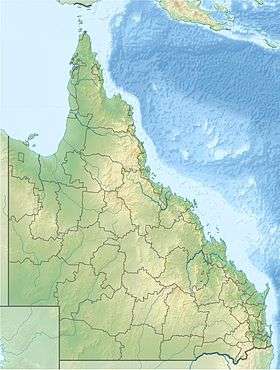 Location of the Tallebudgera Creek mouth in Queensland | |
| Wikimedia Commons: Tallebudgera Creek | |
| [2][3] | |
The Tallebudgera Creek is a creek located in South East Queensland, Australia. Its catchment lies within the Gold Coast local government area and covers an area of 98 square kilometres (38 sq mi). The river is approximately 25 kilometres (16 mi) in length and is known for good fishing.
Course and features

The Tallebudgera Creek rises from the Springbrook Plateau below Burleigh Mountain in the Springbrook National Park near Upper Tallebudgera and north of the New South Wales/Queensland border. The creek flows generally north by east through the Tallebudgera Valley towards Burleigh Heads where it is crossed by the Pacific Motorway and the Gold Coast Highway, before reaching its mouth south of the Burleigh Head National Park and emptying into the Coral Sea. The creek descends 100 metres (330 ft) over its 25-kilometre (16 mi) course.[2]
Tallebudgera Creek is known for good fishing, and its name even translates in an indigenous language to "good fishing".[1] Bream, flathead, whiting and the bull shark are common species that are found in the creek.
As well as the main creek there is an extensive canal system, whose shores boast some of the Gold Coast's best housing. It is one of the Gold Coast's three main canal and creek systems, alongside the slightly smaller Currumbin Creek to the south and the much larger Nerang River to the north.
History

The first bridge across the creek was opened in 1926.[4] The road was then known as Main Ocean Road, later upgraded as the Pacific Highway and now known as the Gold Coast Highway.
The Tallebudgera Creek Dam was constructed on the creek in the 1950s as a water supply source for the lower Gold Coast. The dam was decommissioned during the 1970s. It appears that the dam was left for recreation purposes after decommissioning. In 2006, after two years of investigation, reports and public consultations, work commenced to upgrade the existing dam to the required dam safety standards.[5]
See also
References
- 1 2 "Tallebudgera Creek". Visit Gold Coast. Gold Coast Tourism. 2015. Retrieved 28 September 2015.
- 1 2 "Map of Tallebudgera Creek, QLD". Bonzle Digital Atlas of Australia. Retrieved 28 September 2015.
- ↑ "Tallebudgera Creek Catchment". City of Gold Coast. Retrieved 28 September 2015.
- ↑ Longhurst, Robert (1995). Gold Coast:Our heritage in focus. South Brisbane, Queensland: State Library of Queensland. p. 29. ISBN 0-7242-6563-5.
- ↑ "Tallebudgera Creek Dam: At what price a life?". Golden Target Awards. University of Technology Sydney. 2007. Retrieved 5 July 2014.
External links
| Wikimedia Commons has media related to Tallebudgera Creek. |