Taleb Larbi
| Taleb Larbi ﻃﺎﻟﺐ اﻟﻌﺮﺑﻲ | |
|---|---|
| Commune and town | |
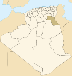
 Location of Taleb Larbi commune within El Oued Province | |
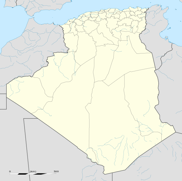 Taleb Larbi Location of Taleb Larbi within Algeria | |
| Coordinates: DZ 33°43′39″N 7°31′2″E / 33.72750°N 7.51722°ECoordinates: DZ 33°43′39″N 7°31′2″E / 33.72750°N 7.51722°E | |
| Country |
|
| Province | El Oued Province |
| District | Taleb Larbi District |
| Elevation | 42 m (138 ft) |
| Population (2008)[1] | |
| • Total | 7,074 |
| Time zone | CET (UTC+1) |
Taleb Larbi (Arabic: ﻃﺎﻟﺐ اﻟﻌﺮﺑﻲ) is a town and commune, and capital of Taleb Larbi District, El Oued Province, Algeria. According to the 2008 census it has a population of 7,074,[1] up from 3,582 in 1998,[2] with an annual of growth rate of 7.2% per year, the second highest in the province.[1]
Transportation
Taleb Larbi is just 5 kilometres (3.1 mi) from the border with Tunisia along the N48. To the west, the N48 meets the N16, which leads west to El Oued and Touggourt and north to Tébessa.
Climate
Taleb Larbi has a hot desert climate (Köppen climate classification BWh), with very hot summers and mild winters, and very little precipitation throughout the year.
| Climate data for Taleb Larbi | |||||||||||||
|---|---|---|---|---|---|---|---|---|---|---|---|---|---|
| Month | Jan | Feb | Mar | Apr | May | Jun | Jul | Aug | Sep | Oct | Nov | Dec | Year |
| Average high °C (°F) | 16.7 (62.1) |
19.4 (66.9) |
23.1 (73.6) |
27.1 (80.8) |
32.2 (90) |
36.5 (97.7) |
40.2 (104.4) |
39.4 (102.9) |
34.6 (94.3) |
28.6 (83.5) |
21.8 (71.2) |
16.8 (62.2) |
28.03 (82.47) |
| Daily mean °C (°F) | 10.8 (51.4) |
13.2 (55.8) |
16.4 (61.5) |
20.1 (68.2) |
24.9 (76.8) |
29.5 (85.1) |
32.4 (90.3) |
32.0 (89.6) |
28.1 (82.6) |
22.3 (72.1) |
15.9 (60.6) |
11.2 (52.2) |
21.4 (70.52) |
| Average low °C (°F) | 4.9 (40.8) |
7.0 (44.6) |
9.7 (49.5) |
13.2 (55.8) |
17.7 (63.9) |
22.6 (72.7) |
24.7 (76.5) |
24.7 (76.5) |
21.6 (70.9) |
16.0 (60.8) |
10.0 (50) |
5.7 (42.3) |
14.82 (58.69) |
| Average precipitation mm (inches) | 9 (0.35) |
8 (0.31) |
12 (0.47) |
9 (0.35) |
6 (0.24) |
3 (0.12) |
0 (0) |
2 (0.08) |
7 (0.28) |
9 (0.35) |
12 (0.47) |
8 (0.31) |
85 (3.33) |
| Source: climate-data.org[3] | |||||||||||||
Education
1.6% of the population has a tertiary education (the second lowest rate in the province), and another 18.2% has completed secondary education.[4] The overall literacy rate is 61.6%, and is 68.9% among males and 53.0% among females.[5]
Localities
The commune of Taleb Larbi is composed of 12 localities:[6]
- Taleb Larbi
- Nakhlat El Mengoub
- Hniche
- Lemdjebès
- Si Mebarek
- Zeïdi
- Garet Ettir
- Laouabed
- Maleh El Hadj Ahmed
- Gour Djouali
- Bouras
- Sagaa
References
- 1 2 3 "Population: El Oued Wilaya" (PDF) (in French). Office National des Statistiques Algérie. Retrieved 12 February 2013.
- ↑ "Algeria Communes". Statoids. Retrieved 9 March 2013.
- ↑ "Climate data for: Taleb Larbi". climate-data.org. Retrieved 18 April 2013.
- ↑ "Structure relative de la population résidente des ménages ordinaires et collectifs âgée de 6 ans et plus selon le niveau d'instruction et la commune de résidence." (PDF) (in French). Office National des Statistiques Algérie. Retrieved 13 February 2013.
- ↑ "Taux d'analphabétisme et taux d'alphabétisation de la population âgée de 15 ans et plus, selon le sexe et la commune de résidence ." (PDF) (in French). Office National des Statistiques Algérie. Retrieved 13 February 2013.
- ↑ "Décret n° 84-365, fixant la composition, la consistance et les limites territoriale des communes. Wilaya d'El Oued" (PDF) (in French). Journal officiel de la République Algérienne. 19 December 1984. p. 1565. Archived from the original (PDF) on 2 March 2013 or before. Retrieved 2 March 2013. Check date values in:
|archive-date=(help)
 |
Biskra Zeribet El Oued (Biskra) |
Tébessa Ben Guecha |
Nafta (Tunisia) | |
| Hassi Khelifa | |
Hazoua (Tunisia) | ||
| ||||
| | ||||
| Trifaoui El Oued |
Douar El Ma | Matrouha (Tunisia) |