Tajov
| Tajov | |
| Village | |
 | |
| Country | Slovakia |
|---|---|
| Region | Banská Bystrica |
| District | Banská Bystrica |
| Elevation | 464 m (1,522 ft) |
| Coordinates | SK 48°45′N 19°04′E / 48.750°N 19.067°ECoordinates: SK 48°45′N 19°04′E / 48.750°N 19.067°E |
| Area | 9.32 km2 (3.60 sq mi) |
| Population | 592 (2013.12.31) |
| Density | 64/km2 (166/sq mi) |
| First mentioned | 1495 |
| Mayor | Ladislav Surovčík |
| Postal code | 976 34 |
| Area code | +421-48 |
| Car plate | BB |
  Location of Tajov in Slovakia | |
  Location of Tajov in the Banská Bystrica Region | |
| Statistics: MOŠ/MIS | |
| Website: www.tajov.sk | |
Tajov is a village and municipality in Banská Bystrica District in the Banská Bystrica Region of central Slovakia.[1]
History
In historical records the village was first mentioned in 1495.
Geography
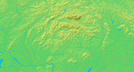
The municipality lies at an altitude of 464 metres and covers an area of 9.289km². It is situated on outskirts of Banská Bystrica, under the Kremnica Mountains. The village has a population of about 592 people.
Famous people
- Jozef Gregor Tajovský, writer
- Vratislav Greško, football player
- Jozef Murgaš, inventor, pioneer of radiotelegraphy
- Alexander Warenberg, composer
References
This article is issued from Wikipedia - version of the 4/17/2015. The text is available under the Creative Commons Attribution/Share Alike but additional terms may apply for the media files.