Taffuh
| Taffuh | |
|---|---|
| Other transcription(s) | |
| • Arabic | تفّوح |
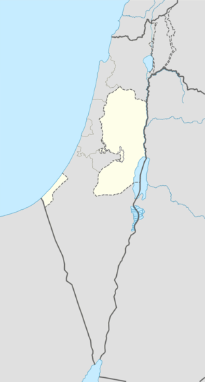 Taffuh Location of Taffuh within the Palestinian territories | |
| Coordinates: 31°32′21.08″N 35°3′11.1″E / 31.5391889°N 35.053083°ECoordinates: 31°32′21.08″N 35°3′11.1″E / 31.5391889°N 35.053083°E | |
| Governorate | Hebron |
| Government | |
| • Type | Municipality |
| Population (2007) | |
| • Jurisdiction | 10,597 |
| Name meaning | from "Beth Tappuah"[1] |
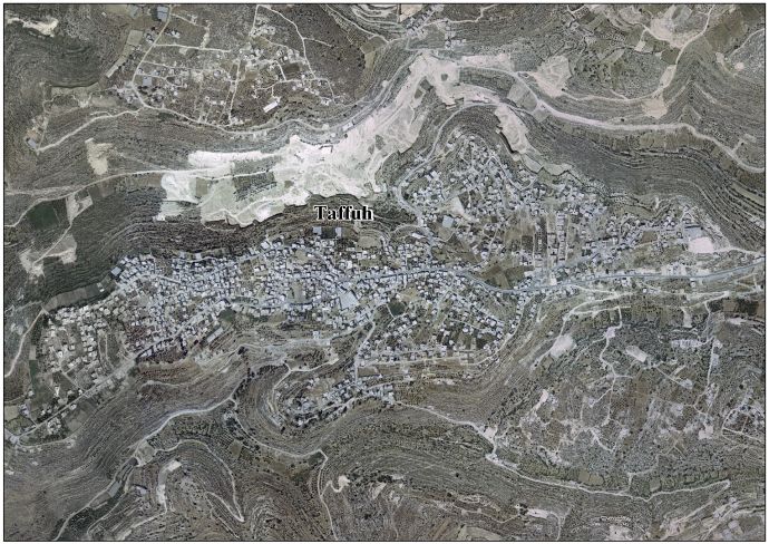
Taffuh (Arabic: تفّوح) (lit. fragrance) is a Palestinian town located eight kilometers west of Hebron.The town is in the Hebron Governorate in the southern West Bank. According to the Palestinian Central Bureau of Statistics, the town had a population of over 10,597 in 2007.[2]
History
The city of Beth-tappuah, literally House of Apple [tree], cited in the Book of Joshua (15: 53), is often located in the hill country of the Tribe of Judah, 5 km west northwest of Hebron.[3] Archaeological finds in the vicinity of the hill site include remains of an ancient road, a well to the west, cisterns, and rock-cuttings.[4] Some, but not all, experts identify this now with the modern Arab village established not far from the cite.[5] The Palestine Exploration Fund's Survey of Western Palestine (SWP) noted : "Evidently an ancient site; there are caves here, with trenches leading down to them, as at Khurbet 'Aziz, and he rock is quarried. An ancient road leads past the village."[6]
Ottoman era
In 1863, in the late Ottoman era, Victor Guérin visited, and found the village to have 400 inhabitants. He also noted that several houses seemed ancient.[7] An Ottoman village list of about 1870 counted 54 houses and a population of 161, though the population count included men only.[8]
In 1883, the SWP described Taffuh as "A village of ancient appearance, standing high at the edge of a ridge ; on the north are the steep slopes of Wady Kedir, in which are olives belonging to the place. An ancient main-road passes through the village, and runs along flat ground to the west for a little way, then descends the ridge. There is a well to the west, with cisterns, caves, and rock-cuttings. The village has vineyards round it, and good springs in the valley to the west."[9]
British Mandate era
In the 1922 census of Palestine conducted by the British Mandate authorities, Taffuh had a population of 461 inhabitants, all Muslims,[10] increasing in the 1931 census to 580, all Muslim, in 124 inhabited houses.[11]
In 1945 the population of Taffuh was 780, all Muslims,[12] who owned 12,103 dunams of land according to an official land and population survey.[13] 1,073 dunams were plantations and irrigable land, 3,543 for cereals,[14] while 31 dunams were built-up (urban) land.[15]
1948-1967
In the wake of the 1948 Arab–Israeli War, and after the 1949 Armistice Agreements, Taffuh came under Jordanian rule.
1967-present
After the Six-Day War in 1967, Taffuh has been under Israeli occupation.
Footnotes
- ↑ Palmer, 1881, p. 408
- ↑ 2007 PCBS Census Palestinian Central Bureau of Statistics. p.119.
- ↑ Woudstra, 1981, p. 251
- ↑ Bugatti, 2002, p. 59
- ↑ Wilkinson, Hill and Ryan, 1988, p. 58, note 13
- ↑ Conder and Kitchener, 1883, SWP III, p. 379
- ↑ Guérin, 1869, p. 374
- ↑ Socin, 1879, p. 161
- ↑ Conder and Kitchener, 1883, SWP III, p. 310
- ↑ Barron, 1923, Table V, Sub-district of Hebron, p. 10
- ↑ Mills, 1932, p. 34.
- ↑ Department of Statistics, 1945, p. 23
- ↑ Government of Palestine, Department of Statistics. Village Statistics, April, 1945. Quoted in Hadawi, 1970, p. 50
- ↑ Government of Palestine, Department of Statistics. Village Statistics, April, 1945. Quoted in Hadawi, 1970, p. 94
- ↑ Government of Palestine, Department of Statistics. Village Statistics, April, 1945. Quoted in Hadawi, 1970, p. 143
Bibliography
- Bagatti, Bellarmino (2002). Ancient Christian villages of Judaea and the Negev. Franciscan Printing Press.
- Barron, J. B., ed. (1923). Palestine: Report and General Abstracts of the Census of 1922. Government of Palestine.
- Conder, Claude Reignier; Kitchener, H. H. (1883). The Survey of Western Palestine: Memoirs of the Topography, Orography, Hydrography, and Archaeology. 3. London: Committee of the Palestine Exploration Fund.
- Department of Statistics (1945). Village Statistics, April, 1945. Government of Palestine.
- Guérin, Victor (1869). Description Géographique Historique et Archéologique de la Palestine (in French). 1: Judee, pt. 3. Paris: L'Imprimerie Nationale.
- Hadawi, Sami (1970). Village Statistics of 1945: A Classification of Land and Area ownership in Palestine. Palestine Liberation Organization Research Center.
- E. Mills, ed. (1932). Census of Palestine 1931. Population of Villages, Towns and Administrative Areas. Jerusalem: Government of Palestine.
- Palmer, E. H. (1881). The Survey of Western Palestine: Arabic and English Name Lists Collected During the Survey by Lieutenants Conder and Kitchener, R. E. Transliterated and Explained by E.H. Palmer. Committee of the Palestine Exploration Fund.
- Socin, A. (1879). "Alphabetisches Verzeichniss von Ortschaften des Paschalik Jerusalem". Zeitschrift des Deutschen Palästina-Vereins. 2: 135–163.
- Wilkinson, John; Hill, Joyce; Ryan, William Francis (1988). Jerusalem pilgrimage, 1099-1185. Hakluyt Society.
- Woudstra, Marten H. (1981). The book of Joshua. Grand Rapids: Wm. B. Eerdmans Publishing Co.
External links
- Welcome To Taffuh
- Survey of Western Palestine, Map 21: IAA, Wikimedia commons
- Taffuh Town (Fact Sheet), ARIJ
- Taffuh Town Profile, ARIJ
- Taffuh aerial photo, ARIJ
- The priorities and needs for development in Taffuh town based on the community and local authorities’ assessment, ARIJ
| Cities |
|  |
|---|---|---|
| Towns |
| |
| Villages |
| |
| Refugee camps | ||