Surigao del Norte
| Surigao del Norte | |||
|---|---|---|---|
| Province | |||
| Province of Surigao del Norte | |||
|
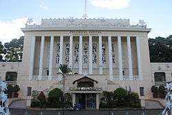
Surigao del Norte provincial capitol | |||
| |||
 Location in the Philippines | |||
| Coordinates: 9°40′N 125°38′E / 9.67°N 125.63°ECoordinates: 9°40′N 125°38′E / 9.67°N 125.63°E | |||
| Country | Philippines | ||
| Region | Caraga (Region XIII) | ||
| Founded | June 19, 1960 | ||
| Capital | Surigao City | ||
| Government | |||
| • Type | Sangguniang Panlalawigan | ||
| • Governor | Sol F. Matugas (Liberal) | ||
| • Vice Governor | Arturo Carlos Egay, Jr. (Liberal) | ||
| Area[1] | |||
| • Total | 1,972.93 km2 (761.75 sq mi) | ||
| Area rank | 62nd out of 81 | ||
| Population (2015 census)[2] | |||
| • Total | 485,088 | ||
| • Rank | 57th out of 81 | ||
| • Density | 250/km2 (640/sq mi) | ||
| • Density rank | 38th out of 81 | ||
| Divisions | |||
| • Independent cities | 0 | ||
| • Component cities | |||
| • Municipalities | |||
| • Barangays | 335 | ||
| • Districts | 1st and 2nd districts of Surigao del Norte | ||
| Time zone | PST (UTC+8) | ||
| ZIP code | 8400–8425 | ||
| IDD : area code | +63 (0)86 | ||
| ISO 3166 code | PH-SUN | ||
| Spoken languages | |||
| Website |
surigaodelnorte | ||


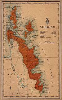
Surigao del Norte (Surigaonon: Probinsya nan Surigao del Norte; Cebuano: Amihanang Surigao; Filipino: Hilagang Surigao) is a province in the Philippines located in the Caraga region of Mindanao. Its capital is Surigao City.[3] The province comprises two major islands—Siargao and Bucas Grande—in the Philippine Sea, and a small region at the northeastern tip of Mindanao. This mainland portion borders Agusan del Norte, and Surigao del Sur to the south.
Surigao del Norte is the second northernmost of the Mindanao provinces and is an important transportation hub between Visayas and Mindanao. Numerous ferries cross the Surigao Strait between Surigao and the island of Leyte carrying vehicles and passengers between Liloan in Southern Leyte and Surigao City.
History
The area of Surigao del Norte was referred to as "Caraga" during the Spanish colonial period. The seat of government was at Tandag until it was transferred to the town of Surigao in 1848. Surigao became a military district of Mindanao in 1860.[4]
On September 18, 1960, through Republic Act 2786 dated June 19, 1960, the province of Surigao was divided into Surigao del Norte and Surigao del Sur.[5] The town of Surigao became a city on August 30, 1970 pursuant to RA 6134.[6]
Dinagat Islands had been a part of the First District of Surigao del Norte until becoming a province on its own on December 2, 2006, with the approval of Republic Act No. 9355,[7] the Charter of the Province of Dinagat Islands, in a plebiscite. Between February 2010 and March 2011, the islands were part again of Surigao del Norte after declaring RA 9355 unconstitutional by the Supreme Court, then were reinstated as a separate province.
Geography
Surigao del Norte is an archipelago province situated at the rim of the Asian continental shelf. It is located at the northeastern tip of Mindanao and faces the Philippine Trench. The province is bounded by the Dinagat Islands on the north, east by the Philippine Sea, south by the provinces of Agusan del Norte and Surigao del Sur, and on the west by the Surigao Strait.

The province, with an area of 1,972.93 square kilometres (761.75 sq mi),[1] comprises the mainland situated at the northeastern tip of Mindanao and several offshore islands, the largest of which include Siargao and Bucas Grande. The mainland is generally mountainous.[4]
The province has many caves and tunnels in its islands. Some are half-submerged in water most of the time and could be accessed only during low tides like the Sohoton Cove at Bucas Grande Island.
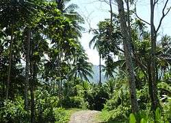
Its biggest islands are usually mountainous and rich in minerals. Nonoc Island has one of the world's largest deposits of nickel. The smaller ones either rest on sand and gravel or have a limestone base bonded by boulders, reefs and sandbars. Some islets which include those in Del Carmen in Siargao Island are a cluster of rock formations jutting out from the sea covered with shrubs and coconut trees.
Climate
Surigao del Norte has no pronounced dry season, receiving maximum rainfall from November to January.[4]
| Climate data for Surigao del Norte | |||||||||||||
|---|---|---|---|---|---|---|---|---|---|---|---|---|---|
| Month | Jan | Feb | Mar | Apr | May | Jun | Jul | Aug | Sep | Oct | Nov | Dec | Year |
| Average high °C (°F) | 29.2 (84.6) |
29.8 (85.6) |
30.8 (87.4) |
31.9 (89.4) |
32.6 (90.7) |
32.6 (90.7) |
32.3 (90.1) |
32.5 (90.5) |
32.5 (90.5) |
31.9 (89.4) |
30.6 (87.1) |
29.9 (85.8) |
31.38 (88.48) |
| Average low °C (°F) | 23.4 (74.1) |
23.6 (74.5) |
24.0 (75.2) |
24.7 (76.5) |
25.2 (77.4) |
25.0 (77) |
24.9 (76.8) |
24.9 (76.8) |
24.8 (76.6) |
24.7 (76.5) |
24.3 (75.7) |
23.9 (75) |
24.45 (76.01) |
| Average rainy days | 24 | 18 | 17 | 13 | 9 | 12 | 11 | 10 | 12 | 15 | 19 | 21 | 181 |
| Source: Storm247 [8] | |||||||||||||
Administrative divisions
Surigao del Norte comprises 20 municipalities and 1 component city, organized into two legislative districts and further subdivided into 335 barangays.
| ||||||||||||||||||||||||||||||||||||||||||||||||||||||||||||||||||||||||||||||||||||||||||||||||||||||||||||||||||||||||||||||||||||||||||||||||||||||||||||||||||||||||||||||||||||||||||||||||||||||||||||||||||||||||||||||||||||||||||||||||||||||||||||||||||||||||||||||||||||||||||||||||||||||||||||||||||||||||||||||
People and culture
Surigao is home to the Mamanwa ethnic tribe. Their dances are showcased in a local festival called "Bonok-Bonok", held at the feast of San Nicolas de Tolentino which is held annually on September 10. The Bonok-Bonok depicts the native folks' merry-making to show gratitude to God for bountiful harvest and good health.
A collection of ancient archaeological diggings like burial coffins, jars and Chinese ceramics unearthed in Panhutungan, Placer is on public display at the Surigaonon Heritage Mini-Museum located at the Boulevard in Surigao City.
Demographics
| Population census of Surigao del Norte | ||
|---|---|---|
| Year | Pop. | ±% p.a. |
| 1990 | 327,113 | — |
| 1995 | 340,043 | +0.73% |
| 2000 | 374,465 | +2.09% |
| 2007 | 409,468 | +1.24% |
| 2010 | 442,588 | +2.87% |
| 2015 | 485,088 | +1.76% |
| (Data excludes Dinagat Islands that were part of Surigao del Norte until 2006). Source: National Statistics Office[2][9][10] | ||
The population of Surigao del Norte in the 2015 census was 485,088 people,[2] with a density of 250 inhabitants per square kilometre or 650 inhabitants per square mile.
The inhabitants of the province is mostly of pure/mixed Austronesian stock, with some people of Chinese and Arab heritage. Spanish and American ancestries are also evident, albeit a minor percentage.
Some 95.80% of the people speak Surigaonon as a parent language. Cebuano and its dialect Boholano are also present. Waray-Waray is spoken by a small percentage. A majority are able to speak Filipino and English as second languages. There are also speakers of Kamayo and Manobo languages, although of minor percentages.
Religion
The dominant religion is Roman Catholicism with 94 percent adherence. Other religions include Aglipayan and some Protestant Churches.
Flora and fauna
Mangroves are the major vegetation in the coastal areas of the province, which form interminable marine forests covering 175 square kilometres (68 sq mi) along the coasts of the mainland and the islands of Siargao and Bucas Grande. The province is host to a variety of marine ecosystems like the lush seagrass beds and coral reefs which are relatively healthy and intact, supporting a rich diversity of marine flora and fauna.
Over 23 different species are caught the whole year round. Marlin, tuna, lapu-lapu, mollusks, crabs, even squids, stingrays and octopuses can be bought from fish vendors and fishermen.
The unique "magcono" (ironwood) forests of Surigao del Norte are one of the watersheds most productive resources. By its nature, it is slow growing and adapted to a mineralized soil.
Tourist attractions
Surigao City, the provincial capital, is dubbed as the "Gateway to Mindanao". The ferry landing terminal in Lipata links Mindanao to Luzon through Eastern Visayas. It annually showcases its distinct cultural heritage through the Bonok-Bonok Maradjao Karadjao Festival.
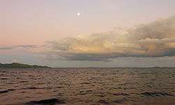
On the northern side of the province are Siargao and Bucas Grande Islands, known for their long stretch of sugar-fine beaches, vast mangrove forest, and deep waters teeming with marine life.
The Panhutongan and Amoslog archeological excavations in Placer would give a glimpse of the origins of the province and its people.
|


References
- 1 2 3 4 "Province: Surigao del Norte". PSGC Interactive. Quezon City, Philippines: Philippine Statistics Authority. Retrieved 8 January 2016.
- 1 2 3 4 Census of Population (2015): Highlights of the Philippine Population 2015 Census of Population (Report). PSA. Retrieved 20 June 2016.
- ↑ http://www.philippinecountry.com/provcitmun.html#snorte
- 1 2 3 Lancion, Jr., Conrado M.; cartography by de Guzman, Rey (1995). "The Provinces; Surigao del Norte". Fast Facts about Philippine Provinces (The 2000 Millenium ed.). Makati, Metro Manila, Philippines: Tahanan Books. p. 154. ISBN 971-630-037-9. Retrieved 29 April 2016.
- ↑ "Republic Act No. 2786 - An Act to Create the Provinces of Surigao del Norte and Surigao del Sur". Chan Robles Virtual Law Library. 19 June 1960. Retrieved 11 January 2016.
- ↑ "Republic Act No. 6134 - An Act Creating the City of Surigao". Chan Robles Virtual Law Library. 31 August 1970. Retrieved 11 January 2016.
- ↑ "Republic Act No. 9355; An Act Creating the Province of Dinagat Islands" (PDF). Senate of the Philippines. Retrieved 11 January 2016.
- ↑ "Weather forecast for Surigao del Norte, Philippines". Storm247.com. StormGeo AS, Nordre Nøstekaien 1, N-5011 Bergen, Norway: StormGeo AS. Retrieved 29 April 2016.
- 1 2 Census of Population and Housing (2010): Population and Annual Growth Rates for The Philippines and Its Regions, Provinces, and Highly Urbanized Cities (PDF) (Report). NSO. Retrieved 29 June 2016.
- ↑ "CARAGA". Census of Population and Housing (2010): Total Population by Province, City, Municipality and Barangay (Report). NSO. Retrieved 29 June 2016.
External links
-
 Media related to Surigao del Norte at Wikimedia Commons
 -
 Geographic data related to Surigao del Norte at OpenStreetMap
 - Philippine Standard Geographic Code
- Local Governance Performance Management System
- Surigao del Norte provincial profile at Philippine Provincial Profiles
 |
Dinagat Islands Hiniyuan Passage |
| ||
| Bohol Sea | |
Philippine Sea | ||
| ||||
| | ||||
| Agusan del Norte / Surigao del Sur |
Surigao City (capital) | |
| Municipalities | |
| Component city | |