Sumaila
| Sumaila | |
|---|---|
| Town and Local Government Area | |
| Town of Sumaila | |
|
Nickname(s): "Ta Sama'ila", "Masaukin Jobe" | |
| Motto: (A' Sumaila) | |
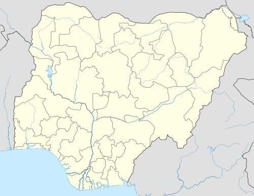 Sumaila Location in Nigeria | |
| Coordinates: 11°32′N 8°58′E / 11.533°N 8.967°ECoordinates: 11°32′N 8°58′E / 11.533°N 8.967°E | |
| State | Kano State |
| Founded | 1750 |
| Settlement Status |
1750 Fulani Military Stockade, Sultanate of Kano |
| Town and District Status |
1923 Government of Northern Region, Nigeria |
| Local Government Area Status |
1982 Government of State of Kano |
| Named for | Magajin Jobe - Sama'ila |
| Government | |
| • Type | Local Government Council |
| • Chairperson Local Council | Abdullhamid Idris Rimi |
| • Speaker, Local Assembly | (interregnum) |
| Area | |
| • Town and Local Government Area | 1,250 km2 (480 sq mi) |
| • Water | 18 km2 (6.9 sq mi) 3.0% |
| • Urban | 500 km2 (200 sq mi) |
| Population (2006 Census) | |
| • Town and Local Government Area | 253,661 |
| • Density | 200/km2 (530/sq mi) |
| • Metro | 220,000 |
| Demonym(s) | Sumailan |
| Time zone | WAT (UTC+1) |
| 3-digit postal code prefix | 712 |
| ISO 3166 code | NG.KN.SU |
Sumaila is a historic town and headquarters of a Local Government Area in Kano State, Northern Nigeria.
History
Sumaila was established as a Jobe- Fulani 'Sansani' or Settlement in the 1740s.[1] located within the fertile plains of south eastern Kano, it provided the clan an easy migratory pathway to the grazing grounds of the savannah of eastern Hausa land. Originally called 'Garun- Sam'ila' after one of its first settlers, it attracted little attention during the time of the Sultanate,
The sharp Rise of Jobe influence in eastern Kano in the late 18th century saw the construction of a stockade and a partial fort around the town in the 1750s.[2]
Sumaila rose to prominence in the time of the Caliphate when it became the site of an epic battle that halted the advance of the (Bornoan) cavalry when El-Kanemi encroached into the Sokoto Caliphate.
When during the Reign of Emir Abdullahi Maje-Karofi, the Ningi rebellion broke out, a Ribat was constructed around the town and a permanent fulani force was stationed there to protect the southern borders of the Emirate. During the Kano civil war or Basasa, Sumaila was a major hub for pan-Yusuf forces because of its close proximity to Takai; the capital of the Yusufawa.
Colonial period
Serving as a frontier fortress, the British pacification campaigns greatly affected Sumaila. In 1903, the entire Fulani military contingent of the fort under Dan-Sumaila Garba- Maje Gabas was lost in the Kano- Sokoto expedition.[1] The Last Caliph of Sokoto, Sultan Attahiru passed through the outskirts of the town attracting there from a large followership in his pilgrimage to Burmi after the fall of the Caliphate.
The fall of the Emirate witnessed a sharp decline in commerce in eastern Kano and in the 1910s, a provincial reorganization removed administration of the District's affairs to Wudil.[1] and Sumaila was relegated to sub-borough status.
In 1923 the discovery of gold reserves by a British mining expedition led to another provincial reorganization that restored District Status, political crisis however within the provinces administration and fears of the pre-federal Nigerian government then being administered from Lagos and managed by non-Northerners scuttled the mining efforts.
Post-colonial period
In 1967, the collapse of the Government of Northern Nigeria again ended the administrative independence of Sumaila, this was not to be restored until the Second Nigerian Republic when a Sumailan, Abubakar Rimi was elected Governor of Kano under the People's Redemption Party. In 1983, the collapse of the PRP government saw another momentary transference of administration to Wudil.
Prominent Sumailans
- Mandikko Dan Bakatsine- the first Madaki of Kano- Kano Emirate, Sokoto Caliphate and later appointed Makama of Kano Emirate.
- Muhammadu Abubakar Rimi- the first executive Governor of the state of Kano,Former Chairman Nigerian Security Printing and Minting Plc.,Former Chairman National Agricultural Co-operative Bank, Former Minister of Communications, Federal Republic of Nigeria, Member Consituent Assembly (1977),Former Administrative Secretary, Nigerian Institute of International Affairs, Former Instructor Clerical Training Center Sokoto,Independent Candidate Federal Parlimantery elections Sumaila Constituency (1964), Former Presidential Aspirant People's Democratic Party (P.D.P.), Former Deputy National Secretary People's Redemption Party,Founder Sahara Chemists Kano.
- Musa Saidu Abubakar Magami-Nigerian civil servant,Nigerian Politician,Bureaucrat,School Teacher, Former Board Member, Nigerian Ports Authority and Federal Character Commission, Former Gubnetorial Aspirant Social Democratic Party (S.D.P.) Kano State,Former Secretary Kano Municipal Local Government,Former Member Consituent Assembly (1977), Former Member Consituent Assembly(1988), Member Constitutional Conference (1995), Northern Elements Progressive Union Candidate Federal Parlimantery elections Sumaila Constituency (1964)
- Abdullahi Aliyu Sumaila- Nigerian civil servant,Nigerian Politician, Author,Bureaucrat,School Teacher,Academician, Enterprenuer,Administrator, Large Scale Farmer,Humanitarian,Media Administrator, Former Assistant Head Master,Kano Local Education Authority,Former Part-Time Lecturer Ahmadu Bello University, Faculty of Arts and Social Sciences,Department of Political Science, Former Assistant Secretary Cabinet Office, Kano,Former Assistant Secretary Ministry of Information and Home Affairs,Kano, Former Secretary Kano State Executive Council, Former Principal Secretary to the first executive Governor of the state of Kano , Patron Youth Council of Nigeria Kano State Chapter, Former Permanent Secretary at the Ministries of Works,Housing and Transport and Civil Service Commission, Former Secretary General People's Redemption Party Kano State Chapter, Former, Vice Chairman Social Democratic Party, Kano State, Board Chairman at Precise Oil Resources, Aurum Nigeria Limited, Kano State Television Corporation,Hadejia-Jama'are River Basin Development Authority,KADFRU Limited,Chairman Kano State Anti-Apartheid Committee, Treasurer Dr. Bala Mohammed Memorial Committee, Chairman, Kano State Hockey Club, Board Director at Arewa Steel Works Limited, United Confectionery Limited, Hayder Manufacturing and Trading Company and Dayekh Tiles Limited,Former Secretary Muslim Students Association, Advanced Teachers College, Kano,Former National Secretary Kano Sudents Association,Former Treasurer, Third World Association of Ahmadu Bello University, Samaru Zaria, Former Financial Secretary Wudil Teachers College Old Students Association(WUTCOSA),Former Chairman Finance Committee, Kano State Foundation, Wudil Local Government Chapter,Former Member Steering, Kano State Foundation, Wudil Local Government Chapter,Member, Sports Revival Committee,Kano,National Delegate to the People's Front of Nigeria (PFN) Convention,Ten Delegate of the Social Democratic Party, S.D.P. representing Tarauni Local Government,Member, Constitution Co-ordinating Committee,(1998), Member, Transition Main Committee,Kano State(1999), Patron Kano State Students Association (1996/1997 Session),Member, People's Democratic Movement (PDM),Member People's Consensus Party (P.C.P.),Member of National Contact and Mobilization Committee of United Nigeria Congress Party Abuja,Member Kano State Cacus United Nigeria Congress Party,Member Elders Committee People's Democratic Party, Kano State, Life Patron Sumaila Progressives Association (SUPA),Founding Financier Ma'aji Islamiyya School, Sumaila,Former Member Zahar Haqu Northern Elements Progressive Union,Students Wing.
- Garba Abba Sumaila-Politician,Bussinessman, Former Chairman Peoples Solidarity Party (PSP) Kano Chapter, Former Financial Secretary SDP Kano State Chapter, Former Director General Kano State, Former Member Peoples Democratic Movement, Kano State Chapter, Member Constitutional Conference.
- Aliyu Abdullahi Sumaila, Nigerian Mortgage Banker, Insurance Executive,Nigerian Politician,Academician, Certified Accountant, Financial and Management Consultant, Sports Administrator,Certified Public Accountant,Investment Manager,Bureaucrat,Media Administrator,Managing Director Dala Building Society Plc, Former Executive Director Business Development Suntrust Bank, Board Director Express Radio Kano, Chairman Indepth Metropolis Plc.,Chairman DBS Real Estate and Investment Limited, Former,Head Northern Operations Halal Takaful Nigeria, Former Regional Head Lotus Capital Limited, National Vice-Chairman and Kano State Chairman Youth Sports Federation of Nigeria (YSFON), Former Lecturer Bayero University Kano and Kano State Polytechnic, Former Manager, Kano State Investment and Properties Limited,Former Ag. Head of Kano Branch/ Head of Business Strategy & Market Compliance Gidauniya Investment & Securities Limited,Former Sales Executive (Commercial Unit)Kano State Television Corporation STV 67/ 48 (Television Station), Former Executive Trainee Abdu Abdurrahim & Co., Deputy Gubnetorial Candidate Peoples Democratic Movement, Kano State, Board Director at Indepth Sports Limited, Indepth Markets Limited, Hydar Consulting, Aurum Nigeria Limited, A.A.Sumaila & Sons Limited, Pathfinder Consultancy Service and Sauda Voyager Nigeria Limited, former Kano State House of Assembly Aspirant under the People's Democratic Party and Congress for Progressive Change (C.P.C.) Sumaila Constituency,Former Aspirant House of Representatives under the All Progressives Congress APC Sumaila/Takai Federal Constituency.
- Ahmed Abdullahi Sumaila, Nigerian Central Banker, Lawyer, Chartered Mediator, Chartered Conciliator, Certified Public Accountant, Certified Financial Analyst, Chartered Risk Analyst, Certified Economist, Professional Manager,Certified Cost Manager,Certified Treasury, Manager and Financial Accountant, Administrator, Bureaucrat, Media Administrator,Former State Counsel Ministry of Justice Kano , Former Head Forex Central Bank of Nigeria, Kano Branch, Former Manager Legal, Kano State Investment and Properties Limited, Former Administrative Officer, Kano State Television Corporation, Former Counsel Buba Aliyu & Co,Former Chairman National Association of Kano State Students, Bayero University Chapter, Former Financial and Legal Adviser Law Students Society,Bayero University Kano,Former Secretary-General National Association of Kano State Students, Law School Chapter.
- Bello Mohammed Dan Sumaila, Nigerian civil servant,Nigerian Banker,Traditional ruler,Former Executive Director, National Centre for Women Develoment, Former Director Federal Civil Service, Former Member Board of Governing Council , Small and Medium Enterprises Development Agency (SMEDAN),Former Manager Devcom Merchant Bank.
- Garba Adamu Sumaila, Nigerian civil servant, Traditional title-holder, School Teacher,Nigerian Politician, Former Executive Secretary Kano State Guidance and Counselling, Former Permanent Secretary at Cabinet Office and Ministry of Education, Former Commissioner I State Universal Basic Education Board (SUBEB).
- Abubakar Mohammed Abubakar Rimi, Politician, Enterprenuer, Former Party Executive People's Democratic Party Kano State, Former House of Representatives Candidate Action Congress (AC) Sumaila/Takai Federal Constituency, Former Board Member Federal Radio Corporation of Nigeria (FRCN),Founder Ramyz Restaurant Kano.
- Dr.Musbahu Abdullahi Sumaila,Politician,Public Servant,Medical Doctor,Former President Kano State Medical Students Association (KAMSA),Bayero University Kano,Former Senior Medical Officer,Ministry of Health Kano,Super numerary Medical Registrar, Federal Ministry of Health,Former National Public Relations Officer,Kano State Medical Students Association,Former Treasurer Bayero University Kano Independent Electroal Committe, Students Union Government Caretaker Committee.
- Yusuf Abdullahi Sumaila,Politician,Central Banker,Banker,Administrator,Former Executive Assistant Zenith Bank Plc.,Former Administrative Officer Kano State Television Corporation,Former Executive Assistant,Gidauniya Investment Securities Limited.
- Dr.Saminu Musa Magami,Lecturer,Specialist in Polymer and Formulation Chemistry,Lecturer Department of Chemistry,Northwest University
- Sabo Idris Sumaila, Civil Servant,Bureaucrat, Former Director General Ministry of Lands,Kano State.
- Idi Aliyu Sumaila, Civil Servant,Bureaucrat,Enterprenuer, Former Planning Officer,Budget Office Kano, Former Manager Leventis Motors,Former General Manager Nigerian Bottling Company,Former Plant Manager, Enugu Nigerian Bottling Company Plc.
- Madaki Dalhatu Iliyasu,born July, 1939,Sumaila Elementary 1947-1951,Birnin Kudu Senior Primary 1951-1953,Rumfa College Kano 1953-1959,Institute of Administration, A.B.U. Zaria, Former Commissioner of Commerce, Industry and Co-operatives 1984-1986.
- Sani Abba Sumaila, Civil Servant,Bureaucrat,Former Permanent Secretary,Kano State Government
- Hassan Mallam Aliyu Sumaila,Civil Servant,Bureaucrat,Former School Teacher, Former Top Management of National Oil and Conoil Plc.
- Kabiru Saidu Magami, Civil Servant, Bureaucrat,Former Director of Protocol to Kano State Governor,Former Director Administration and General Services, Kano State Guidance and Counselling Board.
