Sulloniacis
| Sulloniacis | |
|---|---|
 | |
 Sulloniacis | |
| OS grid reference | TQ174940 |
| Coordinates | 51°38′N 0°18′W / 51.63°N 0.3°W |
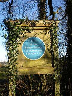
Sulloniacis or Sulloniacae is the name of a place in Roman Britain which is known only from an entry in the Antonine Itinerary, a listing of routes and facilities for the cursus publicus, the official courier service of the Roman Empire. Iter (Itinerary) II of the British section runs between Richborough (Portus Ritupis) and Chester (Deva), and this shows Sulloniacis on the road now known as Watling Street, nine Roman miles from St Albans (Verulamium) and 12 from London. Sulloniacis is usually identified with Roman remains found at Brockley Hill near Edgware in the London Borough of Barnet.[1]
Origin of the name
The name may mean 'Estate of the family/descendants of Sullonios', Sullonios being a personal name which is not known from any other source.[2] However, it could refer to a geographical feature.[1]
Other possible locations
Archaeologist Harvey Sheldon has challenged the general assumption that the Roman site at Brockley Hill is Sulloniacis. Evidence has been found there of pottery production, but modern excavations have failed to produce any evidence of mutationes (stations for changing horses) or mansiones (accommodation for official travellers). Besides, although there are great difficulties in interpreting some of the mileages in the Itineraries, Brockley Hill does seem to be too far to the north. Sheldon suggested several alternative locations, particularly Red Hill, in the vicinity of the Bald Faced Stag in Burnt Oak Broadway. The Hendon and District Archaeological Society has found Roman remains nearby.[3][4]
It is however possible that all the possible locations were within the estate called Sulloniacis, together with a possible Roman occupation site nearby on the hill at Hendon.[4]
Sulloniacis Pastures
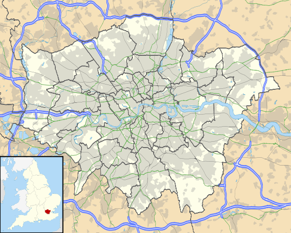
Sulloniacis Pastures is a 4.2 hectare Site of Borough Importance for Nature Conservation, Grade II, located immediately south-east of the Brockley Hill archaeological site at Grid Ref TQ176 940. The site is on grassland which slopes up eastwards from the A41 road. Located on London Clay, it has many flowers typical of clay pasture, such as greater bird's-foot-trefoil and burnet-saxifrage.[5]
See also
References
- 1 2 Sheldon, Harvey (1996). "In Search of Sulloniacis". In Bird, Joanna; Hassall, Mark; Sheldon; Harvey. Interpreting Roman London. Oxbow Books. p. 233. ISBN 1 900188 02 3.
- ↑ A.L.F. Rivet and Colin Smith, The place-names of Roman Britain. London, 1979 (reprinted by Book Club Associates, 1981).
- ↑ Sheldon, pp. 233-241
- 1 2 Pamela Taylor, ed. (1989). A Place In Time – The London Borough of Barnet up to c. 1500. Hendon and District Archaeological Society. ISBN 0950305065.
- ↑ Hewlett, Jan; et al. (1997). Nature Conservation in Barnet. London Ecology Unit. p. 67. ISBN 1 871045 27 4.
Further reading
- Applebaum, Shimon (1951). Sulloniacae, 1950: Excavations at Brockley Hill. Transactions of the London and Middlesex Archaeological Society. Bishopsgate Institute.