Sullivan Township, Ashland County, Ohio
| Sullivan Township, Ashland County, Ohio | |
|---|---|
| Township | |
|
Township Hall and fire department in Sullivan | |
 Location of Sullivan Township in Ashland County | |
| Coordinates: 41°1′46″N 82°13′21″W / 41.02944°N 82.22250°WCoordinates: 41°1′46″N 82°13′21″W / 41.02944°N 82.22250°W | |
| Country | United States |
| State | Ohio |
| County | Ashland |
| Area | |
| • Total | 25.6 sq mi (66.2 km2) |
| • Land | 25.4 sq mi (65.8 km2) |
| • Water | 0.2 sq mi (0.4 km2) |
| Elevation[1] | 1,135 ft (346 m) |
| Population (2010) | |
| • Total | 2,513 |
| • Density | 99/sq mi (38.2/km2) |
| Time zone | Eastern (EST) (UTC-5) |
| • Summer (DST) | EDT (UTC-4) |
| ZIP code | 44880 |
| Area code(s) | 419 |
| FIPS code | 39-75357[2] |
| GNIS feature ID | 1085715[1] |
| Website |
www |

Sullivan Township is one of the fifteen townships of Ashland County, Ohio, United States. As of the 2010 census the population was 2,513.[3]
Geography
Located in the northeastern corner of the county, it borders the following townships:
- Huntington Township, Lorain County - north
- Spencer Township, Medina County - northeast corner
- Homer Township, Medina County - east
- Jackson Township - southeast
- Orange Township - southwest
- Troy Township - west
- Rochester Township, Lorain County - northwest corner
No municipalities are located in Sullivan Township, although the unincorporated community of Sullivan is located in the center of the township.
Name and history
Sullivan Township was organized in 1819 as part of Medina County, and then became part of Lorain County in December 1822.[4] It was added to Ashland County when it was formed on February 24, 1846 from portions of Huron, Lorain, Richland, and Wayne counties.[5]
It is the only Sullivan Township statewide.[6]
Government
The township is governed by a three-member board of trustees, who are elected in November of odd-numbered years to a four-year term beginning on the following January 1. Two are elected in the year after the presidential election and one is elected in the year before it. There is also an elected township fiscal officer,[7] who serves a four-year term beginning on April 1 of the year after the election, which is held in November of the year before the presidential election. Vacancies in the fiscal officership or on the board of trustees are filled by the remaining trustees.
References
- 1 2 "US Board on Geographic Names". United States Geological Survey. 2007-10-25. Retrieved 2008-01-31.
- ↑ "American FactFinder". United States Census Bureau. Retrieved 2008-01-31.
- ↑ "Geographic Identifiers: 2010 Demographic Profile Data (G001): Sullivan township, Ashland County, Ohio". U.S. Census Bureau, American Factfinder. Retrieved July 8, 2013.
- ↑ Hill, George William (1863). History of Ashland County, Ohio. Williams Bros. p. 544.
- ↑ "Ashland County". Ohio History Central. Retrieved 12 March 2014.
- ↑ "Detailed map of Ohio" (PDF). United States Census Bureau. 2000. Retrieved 2007-02-16.
- ↑ §503.24, §505.01, and §507.01 of the Ohio Revised Code. Accessed 4/30/2009.
External links
Municipalities and communities of Ashland County, Ohio, United States | ||
|---|---|---|
| City | 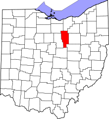 | |
| Villages | ||
| Townships | ||
| CDP | ||
| Unincorporated communities | ||
| Footnotes | ‡This populated place also has portions in an adjacent county or counties | |