Sujawal District
Sujawal (also spelled Sajawal) ( Sindhi: سجاول ; Urdu: سجاول ) is a new district of the Sindh province of Pakistan.[1] It is located at 24°36'23" of North and 68°4'19" of East[2] and is bordered in the northwest by the Indus river which separates it from Thatta District. The district has an area of 7335 km².
Administration
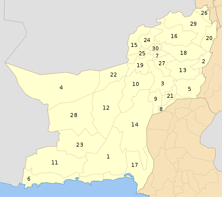
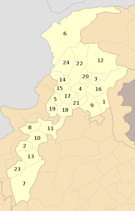
The newly formed district is being made to smooth the administrative affairs of the area. Sujawal District is subdivided into four tehsils Jaati, Bathoro, Shah Bandar and Sujawal and 30 Union Councils.[3]
History & Geography
The decision to divide Thatta District into two districts by the provincial government was made on 12 October 2013 through a notification issued by Revenue Department of Sindh. The provincial revenue department said…
A new district encompassing Sujawal, Kharochhan (barring 10 dehs), Mirpur Bathoro, Jaati and Shah Bundar tehsils (talukas) would be Sindh’s 28th district to be called Sujawal. Its headquarters will be located in Sujawal tehsil (taluka). The new district has been established under Section 6 of the Sindh Land Revenue Act, 1967. Ref> Provincial Revenue Department of Sindh Notification 12 October 2013
[4]
According to the notification the right side of Indus River will comprise old Thatta district and the left side will come under the jurisdiction of newly created Sujawal. The Thatta District (area wise among the largest districts of the province), will have half the size in its new boundaries, comprising Thatta, Mirpur Sakro, Keti Bunder and Ghorabari tehsils (talukas). And some area’s of Kharochhan tehsil (taluka) have also been included in new Thatta District. The historical city of Thatta, which was once the capital of Sindh, was carved out from Karachi as a separate city in August 1948. It was the second largest district in Sindh, in terms of area, covering over 17,335 square kilometers before recently separation into two parts. Provincial Revenue Department of Sindh Notification 12 October 2013. There are two Provincial Assembly seats Constituency PS-86 and Constituency PS-87 and one National Assembly seat Constituency NA-238 in newly formed districts Sujawal.[5][6]
Demography and languages
According to the 1998 census of Pakistan, the population of the newly formed districts Sujawal was 800,000 of which 8.93% lived in urban environments.[7][8] Sindhi is the most spoken language of the district.
Climate
This district has a moderate climate, hot in summer and cold in winter. During the peak of summer, the temperature may rise to 106 °Fahrenheit during the day, but in the winter months the minimum temperature may fall below 19 °Fahrenheit. The average rainfall in the district is 48 mm.[9][10]
See also
References
External links
Coordinates: 24°36′23″N 68°4′19″E / 24.60639°N 68.07194°E / 24.60639; 68.07194

_Districts.svg.png)


