Sublette County, Wyoming
| Sublette County, Wyoming | |
|---|---|
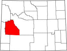 Location in the U.S. state of Wyoming | |
 Wyoming's location in the U.S. | |
| Founded | 1923 |
| Named for | William Sublette |
| Seat | Pinedale |
| Largest town | Pinedale |
| Area | |
| • Total | 4,936 sq mi (12,784 km2) |
| • Land | 4,887 sq mi (12,657 km2) |
| • Water | 49 sq mi (127 km2), 1.0% |
| Population (est.) | |
| • (2015) | 9,899 |
| • Density | 2.1/sq mi (1/km²) |
| Congressional district | At-large |
| Time zone | Mountain: UTC-7/-6 |
| Website |
www |
Sublette County is a county located in the U.S. state of Wyoming. As of the 2010 census, the population was 10,247.[1] The county seat is Pinedale.[2] It is a sparsely populated rural county in western Wyoming, along the Green River.
History
Sublette County was created February 15, 1921, with land detached from Fremont County and Lincoln County, and organized in 1923.[3] Historically, the area was important to the fur trade, and the county itself takes its name from one of Wyoming's early fur traders, William Lewis Sublette.[4] Today the county celebrates its fur trade heritage with the Museum of the Mountain Man in Pinedale.
Geography

According to the U.S. Census Bureau, the county has a total area of 4,936 square miles (12,780 km2), of which 4,887 square miles (12,660 km2) is land and 49 square miles (130 km2) (1.0%) is water.[5]
Adjacent counties
- Fremont County (east)
- Sweetwater County (southeast)
- Lincoln County (southwest)
- Teton County (northwest)
National protected areas
- Bridger National Forest (part)
- Shoshone National Forest (part)
- Teton National Forest (part)
Although the Bridger National Forest and the Teton National Forest have been administratively combined into the Bridger-Teton National Forest, it is important to note that the county contains portions of both original forests.
Demographics
| Historical population | |||
|---|---|---|---|
| Census | Pop. | %± | |
| 1930 | 1,944 | — | |
| 1940 | 2,778 | 42.9% | |
| 1950 | 2,481 | −10.7% | |
| 1960 | 3,778 | 52.3% | |
| 1970 | 3,755 | −0.6% | |
| 1980 | 4,548 | 21.1% | |
| 1990 | 4,843 | 6.5% | |
| 2000 | 5,920 | 22.2% | |
| 2010 | 10,247 | 73.1% | |
| Est. 2015 | 9,899 | [6] | −3.4% |
| U.S. Decennial Census[7] 1870–2000[8] 2010–2015[1] | |||
2000 census
As of the census[9] of 2000, there were 5,920 people, 2,371 households, and 1,707 families residing in the county. Since 2000, however, an oil boom has increased the population by at least 1,000. The population density was 1 person per square mile (0/km²). There were 3,552 housing units at an average density of 1 per square mile (0/km²). The racial makeup of the county was 97.48% White, 0.20% Black or African American, 0.49% Native American, 0.24% Asian, 0.08% Pacific Islander, 0.52% from other races, and 0.98% from two or more races. 1.89% of the population were Hispanic or Latino of any race. 21.7% were of German, 17.5% English, 11.0% American and 10.1% Irish ancestry.
There were 2,371 households out of which 32.70% had children under the age of 18 living with them, 63.30% were married couples living together, 5.30% had a female householder with no husband present, and 28.00% were non-families. 23.60% of all households were made up of individuals and 6.50% had someone living alone who was 65 years of age or older. The average household size was 2.47 and the average family size was 2.91.
In the county the population was spread out with 25.80% under the age of 18, 6.00% from 18 to 24, 27.50% from 25 to 44, 28.70% from 45 to 64, and 12.00% who were 65 years of age or older. The median age was 40 years. For every 100 females there were 104.30 males. For every 100 females age 18 and over, there were 104.50 males.
The median income for a household in the county was $39,044, and the median income for a family was $45,000. Males had a median income of $35,000 versus $21,109 for females. The per capita income for the county was $20,056. About 7.40% of families and 9.70% of the population were below the poverty line, including 10.40% of those under age 18 and 8.70% of those age 65 or over.
2010 census
As of the 2010 United States Census, there were 10,247 people, 3,906 households, and 2,594 families residing in the county.[10] The population density was 2.1 inhabitants per square mile (0.81/km2). There were 5,770 housing units at an average density of 1.2 per square mile (0.46/km2).[11] The racial makeup of the county was 93.2% white, 0.8% American Indian, 0.5% Asian, 0.3% black or African American, 3.7% from other races, and 1.4% from two or more races. Those of Hispanic or Latino origin made up 6.9% of the population.[10] In terms of ancestry, 31.8% were German, 22.0% were English, 11.3% were Irish, 6.3% were American, and 5.1% were Scottish.[12]
Of the 3,906 households, 32.0% had children under the age of 18 living with them, 56.3% were married couples living together, 5.1% had a female householder with no husband present, 33.6% were non-families, and 25.6% of all households were made up of individuals. The average household size was 2.48 and the average family size was 2.99. The median age was 38.3 years.[10]
The median income for a household in the county was $70,147 and the median income for a family was $81,389. Males had a median income of $51,125 versus $31,940 for females. The per capita income for the county was $31,433. About 2.7% of families and 4.2% of the population were below the poverty line, including 2.2% of those under age 18 and 1.1% of those age 65 or over.[13]
Government
Sublette County is managed by a county commission with three members.
In 2011, Sublette County residents petitioned voters to approve an increase in this number to five as allowed under Wyoming law. The ballot initiative passed and five commissioners were to be seated during the 2012 election cycle.[14]
In early 2012, another ballot initiative was presented to voters requesting their approval to decrease the number of county commissioners back to three even before seating the two additional commissioners. This second special election, held on May 8, 2012, returned the number of commissioners on the council back to the original number of three.[15]
Communities
Towns
Census-designated places
Unincorporated community
Media references
- In 2007, Alexandra Fuller reported on the rising crime rate, influx of roughnecks and methamphetamine, the decline in ranching, and environmental damage associated with recent oil boom. See Fuller, Alexandra Letter from Wyoming: Boomtown Blues, The New Yorker p. 35 (February 5, 2007).
- In 1965, Berton Roueché described his wonderful trip along the Green River that set out from the Circle S Ranch in Cora, Wyoming in Subletter County with the ranch's foreman Thomas Scholebo. See Roueche, Berton, Reporter at Large: Something About a River, The New Yorker p. 105 (October 23, 1965).
See also
References
- 1 2 "State & County QuickFacts". United States Census Bureau. Retrieved January 25, 2014.
- ↑ "Find a County". National Association of Counties. Retrieved 2011-06-07.
- ↑ Long, John H., ed. (2004). "Wyoming: Individual County Chronologies". Wyoming Atlas of Historical County Boundaries. The Newberry Library. Retrieved August 19, 2015.
- ↑ Urbanek, Mae (1988). Wyoming Place Names. Missoula, MT: Mountain Press Publishing Company. ISBN 0-87842-204-8.
- ↑ "2010 Census Gazetteer Files". United States Census Bureau. August 22, 2012. Retrieved August 18, 2015.
- ↑ "County Totals Dataset: Population, Population Change and Estimated Components of Population Change: April 1, 2010 to July 1, 2015". Retrieved July 2, 2016.
- ↑ "U.S. Decennial Census". United States Census Bureau. Retrieved August 18, 2015.
- ↑ "Historical Decennial Census Population for Wyoming Counties, Cities, and Towns". Wyoming Department of Administration & Information, Division of Economic Analysis. Retrieved January 25, 2014.
- ↑ "American FactFinder". United States Census Bureau. Retrieved 2011-05-14.
- 1 2 3 "DP-1 Profile of General Population and Housing Characteristics: 2010 Demographic Profile Data". United States Census Bureau. Retrieved 2016-01-12.
- ↑ "Population, Housing Units, Area, and Density: 2010 - County". United States Census Bureau. Retrieved 2016-01-12.
- ↑ "DP02 SELECTED SOCIAL CHARACTERISTICS IN THE UNITED STATES – 2006-2010 American Community Survey 5-Year Estimates". United States Census Bureau. Retrieved 2016-01-12.
- ↑ "DP03 SELECTED ECONOMIC CHARACTERISTICS – 2006-2010 American Community Survey 5-Year Estimates". United States Census Bureau. Retrieved 2016-01-12.
- ↑ "Sublette County voters expand county commission". News Article. Billings Gazette. August 2011. Retrieved 2012-05-09.
- ↑ "The Three's Have It In Sublette County". News Article. Sublette Times. May 2012. Retrieved 2012-05-09.
External links
- Socioeconomics of Sublette County
- Sublette County Travel Website
- Sublette County Chamber of Commerce
- Sublette County Government
- Pinedale Town Hall
- Big Piney Town Hall
- Area Information
| Wikimedia Commons has media related to Sublette County, Wyoming. |
 |
Teton County | | ||
| |
Fremont County | |||
| ||||
| | ||||
| Lincoln County | Sweetwater County |
Municipalities and communities of Sublette County, Wyoming, United States | ||
|---|---|---|
| Towns | | |
| CDPs | ||
| Unincorporated communities | ||
| Ghost towns | ||
Cheyenne (capital) | |
| Topics |
|
| Society |
|
| Regions | |
| Cities | |
| Counties | |
Coordinates: 42°46′N 109°55′W / 42.76°N 109.92°W