Stung Treng
| Stung Treng ស្ទឹងត្រែង Xieng Teng | |
|---|---|
| Town | |
|
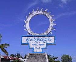
Sign at the entrance to Stung Treng | |
 Stung Treng Location of Stung Treng, Cambodia | |
| Coordinates: 13°31′N 105°58′E / 13.517°N 105.967°E | |
| Country |
|
| Province | Stung Treng Province |
| Government | |
| • Type | Town |
| Population (2009) | |
| • Total | 29,665 |
Stung Treng (Khmer: ស្ទឹងត្រែង) is the capital of Stung Treng Province, Cambodia. It is located in the western part of the Virachey National Park.[1] It is the major city (and capital) of both the district and province and has a population of 29,665 (2009). In Lao, the city's name is known as Xieng Teng.
Stung Treng is located on a high sandy bank overlooking the Mekong River, where it is joined by the Se Kong river. It lies along the National Highway 7,[2][3] about 400 km from Phnom Penh and 50 km south of the Laos border. The city has two main brides the Stung Treng Bridge on the Mekong and the Sekong bridge on the Sekong river. The population is made up of a mix of Khmer and Lao peoples. It contains a hospital, the Acleda Bank, Kong Ratana Sambath Guesthouse, Ou Dynak Red Guesthouse, Sok Sambath Hotel and Sorya Restaurant and an old settlement nearby called Thala Borivat.[1]
The city is served by Stung Treng Airport, but currently there are no regular commercial services.
Climate
| Climate data for Stung Treng | |||||||||||||
|---|---|---|---|---|---|---|---|---|---|---|---|---|---|
| Month | Jan | Feb | Mar | Apr | May | Jun | Jul | Aug | Sep | Oct | Nov | Dec | Year |
| Record high °C (°F) | 36.1 (97) |
37.2 (99) |
38.3 (100.9) |
40.6 (105.1) |
38.9 (102) |
37.2 (99) |
38.9 (102) |
38.9 (102) |
33.9 (93) |
33.9 (93) |
34.4 (93.9) |
33.9 (93) |
40.6 (105.1) |
| Average high °C (°F) | 31.1 (88) |
32.8 (91) |
34.4 (93.9) |
35.0 (95) |
32.8 (91) |
31.7 (89.1) |
30.6 (87.1) |
30.6 (87.1) |
30.0 (86) |
30.0 (86) |
30.0 (86) |
29.4 (84.9) |
31.5 (88.7) |
| Daily mean °C (°F) | 25.0 (77) |
26.7 (80.1) |
28.9 (84) |
30.0 (86) |
28.6 (83.5) |
27.8 (82) |
27.0 (80.6) |
27.2 (81) |
26.7 (80.1) |
26.4 (79.5) |
25.8 (78.4) |
24.2 (75.6) |
27.0 (80.6) |
| Average low °C (°F) | 18.9 (66) |
20.6 (69.1) |
23.3 (73.9) |
25.0 (77) |
24.4 (75.9) |
23.9 (75) |
23.3 (73.9) |
23.9 (75) |
23.3 (73.9) |
22.8 (73) |
21.7 (71.1) |
18.9 (66) |
22.5 (72.5) |
| Record low °C (°F) | 9.4 (48.9) |
11.1 (52) |
17.2 (63) |
20.0 (68) |
18.9 (66) |
19.4 (66.9) |
20.0 (68) |
19.4 (66.9) |
18.9 (66) |
17.2 (63) |
11.7 (53.1) |
10.0 (50) |
9.4 (48.9) |
| Average precipitation mm (inches) | 2.5 (0.098) |
12.7 (0.5) |
27.9 (1.098) |
83.8 (3.299) |
203.2 (8) |
276.9 (10.902) |
337.8 (13.299) |
309.9 (12.201) |
325.1 (12.799) |
188.0 (7.402) |
61.0 (2.402) |
12.7 (0.5) |
1,841 (72.48) |
| Source: Sistema de Clasificación Bioclimática Mundial[4] | |||||||||||||
References
- 1 2 Ray, Nick; Robinson, Daniel (1 August 2008). Lonely Planet Cambodia. Lonely Planet. p. 289. ISBN 978-1-74104-317-4. Retrieved 9 January 2011.
- ↑ Google Maps (Map). Google.
- ↑ Bing Maps (Map). Microsoft and Harris Corporation Earthstar Geographics LLC.
- ↑ "Stung Treng (Cambodia)" (PDF). Centro de Investigaciones Fitosociológicas. Retrieved 21 November 2016.
See also
External links
 Media related to Stung Treng (City) at Wikimedia Commons
 Stung Treng travel guide from Wikivoyage
| Capital city |  | |
|---|---|---|
| Districts | ||
| Provincial capitals | ||
|---|---|---|
| Municipal cities | ||
| Other cities | ||
Coordinates: 13°31′N 105°58′E / 13.517°N 105.967°E