Strathcona County
| Strathcona County | ||
|---|---|---|
| Specialized municipality | ||
| ||
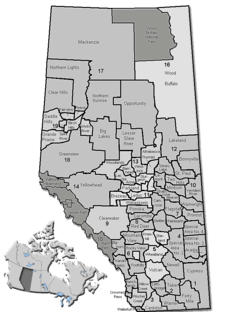 Location of Strathcona County in Alberta | ||
| Coordinates: 53°31′24″N 113°18′32″W / 53.52333°N 113.30889°WCoordinates: 53°31′24″N 113°18′32″W / 53.52333°N 113.30889°W | ||
| Country | Canada | |
| Province | Alberta | |
| Region | Edmonton Capital Region | |
| Census division | No. 11 | |
| - Municipal district | 1943 | |
| - Specialized municipality | January 1, 1996 | |
| Government[1] | ||
| • Mayor | Roxanne Carr | |
| • Governing body |
Strathcona County Council
| |
| • Commissioner | Rob Coon | |
| • Office location | Sherwood Park | |
| Area (2011)[2] | ||
| • Total | 1,180.56 km2 (455.82 sq mi) | |
| Population (2011)[2] | ||
| • Total | 92,490 | |
| • Density | 78.3/km2 (203/sq mi) | |
| • Municipal census (2015) | 95,597[3] | |
| Time zone | MST (UTC-7) | |
| • Summer (DST) | MDT (UTC-6) | |
| Website |
strathcona | |
Strathcona County is a specialized municipality in central Alberta, Canada between Edmonton and Elk Island National Park.
It is located in Division No. 11 and is also part of the Edmonton Census Metropolitan Area. More than half of the population lives in Sherwood Park, a large community east of Edmonton that has opted to retain hamlet status. Strathcona County was designated as a specialized municipality on January 1, 1996, in order to accommodate the specific needs of an area that includes both urban and rural territory.[4]
History
First officially recognized in 1893 by the territorial legislature (it was then part of the North West Territories) as Statute Labour District #2, Strathcona County has changed immensely since its inception. In 1913 Statute Labour District #2 was renamed to Local Improvement District #517 (Clover Bar), which then, in 1943, merged with Local Improvement District #518 (Strathcona) to become Municipal District #83 (Strathcona). By joining with local school divisions in 1962, Municipal District #83 officially became a county. County status was subsequently revoked in 1995 when the County Act was repealed by the provincial legislature, but was quickly returned in 1996 when the County of Strathcona #20 officially changed its name to Strathcona County and received Specialized Municipality status.[4]
On March 29, 2007, Strathcona County announced plans to create an entirely new urban community from scratch to complement Sherwood Park. This development is supposed to be more dense and pedestrian friendly, and could hold up to 200,000 people. However, opponents have pointed out that the development will destroy land of high agricultural value.[5]
Demographics
The population of Strathcona County according to its 2015 municipal census is 95,597, a 3.5% change from its 2012 municipal census population of 92,403.[3]
In the 2011 Census, Strathcona County had a population of 92,490 living in 33,129 of its 34,136 total dwellings, a 12.1% change from its 2006 population of 82,511. With a land area of 1,180.56 km2 (455.82 sq mi), it had a population density of 78.3/km2 (202.9/sq mi) in 2011.[2]
In 2006, Strathcona County had a population of 82,511 living in 29,293 dwellings, a 14.6% increase from 2001. The specialized municipality has a land area of 1,179.43 km2 (455.38 sq mi) and a population density of 70.0/km2 (181/sq mi).[6]
According to the Canada 2001 Census,[7] Strathcona County had a population of 71,986, a 12.2% increase from 1996. With a land area of 1,182.11 square kilometres (456.42 sq mi) and 24,528 dwellings, it had a population density was 60.9 persons per square kilometre in 2001.
Geography
Communities and localities
|
The following urban municipalities are surrounded by Strathcona County.
|
The following hamlets are located within Strathcona County.[9] |
The following localities are located within Strathcona County.[10]
- Localities
|
|
|
|
Government
Unlike most Albertan municipal districts, where council appoints a reeve, Strathcona County elects a mayor. Roxanne Carr was elected in 2013.
See also
- List of communities in Alberta
- Specialized municipalities of Alberta
- Strathcona County Transit
- Strathcona County Library
References
- ↑ "Municipal Officials Search". Alberta Municipal Affairs. December 16, 2016. Retrieved December 18, 2016.
- 1 2 3 "Population and dwelling counts, for Canada, provinces and territories, and census subdivisions (municipalities), 2011 and 2006 censuses (Alberta)". Statistics Canada. 2012-02-08. Retrieved 2012-02-08.
- 1 2 "Census: Strathcona County Historical Population". Strathcona County. September 4, 2015. Retrieved September 5, 2015.
- 1 2 Municipality Profile - Alberta Municipal Affairs
- ↑ New city rising
- ↑ Statistics Canada. "Canada 2006 Census: Strathcona County - Community Profile". Retrieved 2007-06-11.
- ↑ Strathcona County Community Profile - Statistics Canada. 2002. 2001 Community Profiles. Released June 27, 2002. Last modified: 2005-11-30. Statistics Canada Catalogue no. 93F0053XIE
- ↑ "Fort Saskatchewan, City (Census Subdivision), Alberta". Statistics Canada. 2012-06-20. Retrieved 2012-08-13.
- 1 2 3 4 "Specialized and Rural Municipalities and Their Communities" (PDF). Alberta Municipal Affairs. 2012-03-01. Retrieved 2012-08-11.
- ↑ "Standard Geographical Classification (SGC) 2006, Economic Regions: 4811052 - Strathcona County, geographical codes and localities, 2006". Statistics Canada. 2010-03-05. Retrieved 2012-08-11.
External links
| Wikimedia Commons has media related to Strathcona County. |
 |
City of Fort Saskatchewan | Sturgeon County | Lamont County | |
| City of Edmonton | |
Elk Island National Park | ||
| ||||
| | ||||
| Leduc County | Leduc County | Beaver County |