Strasburg, Pennsylvania
| Strasburg | |
|---|---|
| Borough | |
|
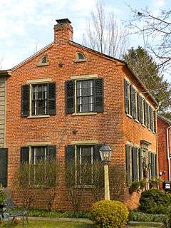
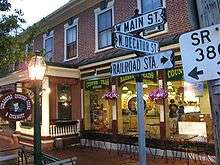
27 East Main Street, built in 1754 | |
| Etymology: Strasbourg, France | |
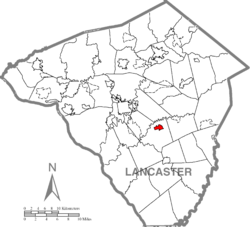 Location of Strasburg in Lancaster County | |
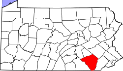
 Strasburg Location in Pennsylvania | |
| Coordinates: 39°58′56″N 76°10′58″W / 39.98222°N 76.18278°WCoordinates: 39°58′56″N 76°10′58″W / 39.98222°N 76.18278°W | |
| Country | United States |
| State | Pennsylvania |
| County | Lancaster |
| Area | |
| • Total | 1.0 sq mi (3 km2) |
| • Land | 1.0 sq mi (3 km2) |
| • Water | 0.0 sq mi (0 km2) |
| Elevation | 463 ft (141 m) |
| Population (2000) | |
| • Total | 2,800 |
| • Density | 2,800/sq mi (1,100/km2) |
| Time zone | EST (UTC-5) |
| • Summer (DST) | EDT (UTC-4) |
| ZIP code | 17579 |
| Area code(s) | 717 |
| Website | |
|
Strasburg Historic District | |
 | |
| Location | E. and W. Main, W. Miller, S. Decatur Sts., Strasburg, Pennsylvania |
| Coordinates | 39°58′51″N 76°11′15″W / 39.98083°N 76.18750°W |
| Area | 68 acres (28 ha) |
| Architect | Multiple |
| Architectural style | Georgian, Federal, German vernacular |
| NRHP Reference # | 83002258[1] |
| Added to NRHP | March 03, 1983 |

Strasburg is a borough in Lancaster County, Pennsylvania, United States. It developed as a linear village along the Great Conestoga Road, stretching about two miles along path later known as the Strasburg Road.[2] The population was 2,800 at the 2000 census. The town was named after Strasbourg in Alsace, the native home of an early settler.[3] The town is often called "Train Town USA" because of the many railroad attractions in and around town, including the Strasburg Rail Road and the Railroad Museum of Pennsylvania. Much of the movie Witness was filmed on a farm nearby. Much of the borough was listed as a historic district by the National Register of Historic Places in 1983.
History
The Old Conestoga Road was in use by 1714, and by 1750 a tavern and some log houses were built near the current site of Strasburg. Strasburg grew as the trade over the road with Philadelphia grew. By 1759, there were 32 taxable properties in the town, including about ten hotels. Many early settlers were Huguenots or Swiss or German Mennonites and several church congregations of various faiths formed during the 1760s. The first church was built in 1807 by Methodists.[4]
The Old Conestoga Road was the main path connecting Philadelphia to the west, but in 1792 the new Philadelphia and Lancaster Turnpike was built, bypassing Strasburg four miles to the north. However, in 1793 construction on the new Strasburg Road started, roughly following the old road, passing through West Chester on the way to Philadelphia. It attracted traffic because it was not a toll-road, unlike the Philadelphia Turnpike. This road later developed into PA 741.[2]
By 1815 there were 90 houses in Strasburg, about half of which were two stories, indicating a relatively well-off population. There were 53 log, 29 brick, and 4 limestone houses. About half of the log houses survive today, as well as 12 of the brick houses and all 4 of the stone houses. About 150 other houses stand in the historic district, nearly all built before 1900.[2]
Geography
Strasburg is located at 39°58′56″N 76°10′58″W / 39.98222°N 76.18278°W (39.982300, -76.182713).[5]
According to the United States Census Bureau, the borough has a total area of 1.0 square mile (2.6 km2), all of it land.
Demographics
| Historical population | |||
|---|---|---|---|
| Census | Pop. | %± | |
| 1840 | 445 | — | |
| 1850 | 880 | 97.8% | |
| 1860 | 921 | 4.7% | |
| 1870 | 1,008 | 9.4% | |
| 1880 | 1,005 | −0.3% | |
| 1890 | 918 | −8.7% | |
| 1900 | 916 | −0.2% | |
| 1910 | 885 | −3.4% | |
| 1920 | 853 | −3.6% | |
| 1930 | 975 | 14.3% | |
| 1940 | 1,706 | 75.0% | |
| 1950 | 1,890 | 10.8% | |
| 1960 | 2,081 | 10.1% | |
| 1970 | 1,897 | −8.8% | |
| 1980 | 1,999 | 5.4% | |
| 1990 | 2,568 | 28.5% | |
| 2000 | 2,800 | 9.0% | |
| 2010 | 2,809 | 0.3% | |
| Est. 2015 | 2,906 | [6] | 3.5% |
| Sources:[7][8][9] | |||
As of the census[8] of 2000, there were 2,800 people, 1,110 households, and 798 families residing in the borough. The population density was 2,714.1 people per square mile (1,049.6/km²). There were 1,135 housing units at an average density of 1,100.2 per square mile (425.5/km²). The racial makeup of the borough was 97.64% White, 0.57% African American, 0.07% Native American, 0.86% Asian, 0.11% from other races, and 0.75% from two or more races. Hispanic or Latino of any race were 0.43% of the population.
There were 1,110 households, out of which 34.9% had children under the age of 18 living with them, 61.6% were married couples living together, 6.9% had a female householder with no husband present, and 28.1% were non-families. 23.7% of all households were made up of individuals, and 9.0% had someone living alone who was 65 years of age or older. The average household size was 2.52 and the average family size was 3.02.
In the borough the population was spread out, with 25.9% under the age of 18, 7.7% from 18 to 24, 30.6% from 25 to 44, 22.3% from 45 to 64, and 13.5% who were 65 years of age or older. The median age was 36 years. For every 100 females there were 92.4 males. For every 100 females age 18 and over, there were 90.5 males.
The median income for a household in the borough was $47,821, and the median income for a family was $56,829. Males had a median income of $38,946 versus $26,424 for females. The per capita income for the borough was $23,346. About 2.0% of families and 3.2% of the population were below the poverty line, including 5.0% of those under age 18 and 3.5% of those age 65 or over.
Fire Department
The Borough of Strasburg is protected by the Strasburg Volunteer Fire Company, Lancaster County Fire Company # 5-10, Zone 5. The Volunteer Fire Department is located at 203 Franklin Street in a brand new four garage bay facility. The Volunteer Fire Department operates an apparatus fleet of one rescue engine, one engine, one quint, one tanker, and one squad.
Notable people
- John Alexander Ahl, (1813–1882), United States Congressman[10]
- David Craighead, (1924-2012), organist.
Education
The borough is in the Lampeter-Strasburg School District.
Attractions
- Strasburg Railroad
- Choo Choo Barn
- National Toy Train Museum
- Railroad Museum of Pennsylvania
- Sight & Sound Theatres
See also
References
- ↑ National Park Service (2009-03-13). "National Register Information System". National Register of Historic Places. National Park Service.
- 1 2 3 Susan M. Zacher, NRHP Nomination Form Strasburg
- ↑ "Early history". Reading Eagle. Jun 9, 1896. p. 25. Retrieved 18 October 2015.
- ↑ History, Strasburg Borough
- ↑ "US Gazetteer files: 2010, 2000, and 1990". United States Census Bureau. 2011-02-12. Retrieved 2011-04-23.
- ↑ "Annual Estimates of the Resident Population for Incorporated Places: April 1, 2010 to July 1, 2015". Retrieved July 2, 2016.
- ↑ "Census of Population and Housing". U.S. Census Bureau. Retrieved 11 December 2013.
- 1 2 "American FactFinder". United States Census Bureau. Retrieved 2008-01-31.
- ↑ "Incorporated Places and Minor Civil Divisions Datasets: Subcounty Resident Population Estimates: April 1, 2010 to July 1, 2012". Population Estimates. U.S. Census Bureau. Retrieved 11 December 2013.
- ↑ Who Was Who in America, Historical Volume, 1607-1896. Chicago: Marquis. 1963. OCLC 39715719.
External links
| Wikimedia Commons has media related to Strasburg, Pennsylvania. |
| Topics | |
|---|---|
| Lists by states |
|
| Lists by insular areas | |
| Lists by associated states | |
| Other areas | |
| |