St. Paul, Indiana
| St. Paul, Indiana | |
|---|---|
| Town | |
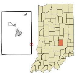 Location of St. Paul in the state of Indiana | |
| Coordinates: 39°25′42″N 85°37′45″W / 39.42833°N 85.62917°WCoordinates: 39°25′42″N 85°37′45″W / 39.42833°N 85.62917°W | |
| Country | United States |
| State | Indiana |
| Counties | Decatur, Shelby |
| Township | Adams, Noble |
| Area[1] | |
| • Total | 0.31 sq mi (0.80 km2) |
| • Land | 0.31 sq mi (0.80 km2) |
| • Water | 0 sq mi (0 km2) |
| Elevation[2] | 856 ft (261 m) |
| Population (2010)[3] | |
| • Total | 1,031 |
| • Estimate (2012[4]) | 1,038 |
| • Density | 3,325.8/sq mi (1,284.1/km2) |
| Time zone | Eastern (EST) (UTC-5) |
| • Summer (DST) | EDT (UTC-4) |
| ZIP code | 47272 |
| FIPS code | 18-67212[5] |
| GNIS feature ID | 442758 |
| Website | http://www.stpaulin.org |
St. Paul is a small town on the border of Decatur and Shelby counties in the U.S. state of Indiana.[6] The population was 1,031 at the 2010 census.
History
St. Paul had its start in the year 1853 by the building of the railroad through that territory. It was named for Jonathan Paul, a pioneer settler.[7]
An old variant name of the community was called Paultown.[8]
Geography
St. Paul is located at 39°25′42″N 85°37′45″W / 39.42833°N 85.62917°W (39.428227, -85.629222),[9] along the Flatrock River.[10]
According to the 2010 census, St. Paul has a total area of 0.31 square miles (0.80 km2), all land.[1]
Demographics
| Historical population | |||
|---|---|---|---|
| Census | Pop. | %± | |
| 1880 | 555 | — | |
| 1930 | 678 | — | |
| 1940 | 695 | 2.5% | |
| 1950 | 669 | −3.7% | |
| 1960 | 702 | 4.9% | |
| 1970 | 785 | 11.8% | |
| 1980 | 976 | 24.3% | |
| 1990 | 1,032 | 5.7% | |
| 2000 | 1,022 | −1.0% | |
| 2010 | 1,031 | 0.9% | |
| Est. 2015 | 1,050 | [11] | 1.8% |
2010 census
As of the census[3] of 2010, there were 1,031 people, 384 households, and 278 families residing in the town. The population density was 3,325.8 inhabitants per square mile (1,284.1/km2). There were 443 housing units at an average density of 1,429.0 per square mile (551.7/km2). The racial makeup of the town was 98.3% White, 0.3% African American, 0.1% Native American, 0.1% Pacific Islander, 0.3% from other races, and 1.0% from two or more races. Hispanic or Latino of any race were 1.5% of the population.
There were 384 households of which 37.2% had children under the age of 18 living with them, 50.8% were married couples living together, 14.3% had a female householder with no husband present, 7.3% had a male householder with no wife present, and 27.6% were non-families. 21.6% of all households were made up of individuals and 9.7% had someone living alone who was 65 years of age or older. The average household size was 2.68 and the average family size was 3.10.
The median age in the town was 35.7 years. 27% of residents were under the age of 18; 9.2% were between the ages of 18 and 24; 27% were from 25 to 44; 25.3% were from 45 to 64; and 11.6% were 65 years of age or older. The gender makeup of the town was 49.3% male and 50.7% female.
2000 census
As of the census[5] of 2000, there were 1,022 people, 372 households, and 286 families residing in the town. The population density was 3,314.7 people per square mile (1,272.9/km²). There were 394 housing units at an average density of 1,277.9 per square mile (490.7/km²). The racial makeup of the town was 97.95% White, 0.10% African American, 0.29% Native American, 0.20% Asian, 0.10% Pacific Islander, and 1.37% from two or more races. Hispanic or Latino of any race were 0.78% of the population.

There were 372 households out of which 44.4% had children under the age of 18 living with them, 58.6% were married couples living together, 12.1% had a female householder with no husband present, and 23.1% were non-families. 18.0% of all households were made up of individuals and 4.8% had someone living alone who was 65 years of age or older. The average household size was 2.75 and the average family size was 3.09.
In the town the population was spread out with 32.0% under the age of 18, 8.5% from 18 to 24, 31.9% from 25 to 44, 19.4% from 45 to 64, and 8.2% who were 65 years of age or older. The median age was 32 years. For every 100 females there were 94.7 males. For every 100 females age 18 and over, there were 98.6 males.
The median income for a household in the town was $39,079, and the median income for a family was $42,650. Males had a median income of $31,806 versus $20,670 for females. The per capita income for the town was $14,819. About 5.3% of families and 9.1% of the population were below the poverty line, including 10.9% of those under age 18 and 8.1% of those age 65 or over.
References
- 1 2 "G001 - Geographic Identifiers - 2010 Census Summary File 1". United States Census Bureau. Retrieved 2015-07-25.
- ↑ "US Board on Geographic Names". United States Geological Survey. 2007-10-25. Retrieved 2008-01-31.
- 1 2 "American FactFinder". United States Census Bureau. Retrieved 2012-12-11.
- ↑ "Population Estimates". United States Census Bureau. Retrieved 2013-06-25.
- 1 2 "American FactFinder". United States Census Bureau. Retrieved 2008-01-31.
- ↑ "St. Paul, Indiana". Geographic Names Information System. United States Geological Survey. Retrieved 2016-11-08.
- ↑ Harding, Lewis Albert (1915). History of Decatur County, Indiana: Its People, Industries and Institutions. B.F. Bowen. p. 106.
- ↑ "USGS detail on St. Paul - Variant Citation". Retrieved 2016-11-08.
- ↑ "US Gazetteer files: 2010, 2000, and 1990". United States Census Bureau. 2011-02-12. Retrieved 2011-04-23.
- ↑ DeLorme (1998). Indiana Atlas & Gazetteer. Yarmouth, Maine: DeLorme. ISBN 0-89933-211-0
- ↑ "Annual Estimates of the Resident Population for Incorporated Places: April 1, 2010 to July 1, 2015". Retrieved July 2, 2016.
- ↑ "Census of Population and Housing". Census.gov. Retrieved June 4, 2015.
Municipalities and communities of Decatur County, Indiana, United States | ||
|---|---|---|
| City | ||
| Towns | ||
| Townships | ||
| CDPs | ||
| Other unincorporated communities |
| |
| Ghost town | ||
| Footnotes | ‡This populated place also has portions in an adjacent county or counties | |
Municipalities and communities of Shelby County, Indiana, United States | ||
|---|---|---|
| City | ||
| Towns | ||
| Townships | ||
| CDP | ||
| Other unincorporated communities |
| |
| Footnotes | ‡This populated place also has portions in an adjacent county or counties | |