St. Michaels Historic District
|
St. Michaels Historic District | |
 | |
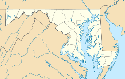  | |
| Location | Saint Michaels, Maryland |
|---|---|
| Coordinates | 38°47′4″N 76°13′24″W / 38.78444°N 76.22333°WCoordinates: 38°47′4″N 76°13′24″W / 38.78444°N 76.22333°W |
| Area | 105 acres (42 ha) |
| Built | 1778 |
| Architectural style | Italianate, Gothic Revival, Federal |
| NRHP Reference # | 86002427[1] |
| Added to NRHP | September 11, 1986 |
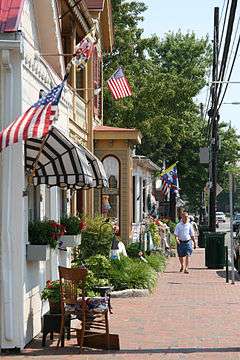
The Saint Michaels Historic District encompasses the historic center of Saint Michaels, Maryland, U.S.A. The late 18th- and early 19th-century town is a small seaport on a tributary of the Chesapeake Bay which has retained a high degree of historic integrity. Of particular interest are an unusual number of gallery-fronted houses.[2]
It was listed on the National Register of Historic Places in 1986.[1]
While writing Chesapeake, James Michener lived here, both researching for the book and experiencing life in the historic town.[3]
References
- 1 2 National Park Service (2010-07-09). "National Register Information System". National Register of Historic Places. National Park Service.
- ↑ Paul Touart (March 1986). "National Register of Historic Places Registration: St. Michaels Historic District" (PDF). Maryland Historical Trust. Retrieved 2016-03-01.
- ↑ "The Heart & Soul of the Chesapeake Bay". Boating in St. Michaels. MarinaLife. Retrieved 2008-07-19.
External links
- St. Michaels Historic District, Talbot County, including photo dated 1986, at Maryland Historical Trust
- St. Michaels Historic District Boundary Map
| Topics |   | |
|---|---|---|
| Lists by county | ||
| Lists by city | ||
| Other lists | ||
| ||
This article is issued from Wikipedia - version of the 11/27/2016. The text is available under the Creative Commons Attribution/Share Alike but additional terms may apply for the media files.