St. George, South Carolina
| St. George, South Carolina | |
|---|---|
| Town | |
|
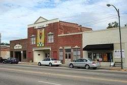
The restored Lourie Theater, Downtown St. George | |
 Location of St. George, South Carolina | |
| Coordinates: 33°11′N 80°35′W / 33.183°N 80.583°WCoordinates: 33°11′N 80°35′W / 33.183°N 80.583°W | |
| Country | United States |
| State | South Carolina |
| County | Dorchester |
| Area | |
| • Total | 2.7 sq mi (6.9 km2) |
| • Land | 2.7 sq mi (6.9 km2) |
| • Water | 0.0 sq mi (0.0 km2) |
| Elevation | 105 ft (32 m) |
| Population (2000) | |
| • Total | 2,092 |
| • Density | 779.7/sq mi (301.1/km2) |
| Time zone | Eastern (EST) (UTC-5) |
| • Summer (DST) | EDT (UTC-4) |
| FIPS code | 45-62530[1] |
| GNIS feature ID | 1250508[2] |
Saint George is a town in Dorchester County, South Carolina, United States. The population was 2,084 at the 2010 census, a loss of 8 persons from 2000. It has been the county seat of Dorchester County[3] since the latter's formation from Colleton County in 1897.
As defined by the U.S. Office of Management and Budget, and used by the U. S. Census Bureau for statistical purposes only, Saint George is included within the Charleston-North Charleston-Summerville metropolitan area.
History
The Appleby's Methodist Church, Carroll Place, and Indian Fields Methodist Campground are listed on the National Register of Historic Places.[4]
Geography
Saint George is located at 33°11′N 80°35′W / 33.183°N 80.583°W (33.1868, -80.5783).[5]
According to the United States Census Bureau, the town has a total area of 2.7 square miles (6.9 km²), all of it land.
It is located very near the crossing of Interstate 26 and Interstate 95.
World Grits Festival
In the mid-1980s, town leaders wanted to create a yearly festival for the city. After reviewing possible festival ideas, local grocery store owner John Walters discovered from contacts at Quaker Oats that the upper part of Dorchester County (where Saint George is located) consumes more grits per capita than any other place in the world. The Worlds Grits Festival was then created and has been held each year since. During the festival, which takes place in mid-April, close to 30,000 people flock to the tiny town for food, music, and games. One event includes people rolling in grits.
Demographics
| Historical population | |||
|---|---|---|---|
| Census | Pop. | %± | |
| 1880 | 279 | — | |
| 1890 | 629 | 125.4% | |
| 1900 | 576 | −8.4% | |
| 1910 | 957 | 66.1% | |
| 1920 | 1,386 | 44.8% | |
| 1930 | 1,639 | 18.3% | |
| 1940 | 1,906 | 16.3% | |
| 1950 | 1,938 | 1.7% | |
| 1960 | 1,833 | −5.4% | |
| 1970 | 1,806 | −1.5% | |
| 1980 | 2,134 | 18.2% | |
| 1990 | 2,077 | −2.7% | |
| 2000 | 2,092 | 0.7% | |
| 2010 | 2,084 | −0.4% | |
| Est. 2015 | 2,176 | [6] | 4.4% |
| U.S. Decennial Census | |||
As of the census[1] of 2000, there were 2,092 people and 804 households residing in the town. The population density was 779.7 people per square mile (301.4/km²). There were 928 housing units at an average density of 345.9 per square mile (133.7/km²). The racial makeup of the town was 51.19% White, 47.22% African American, 0.19% Native American, 0.72% Asian, 0.33% from other races, and 0.33% from two or more races. Hispanic or Latino of any race were 0.91% of the population.
There were 804 households out of which 30.2% had children under the age of 18 living with them, 42.4% were married couples living together, 19.5% had a female householder with no husband present, and 34.6% were non-families. 32.7% of all households were made up of individuals and 15.2% had someone living alone who was 65 years of age or older. The average household size was 2.36 and the average family size was 3.00.
In the town the population was spread out with 23.9% under the age of 18, 7.6% from 18 to 24, 26.6% from 25 to 44, 22.7% from 45 to 64, and 19.2% who were 65 years of age or older. The median age was 39 years. For every 100 females there were 91.8 males. For every 100 females age 18 and over, there were 87.4 males.
The median income for a household in the town was $24,651, and the median income for a family was $40,000. Males had a median income of $27,639 versus $19,957 for females. The per capita income for the town was $13,389. About 14.2% of families and 18.7% of the population were below the poverty line, including 22.2% of those under age 18 and 25.2% of those age 65 or over.
References
- 1 2 "American FactFinder". United States Census Bureau. Retrieved 2008-01-31.
- ↑ "US Board on Geographic Names". United States Geological Survey. 2007-10-25. Retrieved 2008-01-31.
- ↑ "Find a County". National Association of Counties. Retrieved 2011-06-07.
- ↑ National Park Service (2009-03-13). "National Register Information System". National Register of Historic Places. National Park Service.
- ↑ "US Gazetteer files: 2010, 2000, and 1990". United States Census Bureau. 2011-02-12. Retrieved 2011-04-23.
- ↑ "Annual Estimates of the Resident Population for Incorporated Places: April 1, 2010 to July 1, 2015". Retrieved July 2, 2016.
Municipalities and communities of Dorchester County, South Carolina, United States | ||
|---|---|---|
| City |  | |
| Towns | ||
| Unincorporated community | ||
| Ghost town | ||
| Footnotes | ‡This populated place also has portions in an adjacent county or counties | |