Srisailam Dam
| Srisailam Dam | |
|---|---|
| Location | Kurnool district, Andhra Pradesh State, And, Mahbubnagar District, Telangana State, India |
| Coordinates | 16°05′13″N 78°53′50″E / 16.08694°N 78.89722°ECoordinates: 16°05′13″N 78°53′50″E / 16.08694°N 78.89722°E |
| Construction began | 1960 |
| Opening date | 1981 |
| Dam and spillways | |
| Type of dam | Earth-fill & Gravity |
| Impounds | Krishna River |
| Height | 145.10 m (476 ft)[1][2] |
| Length | 512 m (1,680 ft) |
| Spillway capacity | 38369 cumecs |
| Reservoir | |
| Creates | Srisailam Reservoir |
| Total capacity | 216 Tmcft |
| Catchment area | 206,040 km2 (79,550 sq mi) |
| Surface area | 616 km2 (238 sq mi) |
| Power station | |
| Turbines |
6 × 150 MW (200,000 hp) reversible Francis-type (left bank) 7 × 110 MW (150,000 hp) Francis type (right bank) |
| Installed capacity | 1,670 MW (2,240,000 hp) |
The Srisailam Dam is constructed across the Krishna River on the border of Mahabubnagar District, Telangana and Kurnool district, Andhra Pradesh near Srisailam temple town and is the 2nd largest capacity working hydroelectric station in the country.[3]
The dam was constructed in a deep gorge in the Nallamala Hills in between Mahabubnagar and Kurnool districts, 300 m (980 ft) above sea level. It is 512 m (1,680 ft) long, 145 metres (476 ft) maximum height and has 12 radial crest gates. It has a reservoir of 616 square kilometres (238 sq mi). Project has an estimated live capacity to hold 178.74 Tmcft at its full reservoir level of 885 feet (270 m) MSL. The minimum draw down level (MDDL) of the reservoir is at 705 feet (215 m) MSL from its river sluice gates. The left bank underground power station houses 6 × 150 megawatts (200,000 hp) reversible Francis-pump turbines for pumped-storage operation and the right bank semi under ground power station houses 7 × 110 megawatts (150,000 hp) Francis-turbine generators.
Tail pond dam /weir located 14 km downstream of Srisailam dam is under advanced stage of construction to hold the water released by the hydro turbines and later pump back in to the Srisailam reservoir by operating the turbines in pump mode.[4] The weir portion got breached in November 2015 unable to withstand the normal water release from the hydro power stations.[5]

Project history
The Srisailam project began in 1960, initially as a power project. After several delays, the main dam was finally completed twenty years later in 1980 July 26. In the meantime the project was converted into a multipurpose facility with a generating capacity of 770 megawatts (1,030,000 hp) by its second stage which was completed in 1987. The dam is to provide water for an estimated 2,000 square kilometres (770 sq mi). Under the right bank branch canal 790 square kilometres (310 sq mi) in Kurnool and Kadapa districts will have assured irrigation. From the initial modest estimate of ₹384.7 million for a power project the total cost of the multipurpose project was estimated to cross ₹10 billion in its enlarged form. The dam has alone cost ₹4.04 billion together with the installation of four generating sets of 110 MW each. The right bank branch canal is estimated to cost ₹4.49 billion and the initial investment of ₹1.4 billion has been provided by the World Bank. The projected cost-benefit ratio of the project has been worked out at 1:1.91 at 10% interest on capital outlay.. In 1998 a coffer dam was over topped by flooding. The power house required repairs and did not generate power for a year. On 2 October 2009, Srisailam dam experienced a record inflow which threatened the dam.[6]
Irrigation schemes
Srisailam right main canal (SRMC) is constructed with 44,000 cusecs capacity at full supply level of 267.92 metres (879 ft) MSL to feed Veligodu reservoir, Brahmamsagar Reservoir, Alaganoor reservoir, Gorakallu reservoir, Owk reservoir, Gandikota reservoir, Mylavaram reservoir, Somasila resrvoir and Kandeleru reservoir. This canal also supplies water to Telugu Ganga project which supplies Krishna river water to Chennai city for its drinking purpose.[7] This main canal by feeding water to K. C. Canal, Srisailam right bank canal, Telugu Ganga canal and Galeru Nagari canal irrigates vast area in Kurnool, Kadapa, Chittor and Nellore districts.
Handri-Neeva lift canal by drawing water from the Srisailam reservoir, supplies drinking water in all the districts of Rayalaseema
Veligonda reservoir receives water by gravity through tunnels to irrigate lands in Nellore, Kadapa and Prakasam districts.
Kalwakurthy lift irrigation scheme by drawing water from the Srisailam reservoir, supplies irrigation water in Mahbubnagar and Nalgonda districts
Srisailam left bank canal receives water by gravity through tunnels to irrigate lands in Nalgonda district.
Power generation optimization
At present the initial inflows into Srisailam reservoir are stored excessively without using for power generation. The flood water fills the remaining empty Srisailam reservoir quickly and most of the flood water overflows into downstream Nagarjunasagar reservoir without being used for power generation.[8] The endeavor shall be to fill the Nagarjunasagar reservoir fully with the uniform water released through the power generating units.
 Srisailam right bank power house
 Hydroelectric station turbine
 Hydroelectric station turbine
See also
- Krishna Water Disputes Tribunal
- List of power stations in India
- List of dams and reservoirs in India
- List of hydroelectric power station failures
- Nagarjuna Sagar tail pond
References
- ↑ "India: National Register of Large Dams 2009" (PDF). Central Water Commission. Retrieved 10 July 2011.
- ↑ Jauhari, V.P. (2005). Sustaining river linking. New Delhi, India: Mittal Publications. p. 84. ISBN 817099991X.
- ↑ "Srisailam (N.S.R.S.P) Dam D00557". Retrieved 22 September 2015.
- ↑ "Srisailam Tail pond Dam". Retrieved 22 December 2015.
- ↑ "Srisailam Tail pond Dam leaked". Retrieved 22 December 2015.
- ↑ Managing historic flood in the Krishna river basin in the year 2009
- ↑ "Telugu Ganga project". Retrieved 22 September 2015.
- ↑ Optimisation of power generation from Srisailam Hydroelectric Power Station
External links
| Wikimedia Commons has media related to Srisailam Dam. |
- Large dams and conflicts in the Krishna Basin
- Six crest gates of Srisailam dam opened
- Gush of water: Water being released into the river by opening crest gates at Srisailam dam on Tuesday
| Rivers | 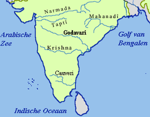 | ||||||||||||||
|---|---|---|---|---|---|---|---|---|---|---|---|---|---|---|---|
| Dams and barrages | |||||||||||||||
| Hydro power stations | |||||||||||||||
| Geographical features/regions | |||||||||||||||
| Riparian districts |
| ||||||||||||||
| Cities | |||||||||||||||
| Ores and minerals | |||||||||||||||
| Oil/gas fields | |||||||||||||||
| Industries |
| ||||||||||||||
| Transport | |||||||||||||||
| Pollution concerns, River basin's sustainable productivity & ecology |
| ||||||||||||||
| Related topics | |||||||||||||||
| Other river basins | |||||||||||||||
Dams on the Krishna River | |
|---|---|