Sparta, Kentucky
| Sparta, Kentucky | |
|---|---|
| City | |
 Location of Sparta, Kentucky | |
| Coordinates: 38°41′9″N 84°54′26″W / 38.68583°N 84.90722°WCoordinates: 38°41′9″N 84°54′26″W / 38.68583°N 84.90722°W | |
| Country | United States |
| State | Kentucky |
| Counties | Gallatin, Owen |
| Area | |
| • Total | 5.6 sq mi (14.4 km2) |
| • Land | 5.5 sq mi (14.4 km2) |
| • Water | 0.0 sq mi (0.0 km2) |
| Elevation | 509 ft (155 m) |
| Population (2000) | |
| • Total | 230 |
| • Density | 41.5/sq mi (16.0/km2) |
| Time zone | Eastern (EST) (UTC-5) |
| • Summer (DST) | EDT (UTC-4) |
| ZIP code | 41086 |
| Area code(s) | 859 |
| FIPS code | 21-72372 |
| GNIS feature ID | 0504031 |
Sparta is a city in Gallatin and Owen counties in the U.S. state of Kentucky. The population was 230 at the 2000 census.
Sparta is home to Kentucky Speedway.
Geography
Sparta is located at 38°41′9″N 84°54′26″W / 38.68583°N 84.90722°W (38.685753, -84.907136).[1]
According to the United States Census Bureau, the city has a total area of 5.6 square miles (14.4 km²), of which 5.6 square miles (14.4 km²) is land and 0.18% is water.
History
Sparta began as a village named Brock's Station in 1802, and was incorporated as a town in 1852. Sparta became a stop on the Louisville & Nashville Railroad; the CSX railroad still runs through Sparta along Eagle Creek. Interstate 71 now is one mile from the city. In 1999, The Kentucky Speedway was built to eventually host a NASCAR Sprint Cup Series race. In 2000, the Truck Series raced the inaugural race and an Xfinity Series race was held the next year. Finally in 2011, the Sprint Cup Series came and hosted their inaugural race.
Demographics
| Historical population | |||
|---|---|---|---|
| Census | Pop. | %± | |
| 1880 | 62 | — | |
| 1910 | 107 | — | |
| 1940 | 563 | — | |
| 1950 | 298 | −47.1% | |
| 1960 | 235 | −21.1% | |
| 1970 | 213 | −9.4% | |
| 1980 | 192 | −9.9% | |
| 1990 | 133 | −30.7% | |
| 2000 | 230 | 72.9% | |
| 2010 | 231 | 0.4% | |
| Est. 2015 | 266 | [2] | 15.2% |
As of the census[4] of 2000, there were 230 people, 88 households, and 63 families residing in the city. The population density was 41.5 people per square mile (16.0/km²). There were 108 housing units at an average density of 19.5 per square mile (7.5/km²). The racial makeup of the city was 96.09% White, 3.04% African American, 0.43% from other races, and 0.43% from two or more races. Hispanic or Latino of any race were 2.61% of the population.
There were 88 households out of which 31.8% had children under the age of 18 living with them, 54.5% were married couples living together, 14.8% had a female householder with no husband present, and 27.3% were non-families. 22.7% of all households were made up of individuals and 11.4% had someone living alone who was 65 years of age or older. The average household size was 2.61 and the average family size was 3.00.
In the city the population was spread out with 23.5% under the age of 18, 8.7% from 18 to 24, 33.5% from 25 to 44, 19.1% from 45 to 64, and 15.2% who were 65 years of age or older. The median age was 34 years. For every 100 females there were 109.1 males. For every 100 females age 18 and over, there were 102.3 males.
The median income for a household in the city was $27,083, and the median income for a family was $31,250. Males had a median income of $27,000 versus $16,875 for females. The per capita income for the city was $16,093. About 8.1% of families and 9.9% of the population were below the poverty line, including 3.2% of those under the age of eighteen and none of those sixty five or over.
References
- ↑ "US Gazetteer files: 2010, 2000, and 1990". United States Census Bureau. 2011-02-12. Retrieved 2011-04-23.
- ↑ "Annual Estimates of the Resident Population for Incorporated Places: April 1, 2010 to July 1, 2015". Retrieved July 2, 2016.
- ↑ "Census of Population and Housing". Census.gov. Retrieved June 4, 2015.
- ↑ "American FactFinder". United States Census Bureau. Retrieved 2008-01-31.
External links
Municipalities and communities of Gallatin County, Kentucky, United States | ||
|---|---|---|
| Cities | 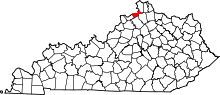 | |
| Unincorporated communities | ||
| Ghost town | ||
| Footnotes | ‡This populated place also has portions in an adjacent county or counties | |
Municipalities and communities of Owen County, Kentucky, United States | ||
|---|---|---|
| Cities | 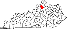 | |
| Unincorporated communities | ||
| Ghost town | ||
| Footnotes | ‡This populated place also has portions in an adjacent county or counties | |