Sparland, Illinois
| Sparland | |
| Village | |
 The historic Robert Waugh House on School Street | |
| Country | United States |
|---|---|
| State | Illinois |
| County | Marshall |
| Elevation | 469 ft (143 m) |
| Coordinates | 41°1′47″N 89°26′22″W / 41.02972°N 89.43944°WCoordinates: 41°1′47″N 89°26′22″W / 41.02972°N 89.43944°W |
| Area | 0.57 sq mi (1 km2) |
| - land | 0.57 sq mi (1 km2) |
| - water | 0.00 sq mi (0 km2) |
| Population | 406 (2010) |
| Density | 865.3/sq mi (334/km2) |
| Timezone | CST (UTC-6) |
| - summer (DST) | CDT (UTC-5) |
| Postal code | 61565 |
| Area code | 309 |
  Location of Sparland within Illinois | |
| Wikimedia Commons: Sparland, Illinois | |
Sparland is a village in Marshall County, Illinois, United States. The population was 406 at the 2010 census, down from 504 in 2000. It is part of the Peoria, Illinois Metropolitan Statistical Area.
Geography

According to the 2010 census, Sparland has a total area of 0.57 square miles (1.48 km2), all land.[1]
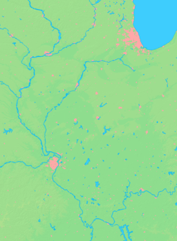
Sparland is located on the Illinois River and has a road bridge connecting to Lacon.
The west side of Sparland is located on a high bluff 175 feet above the Illinois River. From this vantage point there are beautiful views over the Illinois Valley looking east toward Lacon.
Demographics
| Historical population | |||
|---|---|---|---|
| Census | Pop. | %± | |
| 1870 | 558 | — | |
| 1880 | 375 | −32.8% | |
| 1890 | 471 | 25.6% | |
| 1900 | 459 | −2.5% | |
| 1910 | 461 | 0.4% | |
| 1920 | 437 | −5.2% | |
| 1930 | 463 | 5.9% | |
| 1940 | 509 | 9.9% | |
| 1950 | 509 | 0.0% | |
| 1960 | 534 | 4.9% | |
| 1970 | 585 | 9.6% | |
| 1980 | 624 | 6.7% | |
| 1990 | 412 | −34.0% | |
| 2000 | 504 | 22.3% | |
| 2010 | 406 | −19.4% | |
| Est. 2015 | 386 | [2] | −4.9% |
As of the census[4] of 2000, there were 504 people, 185 households, and 143 families residing in the village. The population density was 865.3 people per square mile (335.5/km²). There were 204 housing units at an average density of 350.2 per square mile (135.8/km²). The racial makeup of the village was 99.01% White, 0.40% from other races, and 0.60% from two or more races. Hispanic or Latino of any race were 1.59% of the population.
There were 185 households out of which 34.1% had children under the age of 18 living with them, 65.4% were married couples living together, 7.6% had a female householder with no husband present, and 22.2% were non-families. 18.9% of all households were made up of individuals and 7.6% had someone living alone who was 65 years of age or older. The average household size was 2.72 and the average family size was 3.04.
In the village the population was spread out with 26.2% under the age of 18, 8.9% from 18 to 24, 28.8% from 25 to 44, 21.6% from 45 to 64, and 14.5% who were 65 years of age or older. The median age was 34 years. For every 100 females there were 107.4 males. For every 100 females age 18 and over, there were 110.2 males.
The median income for a household in the village was $32,019, and the median income for a family was $36,750. Males had a median income of $24,063 versus $19,028 for females. The per capita income for the village was $13,924. About 3.7% of families and 5.8% of the population were below the poverty line, including 8.2% of those under age 18 and none of those age 65 or over.
References
- ↑ "G001 - Geographic Identifiers - 2010 Census Summary File 1". United States Census Bureau. Retrieved 2015-12-25.
- ↑ "Annual Estimates of the Resident Population for Incorporated Places: April 1, 2010 to July 1, 2015". Retrieved July 2, 2016.
- ↑ "Census of Population and Housing". Census.gov. Retrieved June 4, 2015.
- ↑ "American FactFinder". United States Census Bureau. Retrieved 2008-01-31.
Municipalities and communities of Marshall County, Illinois, United States | ||
|---|---|---|
| Cities | ||
| Villages | ||
| Townships | ||
| Unincorporated communities |
| |
| Footnotes | ‡This populated place also has portions in an adjacent county or counties | |