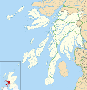
Southend, Argyll
| Southend | |
| Scottish Gaelic: Ceann mu Dheas | |
 Dunaverty |
|
 Southend |
|
| Population | 497 (2001) |
|---|---|
| OS grid reference | NR6908 |
| Civil parish | Southend |
| Council area | Argyll and Bute |
| Lieutenancy area | Argyll and Bute |
| Country | Scotland |
| Sovereign state | United Kingdom |
| Post town | CAMPBELTOWN |
| Postcode district | PA28 |
| Dialling code | 01586 |
| Police | Scottish |
| Fire | Scottish |
| Ambulance | Scottish |
| EU Parliament | Scotland |
| UK Parliament | Argyll and Bute |
| Scottish Parliament | Argyll and Bute |
Coordinates: 55°18′54″N 5°38′28″W / 55.315°N 5.641°W
Southend (Scottish Gaelic: Ceann mu Dheas, pronounced [kʲʰaunˠ̪ mə ʝes̪]) is the main settlement at the southern end of the Kintyre peninsula in Argyll and Bute, Scotland. It lies 8 miles (13 km) south of Campbeltown, the main town in the area. The civil parish of Southend comprises the village and the surrounding land, used mainly for farming and forestry. The population of the parish is 497.[1]
The community has a website at http://www.southendargyll.org.uk/ with links to the Community Council and a Facebook page.
The village is located beside Dunaverty Bay, which at one end has a rocky promontory called Dunaverty Rock, where a fort was located. It is reputed that during the Dunaverty Massacre the Catholic MacDonalds were burned alive in their stronghold at Dunaverty Castle (the trenches of this can still be seen).
The village is also reputed to be the location where Saint Columba first set foot in Scotland. On a rock near the village are two carved human footprints (Petrosomatoglyphs) called Columba's Footprints where it is claimed he first preached on Scottish soil, after being banished from Ireland.
The Antrim coast of Northern Ireland is only 12 miles away and is visible from Southend in clear weather.
Within Southend parish there is St Blaan's Church of Scotland church, primary school, National Health Service surgery (open Monday-Tuesday, Thursday-Friday), village hall, playing field, 18-hole golf course, caravan and camp-site, the Argyll Arms Hotel and the Muneroy shop and tea-room. The main employment sources are farming, forestry and tourism-related business.
Sanda Island lies two miles south-east of Southend, and can be visited on boat trips from Campbeltown.
Notable residents
- Angus MacVicar, author
References
- ↑ General Register Office for Scotland : Census 2001 : Usual Resident Population (KS01) : Argyll and Bute Retrieved 8 September 2010
| Wikimedia Commons has media related to Southend, Argyll and Bute. |