South Hackensack, New Jersey
| South Hackensack, New Jersey | |
|---|---|
| Township | |
| Township of South Hackensack | |
|
Entering South Hackensack | |
| Nickname(s): "Bergen County's Original Small Town"[1] | |
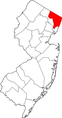
 Map highlighting South Hackensack's location within Bergen County. Inset: Bergen County's location within New Jersey. | |
 Census Bureau map of South Hackensack, New Jersey | |
| Coordinates: 40°51′53″N 74°02′53″W / 40.864785°N 74.0481°WCoordinates: 40°51′53″N 74°02′53″W / 40.864785°N 74.0481°W[2][3] | |
| Country |
|
| State |
|
| County | Bergen |
| Incorporated | November 5, 1935 |
| Government[4] | |
| • Type | Township |
| • Body | Township Committee |
| • Mayor | Gary C. Brugger (D, term ends December 31, 2016)[5][6] |
| • Clerk | Donna Gambutti[7] |
| Area[2] | |
| • Total | 0.741 sq mi (1.919 km2) |
| • Land | 0.718 sq mi (1.860 km2) |
| • Water | 0.023 sq mi (0.060 km2) 3.11% |
| Area rank |
529th of 566 in state 70th of 70 in county[2] |
| Elevation[8] | 13 ft (4 m) |
| Population (2010 Census)[9][10][11] | |
| • Total | 2,378 |
| • Estimate (2015)[12] | 2,465 |
| • Rank |
475th of 566 in state 67th of 70 in county[13] |
| • Density | 3,311.7/sq mi (1,278.7/km2) |
| • Density rank |
200th of 566 in state 41st of 70 in county[13] |
| Time zone | Eastern (EST) (UTC-5) |
| • Summer (DST) | Eastern (EDT) (UTC-4) |
| ZIP code | 07606[14][15] |
| Area code(s) | 201[16] |
| FIPS code | 3400368970[2][17][18] |
| GNIS feature ID | 0882226[2][19] |
| Website |
www |

South Hackensack is a township in Bergen County, New Jersey, United States. As of the 2010 United States Census, the township's population was 2,378,[9][10][11] reflecting an increase of 129 (+5.7%) from the 2,249 counted in the 2000 Census, which had in turn increased by 143 (+6.8%) from the 2,106 counted in the 1990 Census.[20]
South Hackensack was formed as a township by an act of the New Jersey Legislature on November 15, 1935, replacing Lodi Township, based on the results of a referendum held November 5, 1935, which passed by a margin of 309 to 15.[21][22] The township's name derives from its location relative to Hackensack.[22]
Geography
According to the United States Census Bureau, the township had a total area of 0.741 square miles (1.919 km2), including 0.718 square miles (1.860 km2) of land and 0.023 square miles (0.060 km2) of water (3.11%).[2][3]
As a result of the formation of boroughs within its previous limits, South Hackensack is split into three sections. The northeastern, primary residential section is adjacent to Hackensack, Little Ferry and Teterboro. A small section western portion is sandwiched in between Garfield, Lodi, Wallington and Wood-Ridge, while a southern sliver containing only industrial properties lies in the Meadowlands between Carlstadt, Moonachie, and Ridgefield.[23]
Along with other municipalities in the Bergen County area, South Hackensack is a suburb of New York City.
Demographics
| Historical population | |||
|---|---|---|---|
| Census | Pop. | %± | |
| 1900 | 229 | — | |
| 1910 | 693 | 202.6% | |
| 1920 | 987 | 42.4% | |
| 1930 | 1,294 | 31.1% | |
| 1940 | 1,241 | −4.1% | |
| 1950 | 1,503 | 21.1% | |
| 1960 | 1,841 | 22.5% | |
| 1970 | 2,412 | 31.0% | |
| 1980 | 2,229 | −7.6% | |
| 1990 | 2,106 | −5.5% | |
| 2000 | 2,249 | 6.8% | |
| 2010 | 2,378 | 5.7% | |
| Est. 2015 | 2,465 | [12][24] | 3.7% |
| Population sources: 1910-1920[25] 1910-1930[26] 1900-2010[27][28][29] 2000[30][31] 2010[9][10][11] | |||
2010 Census
The 2010 United States Census counted 2,378 people, 845 households, and 612.6 families residing in the township. The population density was 3,311.7 per square mile (1,278.7/km2). The township contained 879 housing units at an average density of 1,224.1 per square mile (472.6/km2). The racial makeup of the township was 72.08% (1,714) White, 5.34% (127) Black or African American, 0.34% (8) Native American, 5.30% (126) Asian, 0.00% (0) Pacific Islander, 14.05% (334) from other races, and 2.90% (69) from two or more races. Hispanics or Latinos of any race were 33.31% (792) of the population.[9]
Out of a total of 845 households, 32.3% had children under the age of 18 living with them, 49.0% were married couples living together, 16.4% had a female householder with no husband present, and 27.5% were non-families. 21.8% of all households were made up of individuals, and 10.8% had someone living alone who was 65 years of age or older. The average household size was 2.81 and the average family size was 3.28.[9]
In the township, 22.0% of the population were under the age of 18, 7.9% from 18 to 24, 28.6% from 25 to 44, 25.6% from 45 to 64, and 15.9% who were 65 years of age or older. The median age was 39.6 years. For every 100 females the census counted 95.4 males, but for 100 females at least 18 years old, it was 93.5 males.[9]
The Census Bureau's 2006-2010 American Community Survey showed that (in 2010 inflation-adjusted dollars) median household income was $70,500 (with a margin of error of +/- $9,389) and the median family income was $81,919 (+/- $8,497). Males had a median income of $55,250 (+/- $13,321) versus $33,472 (+/- $11,009) for females. The per capita income for the borough was $30,777 (+/- $2,660). About 3.4% of families and 6.0% of the population were below the poverty line, including 5.7% of those under age 18 and 1.6% of those age 65 or over.[32]
Same-sex couples headed 5 households in 2010, an increase from the 4 counted in 2000.[33]
2000 Census
As of the 2000 United States Census[17] there were 2,249 people, 811 households, and 593 families residing in the township. The population density was 3,161.2 people per square mile (1,223.0/km²). There were 830 housing units at an average density of 1,166.6 per square mile (451.4/km²). The racial makeup of the township was 82.93% White, 2.18% African American, 0.22% Native American, 5.74% Asian, 0.31% Pacific Islander, 6.31% from other races, and 2.31% from two or more races. Hispanic or Latino of any race were 15.07% of the population.[30][31]
As of the 2000 Census, 36.3% of town residents were of Italian ancestry, the 11th-highest percentage of any municipality in the United States, and fourth-highest in New Jersey, among all places with more than 1,000 residents identifying their ancestry.[34]
There were 811 households out of which 27.7% had children under the age of 18 living with them, 54.7% were married couples living together, 13.1% had a female householder with no husband present, and 26.8% were non-families. 23.1% of all households were made up of individuals and 9.7% had someone living alone who was 65 years of age or older. The average household size was 2.77 and the average family size was 3.27.[30][31]
In the township the population was spread out with 19.7% under the age of 18, 8.8% from 18 to 24, 31.4% from 25 to 44, 23.7% from 45 to 64, and 16.5% who were 65 years of age or older. The median age was 38 years. For every 100 females there were 92.7 males. For every 100 females age 18 and over, there were 90.6 males.[30][31]
The median income for a household in the township was $57,917, and the median income for a family was $66,071. Males had a median income of $39,918 versus $32,344 for females. The per capita income for the township was $27,128. About 5.2% of families and 7.1% of the population were below the poverty line, including 8.5% of those under age 18 and 6.2% of those age 65 or over.[30][31]
Government
Local government
South Hackensack is governed under the Township form of government. The five-member Township Committee is elected directly by the voters at-large in partisan elections to serve three-year terms of office on a staggered basis, with either one or two seats coming up for election each year as part of the November general election in a three-year cycle.[4][35] At an annual reorganization meeting, the Township Committee selects one of its members to serve as Mayor and another as Deputy Mayor.
As of 2016, members of the Township Committee are Mayor Gary C. Brugger (D, term on committee ends December 31, 2018; term as mayor ends 2016), Deputy Mayor Francis X. "Frank" Cagas (D, term on committee ends 2018; term as deputy mayor ends 2016), Walter Eckel Jr. (D, 2017), William Regan (D, 2017) and Vincent Stefano (R, 2016).[5][36][37][38][39][40][41]
Federal, state and county representation
South Hackensack is located in the 9th Congressional District[42] and is part of New Jersey's 36th state legislative district.[10][43][44] Prior to the 2011 reapportionment following the 2010 Census, South Hackensack had been in the 38th state legislative district.[45]
New Jersey's Ninth Congressional District is represented by Bill Pascrell (D, Paterson).[46] New Jersey is represented in the United States Senate by Cory Booker (D, Newark, term ends 2021)[47] and Bob Menendez (D, Paramus, 2019).[48][49]
For the 2016–2017 session (Senate, General Assembly), the 36th Legislative District of the New Jersey Legislature is represented in the State Senate by Paul Sarlo (D, Wood-Ridge) and in the General Assembly by Marlene Caride (D, Ridgefield) and Gary Schaer (D, Passaic).[50] The Governor of New Jersey is Chris Christie (R, Mendham Township).[51] The Lieutenant Governor of New Jersey is Kim Guadagno (R, Monmouth Beach).[52]
Bergen County is governed by a directly elected County Executive, with legislative functions performed by a seven-member Board of Chosen Freeholders.[53] As of 2015, the County Executive is James J. Tedesco III (D, Paramus; term ends December 31, 2018).[54] The seven freeholders are elected at-large in partisan elections on a staggered basis, with two or three seats coming up for election each year, with a Chairman, Vice Chairman and Chairman Pro Tempore selected from among its members at a reorganization meeting held each January.[55] Bergen County's Freeholders are Freeholder Chairwoman Joan Voss (D, 2017; Fort Lee),[56] Vice Chairman Steve Tanelli (D, 2015; North Arlington)[57] Chairman Pro Tempore John A. Felice (R, 2016; River Edge),[58] David L. Ganz (D, 2017; Fair Lawn),[59] Maura R. DeNicola (R, 2016; Franklin Lakes)[60] Thomas J. Sullivan Jr., (D, Montvale, 2015; serving the unexpired term of office that had been occupied by James Tedesco before he was sworn in as County Executive)[61][62] and Tracy Silna Zur (D, 2015; Franklin Lakes).[63][64] Countywide constitutional officials are County Clerk John S. Hogan (D, Northvale),[65] Sheriff Michael Saudino (R)[66] and Surrogate Michael R. Dressler (D, Cresskill).[67][68][53]
Politics
As of March 23, 2011, there were a total of 1,300 registered voters in South Hackensack Township, of which 302 (23.2% vs. 31.7% countywide) were registered as Democrats, 309 (23.8% vs. 21.1%) were registered as Republicans and 688 (52.9% vs. 47.1%) were registered as Unaffiliated. There was one voter registered to another party.[69] Among the township's 2010 Census population, 54.7% (vs. 57.1% in Bergen County) were registered to vote, including 70.0% of those ages 18 and over (vs. 73.7% countywide).[69][70]
In the 2012 presidential election, Democrat Barack Obama received 551 votes (57.2% vs. 54.8% countywide), ahead of Republican Mitt Romney with 389 votes (40.4% vs. 43.5%) and other candidates with 11 votes (1.1% vs. 0.9%), among the 963 ballots cast by the township's 1,368 registered voters, for a turnout of 70.4% (vs. 70.4% in Bergen County).[71][72] In the 2008 presidential election, Democrat Barack Obama received 541 votes (50.1% vs. 53.9% countywide), ahead of Republican John McCain with 512 votes (47.5% vs. 44.5%) and other candidates with 12 votes (1.1% vs. 0.8%), among the 1,079 ballots cast by the township's 1,385 registered voters, for a turnout of 77.9% (vs. 76.8% in Bergen County).[73][74] In the 2004 presidential election, Republican George W. Bush received 499 votes (49.9% vs. 47.2% countywide), ahead of Democrat John Kerry with 485 votes (48.5% vs. 51.7%) and other candidates with 8 votes (0.8% vs. 0.7%), among the 999 ballots cast by the township's 1,377 registered voters, for a turnout of 72.5% (vs. 76.9% in the whole county).[75]
In the 2013 gubernatorial election, Republican Chris Christie received 56.2% of the vote (355 cast), ahead of Democrat Barbara Buono with 37.7% (238 votes), and other candidates with 6.2% (39 votes), among the 653 ballots cast by the township's 1,343 registered voters (21 ballots were spoiled), for a turnout of 48.6%.[76][77] In the 2009 gubernatorial election, Republican Chris Christie received 333 votes (43.6% vs. 45.8% countywide), ahead of Democrat Jon Corzine with 329 votes (43.1% vs. 48.0%), Independent Chris Daggett with 34 votes (4.5% vs. 4.7%) and other candidates with 5 votes (0.7% vs. 0.5%), among the 763 ballots cast by the township's 1,351 registered voters, yielding a 56.5% turnout (vs. 50.0% in the county).[78]
Education
Public school students in pre-Kindergarten through eighth grade are served by the South Hackensack School District at Memorial School. As of the 2012-13 school year, the district's one school had an enrollment of 255 students and 19.8 classroom teachers (on an FTE basis), for a student–teacher ratio of 12.88:1.[79] Students from Teterboro attend the district's school as part of a sending/receiving relationship.[80][81]
Students attending public school for ninth through twelfth grades attend Hackensack High School as part of a sending/receiving relationship with the Hackensack Public Schools, together with students from Maywood and Rochelle Park, with approximately 80 students from South Hackensack attending the high school as of 2012.[82]
Public school students from the borough, and all of Bergen County, are eligible to attend the secondary education programs offered by the Bergen County Technical Schools, which include the Bergen County Academies in Hackensack, and the Bergen Tech campus in Teterboro or Paramus. The district offers programs on a shared-time or full-time basis, with admission based on a selective application process and tuition covered by the student's home school district.[83][84]
Transportation
Roads and highways
As of May 2010, the township had a total of 11.16 miles (17.96 km) of roadways, of which 8.57 miles (13.79 km) were maintained by the municipality, 1.60 miles (2.57 km) by Bergen County and 0.99 miles (1.59 km) by the New Jersey Department of Transportation.[85]
Interstate 80 crosses the main portion of the township,[86] while U.S. Route 46 skirts its southern border[87] and County Route 503 goes along its eastern border.[88]
Public transportation
NJ Transit provides bus service between the township and the Port Authority Bus Terminal in Midtown Manhattan on the 161 and 165 routes, to Newark on the 76 route, with local service offered on the 772 route.[89][90]
Recreation
South Hackensack is home to "School of Rock East," a musical school and venue that features pop rock and indie rock bands on a regular basis.[91]
Sources
- Municipal Incorporations of the State of New Jersey (according to Counties) prepared by the Division of Local Government, Department of the Treasury (New Jersey); December 1, 1958.
- Clayton, W. Woodford; and Nelson, William. History of Bergen and Passaic Counties, New Jersey, with Biographical Sketches of Many of its Pioneers and Prominent Men. Philadelphia: Everts and Peck, 1882.
- Harvey, Cornelius Burnham (ed.), Genealogical History of Hudson and Bergen Counties, New Jersey. New York: New Jersey Genealogical Publishing Co., 1900.
- Van Valen, James M. History of Bergen County, New Jersey. New York: New Jersey Publishing and Engraving Co., 1900.
- Westervelt, Frances A. (Frances Augusta), 1858-1942, History of Bergen County, New Jersey, 1630-1923, Lewis Historical Publishing Company, 1923.
References
- ↑ Kuperinsky, Amy. "'The Jewel of the Meadowlands'?: N.J.'s best, worst and weirdest town slogans", NJ Advance Media for NJ.com, January 22, 2015. Accessed July 12, 2016. "South Hackensack, tucked at the south end of Hackensack between Little Ferry and Teterboro, and scattered throughout Southern Bergen County as a result of some advanced Boroughitis, is known as 'Bergen County's Original Small Town,' though there's no signs."
- 1 2 3 4 5 6 2010 Census Gazetteer Files: New Jersey County Subdivisions, United States Census Bureau. Accessed May 21, 2015.
- 1 2 US Gazetteer files: 2010, 2000, and 1990, United States Census Bureau. Accessed September 4, 2014.
- 1 2 2012 New Jersey Legislative District Data Book, Rutgers University Edward J. Bloustein School of Planning and Public Policy, March 2013, p. 160.
- 1 2 Township Committee Members, Township of South Hackensack. Accessed June 17, 2016.
- ↑ 2016 New Jersey Mayors Directory, New Jersey Department of Community Affairs. Accessed June 14, 2016.
- ↑ Clerk's Office, Township of South Hackensack. Accessed July 21, 2013.
- ↑ U.S. Geological Survey Geographic Names Information System: Township of South Hackensack, Geographic Names Information System. Accessed March 14, 2013.
- 1 2 3 4 5 6 DP-1 - Profile of General Population and Housing Characteristics: 2010 for South Hackensack township, Bergen County, New Jersey, United States Census Bureau. Accessed March 16, 2013.
- 1 2 3 4 Municipalities Grouped by 2011-2020 Legislative Districts, New Jersey Department of State, p. 14. Accessed January 6, 2013.
- 1 2 3 Profile of General Demographic Characteristics: 2010 for South Hackensack township, New Jersey Department of Labor and Workforce Development. Accessed March 16, 2013.
- 1 2 PEPANNRES - Annual Estimates of the Resident Population: April 1, 2010 to July 1, 2015 - 2015 Population Estimates for New Jersey municipalities, United States Census Bureau. Accessed May 22, 2016.
- 1 2 GCT-PH1 Population, Housing Units, Area, and Density: 2010 - State -- County Subdivision from the 2010 Census Summary File 1 for New Jersey, United States Census Bureau. Accessed March 16, 2013.
- ↑ Look Up a ZIP Code for South Hackensack, NJ, United States Postal Service. Accessed February 5, 2012.
- ↑ Zip Codes, State of New Jersey. Accessed November 5, 2013.
- ↑ Area Code Lookup - NPA NXX for Sea Isle City, NJ, Area-Codes.com. Accessed November 5, 2013.
- 1 2 American FactFinder, United States Census Bureau. Accessed September 4, 2014.
- ↑ A Cure for the Common Codes: New Jersey, Missouri Census Data Center. Accessed October 30, 2012.
- ↑ US Board on Geographic Names, United States Geological Survey. Accessed September 4, 2014.
- ↑ Table 7. Population for the Counties and Municipalities in New Jersey: 1990, 2000 and 2010, New Jersey Department of Labor and Workforce Development, February 2011. Accessed March 3, 2013.
- ↑ Snyder, John P. The Story of New Jersey's Civil Boundaries: 1606-1968, Bureau of Geology and Topography; Trenton, New Jersey; 1969. p. 87. Accessed February 5, 2012.
- 1 2 Staff. "Lodi Town Changes Name To South Hackensack", The New York Times, November 7, 1935. Accessed October 7, 2015. "As the name indicates, South Hackensack is directly south of Hackensack, the county seat of Bergen County."
- ↑ Walter Eckel Jr., MapIt. Accessed January 10, 2015.
- ↑ Census Estimates for New Jersey April 1, 2010 to July 1, 2015, United States Census Bureau. Accessed May 22, 2016.
- ↑ Compendium of censuses 1726-1905: together with the tabulated returns of 1905, New Jersey Department of State, 1906. Accessed November 5, 2013. Data for these two years is from Lodi Township.
- ↑ Fifteenth Census of the United States : 1930 - Population Volume I, United States Census Bureau, p. 714. Accessed February 5, 2012.
- ↑ Table 6. New Jersey Resident Population by Municipality: 1930 - 1990, New Jersey Department of Labor and Workforce Development. Accessed February 5, 2012.
- ↑ Bergen County Data Book 2003, Bergen County, New Jersey. Accessed July 21, 2013. Note: This report shows population of 673 in 1910 (vs. 193 shown in 1930 Census report for that year). Data for years prior to formation of Township had been calculated via extrapolation.
- ↑ Historical Population Trends in Bergen County (1900-2010), Bergen County Department of Planning & Economic Development, 2011. Accessed November 5, 2013. Data for years prior to the township's formation were extrapolated by county analysts. Data for 1910 and 1920 is for Lodi Township.
- 1 2 3 4 5 Census 2000 Profiles of Demographic / Social / Economic / Housing Characteristics for South Hackensack township, Bergen County, New Jersey, United States Census Bureau. Accessed March 16, 2013.
- 1 2 3 4 5 DP-1: Profile of General Demographic Characteristics: 2000 - Census 2000 Summary File 1 (SF 1) 100-Percent Data for South Hackensack township, Bergen County, New Jersey, United States Census Bureau. Accessed March 16, 2013.
- ↑ DP03: Selected Economic Characteristics from the 2006-2010 American Community Survey 5-Year Estimates for South Hackensack township, Bergen County, New Jersey, United States Census Bureau. Accessed February 5, 2012.
- ↑ Lipman, Harvy; and Sheingold, Dave. "North Jersey sees 30% growth in same-sex couples", The Record (Bergen County), August 14, 2011, backed up by the Internet Archive as of February 3, 2013. Accessed October 26, 2014.
- ↑ Italian Communities, EPodunk. Accessed June 9, 2007.
- ↑ "Forms of Municipal Government in New Jersey", p. 7. Rutgers University Center for Government Studies. Accessed June 3, 2015.
- ↑ 2016 Municipal User Friendly Budget, Township of South Hackensack. Accessed June 17, 2016.
- ↑ 2016 County and Municipal Directory, Bergen County, New Jersey. Accessed June 17, 2016.
- ↑ Bergen County Statement of Vote November 3, 2015 General Election, Bergen County, New Jersey Clerk, December 2, 2015. Accessed March 21, 2016.
- ↑ Bergen County Statement of Vote BER_20141104_E, Bergen County Clerk, December 16, 2014. Accessed January 10, 2015.
- ↑ Bergen County Statement of Vote General Election 2013, Bergen County Clerk, November 5, 2013. Accessed January 10, 2015.
- ↑ Reorganization Meeting Minutes, Township of South Hackensack, January 2, 2012. Accessed February 4, 2012.
- ↑ Plan Components Report, New Jersey Redistricting Commission, December 23, 2011. Accessed January 6, 2013.
- ↑ 2016 New Jersey Citizen's Guide to Government, p. 64, New Jersey League of Women Voters. Accessed July 20, 2016.
- ↑ Districts by Number for 2011-2020, New Jersey Legislature. Accessed January 6, 2013.
- ↑ 2011 New Jersey Citizen's Guide to Government, p. 64, New Jersey League of Women Voters. Accessed May 22, 2015.
- ↑ Directory of Representatives: New Jersey, United States House of Representatives. Accessed January 5, 2012.
- ↑ About Cory Booker, United States Senate. Accessed January 26, 2015. "He now owns a home and lives in Newark's Central Ward community."
- ↑ Biography of Bob Menendez, United States Senate, January 26, 2015. "He currently lives in Paramus and has two children, Alicia and Robert."
- ↑ Senators of the 114th Congress from New Jersey. United States Senate. Accessed January 26, 2015. "Booker, Cory A. - (D - NJ) Class II; Menendez, Robert - (D - NJ) Class I"
- ↑ Legislative Roster 2016-2017 Session, New Jersey Legislature. Accessed January 17, 2016.
- ↑ "About the Governor". State of New Jersey. Retrieved 2010-01-21.
- ↑ "About the Lieutenant Governor". State of New Jersey. Retrieved 2010-01-21.
- 1 2 2014 Bergen County Directory, p. 10, Bergen County, New Jersey. Accessed May 26, 2015.
- ↑ County Executive, Bergen County, New Jersey. Accessed May 26, 2015.
- ↑ Freeholders, Bergen County, New Jersey. Accessed May 26, 2015.
- ↑ Chairwoman Joan M. Voss, Bergen County, New Jersey. Accessed May 26, 2015.
- ↑ Vice Chairman Steven Tanelli, Bergen County, New Jersey. Accessed May 26, 2015.
- ↑ Chairman Pro Tempore John A. Felice, Bergen County, New Jersey. Accessed May 26, 2015.
- ↑ Freeholder David L. Ganz, Bergen County, New Jersey. Accessed May 26, 2015.
- ↑ Freeholder Maura R. DeNicola, Bergen County, New Jersey. Accessed May 26, 2015.
- ↑ Freeholder Thomas J. Sullivan, Bergen County, New Jersey. Accessed May 26, 2015.
- ↑ Ensslin, John C. "Labor leader Thomas J. Sullivan Jr. takes oath to fill Bergen County freeholder vacancy", The Record (Bergen County), January 28, 2015. Accessed January 28, 2015. "Bergen County’s newest freeholder, labor leader Thomas J. Sullivan Jr., was sworn in Wednesday, vowing to 'listen to everyone’s voice'.... He would next have to run in the November election to serve the last remaining year on Tedesco’s three-year term."
- ↑ Tracy Silna Zur, Bergen County, New Jersey. Accessed May 26, 2015.
- ↑ Freeholder Board, Bergen County, New Jersey. Accessed May 26, 2015.
- ↑ About the Clerk, Bergen County Clerk. Accessed May 26, 2015.
- ↑ About Sheriff Michael Saudino, Bergen County Sheriff's Office. Accessed May 26, 2015.
- ↑ Michael R. Dressler, Bergen County Surrogate's Court. Accessed May 26, 2015.
- ↑ Constitutional Officers, Bergen County, New Jersey. Accessed May 26, 2015.
- 1 2 Voter Registration Summary - Bergen, New Jersey Department of State Division of Elections, March 23, 2011. Accessed December 17, 2013.
- ↑ GCT-P7: Selected Age Groups: 2010 - State -- County Subdivision; 2010 Census Summary File 1 for New Jersey, United States Census Bureau. Accessed December 17, 2013.
- ↑ Presidential November 6, 2012 General Election Results - Bergen County, New Jersey Department of State Division of Elections, March 15, 2013. Accessed December 17, 2013.
- ↑ Number of Registered Voters and Ballots Cast November 6, 2012 General Election Results - Bergen County, New Jersey Department of State Division of Elections, March 15, 2013. Accessed December 17, 2013.
- ↑ 2008 Presidential General Election Results: Bergen County, New Jersey Department of State Division of Elections, December 23, 2008. Accessed December 17, 2013.
- ↑ 2008 General Election Results for South Hackensack, The Record (Bergen County). Accessed February 5, 2012.
- ↑ 2004 Presidential Election: Bergen County, New Jersey Department of State Division of Elections, December 13, 2004. Accessed December 17, 2013.
- ↑ "Governor - Bergen County" (PDF). New Jersey Department of Elections. January 29, 2014. Retrieved December 24, 2014.
- ↑ "Number of Registered Voters and Ballots Cast - November 5, 2013 - General Election Results - Bergen County" (PDF). New Jersey Department of Elections. January 29, 2014. Retrieved December 24, 2014.
- ↑ 2009 Governor: Bergen County, New Jersey Department of State Division of Elections, December 31, 2009. Accessed December 17, 2013.
- ↑ District information for South Hackensack School District, National Center for Education Statistics. Accessed March 9, 2015.
- ↑ Staff. "GUIDE TO SCHOOL ELECTIONS -- TETERBORO", The Record (Bergen County), April 4, 2001. Accessed September 4, 2008. "Teterboro sends its students to South Hackensack schools and has a three-member board that prepares its annual school budget."
- ↑ Gavin, John A. "Teterboro residents vote to exceed state cap on tax levy", The Record (Bergen County), April 30, 2010. Accessed November 5, 2013. "The district has no schools of its own and sends its students to South Hackensack through eighth grade and to Hasbrouck Heights High School."
- ↑ Tarrazi, Alexis. "Agreement reached between Maywood, Hackensack", Hackensack Chronicle, March 9, 2012. Accessed November 5, 2013. "The Maywood school district has been sending its students to Hackensack High School for decades and currently sends 250 students. The high school also serves about 120 students from Rochelle Park and 80 students from South Hackensack, according to The Record."
- ↑ About Us, Bergen County Technical Schools. Accessed December 17, 2013.
- ↑ Admissions, Bergen County Technical Schools. Accessed December 17, 2013.
- ↑ Bergen County Mileage by Municipality and Jurisdiction, New Jersey Department of Transportation, May 2010. Accessed November 5, 2013.
- ↑ U.S. Route 46 Straight Line Diagram, New Jersey Department of Transportation, March 2010. Accessed November 5, 2013.
- ↑ Interstate 80 Straight Line Diagram, New Jersey Department of Transportation, March 2010. Accessed November 5, 2013.
- ↑ County Route 503 Straight Line Diagram, New Jersey Department of Transportation, October 2006. Accessed November 5, 2013.
- ↑ Bergen County Bus / Rail Connections, NJ Transit, backed up by the Internet Archive as of January 11, 2010. Accessed November 5, 2013.
- ↑ Bergen County System Map, NJ Transit. Accessed September 14, 2016.
- ↑ Home Page, School of Rock East. Accessed November 5, 2013.
External links
- South Hackensack Township official website
- South Hackensack School District's 2014–15 School Report Card from the New Jersey Department of Education
- School Data for the South Hackensack School District, National Center for Education Statistics