South Dos Palos, California
| South Dos Palos | |
|---|---|
| census-designated place | |
 Location in Merced County and the state of California | |
 South Dos Palos Location in the United States | |
| Coordinates: 36°57′52″N 120°39′12″W / 36.96444°N 120.65333°WCoordinates: 36°57′52″N 120°39′12″W / 36.96444°N 120.65333°W | |
| Country |
|
| State |
|
| County | Merced |
| Area[1] | |
| • Total | 1.535 sq mi (3.975 km2) |
| • Land | 1.535 sq mi (3.975 km2) |
| • Water | 0 sq mi (0 km2) 0% |
| Elevation[2] | 118 ft (36 m) |
| Population (2010) | |
| • Total | 1,620 |
| • Density | 1,100/sq mi (410/km2) |
| Time zone | Pacific (PST) (UTC-8) |
| • Summer (DST) | PDT (UTC-7) |
| ZIP code | 93665 |
| Area code(s) | 209 |
| FIPS code | 06-72954 |
| GNIS feature ID | 0234957 |
South Dos Palos (formerly, Dos Palos Station)[3] is a census-designated place (CDP) in Merced County, California, United States. South Dos Palos is located 2 miles (3.2 km) southwest of Dos Palos,[3] at an elevation of 118 feet (36 m).[2] The population was 1,620 at the 2010 census, up from 1,385 at the 2000 census.
Geography
South Dos Palos is located at 36°57′52″N 120°39′12″W / 36.96444°N 120.65333°W.[2]
According to the United States Census Bureau, the CDP has a total area of 1.5 square miles (3.9 km2), all of it land.
History
The South Dos Palos post office opened in 1906.[3]
Demographics
2010
The 2010 United States Census[4] reported that South Dos Palos had a population of 1,620. The population density was 1,055.6 people per square mile (407.6/km²). The racial makeup of South Dos Palos was 809 (49.9%) White, 135 (8.3%) African American, 21 (1.3%) Native American, 36 (2.2%) Asian, 10 (0.6%) Pacific Islander, 552 (34.1%) from other races, and 57 (3.5%) from two or more races. Hispanic or Latino of any race were 1,262 persons (77.9%).
The Census reported that 1,620 people (100% of the population) lived in households, 0 (0%) lived in non-institutionalized group quarters, and 0 (0%) were institutionalized.
There were 426 households, out of which 257 (60.3%) had children under the age of 18 living in them, 228 (53.5%) were opposite-sex married couples living together, 106 (24.9%) had a female householder with no husband present, 36 (8.5%) had a male householder with no wife present. There were 36 (8.5%) unmarried opposite-sex partnerships, and 2 (0.5%) same-sex married couples or partnerships. 47 households (11.0%) were made up of individuals and 14 (3.3%) had someone living alone who was 65 years of age or older. The average household size was 3.80. There were 370 families (86.9% of all households); the average family size was 4.02.
The population was spread out with 601 people (37.1%) under the age of 18, 197 people (12.2%) aged 18 to 24, 403 people (24.9%) aged 25 to 44, 315 people (19.4%) aged 45 to 64, and 104 people (6.4%) who were 65 years of age or older. The median age was 25.8 years. For every 100 females there were 100.5 males. For every 100 females age 18 and over, there were 99.4 males.
There were 488 housing units at an average density of 318.0 per square mile (122.8/km²), of which 242 (56.8%) were owner-occupied, and 184 (43.2%) were occupied by renters. The homeowner vacancy rate was 3.5%; the rental vacancy rate was 10.7%. 966 people (59.6% of the population) lived in owner-occupied housing units and 654 people (40.4%) lived in rental housing units.
2000
As of the census[5] of 2000, there were 1,385 people, 342 households, and 286 families residing in the CDP. The population density was 922.0 people per square mile (356.5/km²). There were 365 housing units at an average density of 243.0 per square mile (94.0/km²). The racial makeup of the CDP was 45.78% White, 16.03% African American, 1.95% Native American, 31.62% from other races, and 4.62% from two or more races. Hispanic or Latino of any race were 74.15% of the population.
There were 342 households out of which 55.8% had children under the age of 18 living with them, 52.0% were married couples living together, 24.3% had a female householder with no husband present, and 16.1% were non-families. 13.2% of all households were made up of individuals and 7.3% had someone living alone who was 65 years of age or older. The average household size was 4.05 and the average family size was 4.41.
In the CDP the population was spread out with 41.7% under the age of 18, 11.9% from 18 to 24, 25.4% from 25 to 44, 14.1% from 45 to 64, and 6.9% who were 65 years of age or older. The median age was 23 years. For every 100 females there were 91.8 males. For every 100 females age 18 and over, there were 90.8 males.
The median income for a household in the CDP was $18,500, and the median income for a family was $23,365. Males had a median income of $20,417 versus $12,357 for females. The per capita income for the CDP was $7,170. About 44.6% of families and 42.2% of the population were below the poverty line, including 48.0% of those under age 18 and 14.5% of those age 65 or over.
Politics
In the state legislature South Dos Palos is located in the 12th Senate District, represented by Republican Anthony Cannella, and in the 17th Assembly District, represented by Democrat Cathleen Galgiani.
In the United States House of Representatives, South Dos Palos is in California's 16th congressional district, represented by Democrat Jim Costa.[6]
References
- ↑ "2010 Census U.S. Gazetteer Files – Places – California". United States Census Bureau.
- 1 2 3 U.S. Geological Survey Geographic Names Information System: South Dos Palos, California
- 1 2 3 Durham, David L. (1998). California's Geographic Names: A Gazetteer of Historic and Modern Names of the State. Clovis, Calif.: Word Dancer Press. p. 830. ISBN 1-884995-14-4.
- ↑ "2010 Census Interactive Population Search: CA - South Dos Palos CDP". U.S. Census Bureau. Retrieved July 12, 2014.
- ↑ "American FactFinder". United States Census Bureau. Retrieved 2008-01-31.
- ↑ "California's 16th Congressional District - Representatives & District Map". Civic Impulse, LLC. Retrieved October 1, 2014.
Municipalities and communities of Merced County, California, United States | ||
|---|---|---|
| Cities | 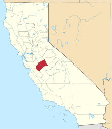 | |
| CDPs | ||
| Unincorporated communities | ||
| Ghost towns |
| |