Smithills
| Smithills | |
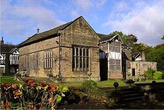 Smithills Hall |
|
 Smithills |
|
| OS grid reference | SD695121 |
|---|---|
| – London | 221.6 mi (356.6 km) NW |
| Metropolitan borough | Bolton |
| Metropolitan county | Greater Manchester |
| Region | North West |
| Country | England |
| Sovereign state | United Kingdom |
| Post town | BOLTON |
| Postcode district | BL1 |
| Dialling code | 01204 |
| Police | Greater Manchester |
| Fire | Greater Manchester |
| Ambulance | North West |
| EU Parliament | North West England |
| UK Parliament | Bolton West |
|
|
Coordinates: 53°36′17″N 2°27′44″W / 53.604657°N 2.462251°W
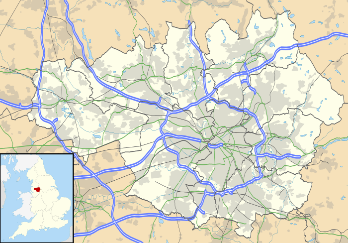
Smithills is a mainly residential suburb of Bolton in Greater Manchester, England. It is 3.1 miles (5 km) northwest of Bolton, 14.5 miles (23 km) south of Blackburn and 17.9 miles (29 km) northwest of Manchester.[1] Smithills lies on the lower south facing slopes of the West Pennine Moors.
Toponymy
The name Smithills derives from the Old English smeþe meaning smooth and hyll, a hill and was recorded as Smythell in 1322.[2]
History
Lying within the boundaries of the historic county of Lancashire since the early 12th century, Smithills was anciently a manor in the township of Halliwell with Smithills Hall as the manor house.[3] In 1877, the south-eastern area of Halliwell became the ninth electoral wards of the County Borough of Bolton.[3][4] The remaining north-western area became known as Halliwell Higher End until 1894 when it changed its name to Smithills and became one of the civil parishes of the Bolton Rural District, but it too became part of the County Borough of Bolton in 1898.[3][4]
Governance
Since 1974, Smithills has been part of the Metropolitan Borough of Bolton and gives its name to one of Bolton Council's electoral wards, the Smithills ward which includes Barrow Bridge, Delph Hill, Doffcocker, Johnson Fold, Moss Bank Park, and Smithills Moor. It is represented in Bolton Town Hall by three councillors: Carole Swarbrick (Lib Dem) since 1996, Roger Hayes (Lib Dem) since 1998, and Andrew Martin (Lib Dem) since 2014.[5] At the United Kingdom Census 2011, the ward had a population of 14,011.[6] The ward is also part of the Bolton West constituency and has been represented in the House of Commons by the Conservative Party MP Chris Green since 2015.
Education
Smithills has two schools: St Peter's Smithills Dean Church of England Primary School for pupils aged 4–11 and Smithills School, a mixed secondary school for pupils aged 11–16.
References
- ↑ "AA Route Planner". The AA. Retrieved 7 August 2016.
- ↑ Mills, David (1976). The Placenames of Lancashire. Batsford. p. 134. ISBN 0-7134-5236-6.
- 1 2 3 Farrer, William; Brownbill, J., eds. (1911). "Township: Halliwell". A History of the County of Lancaster. Victoria County History. Volume 5. British History Online. pp. 12–20. Retrieved 7 August 2016.
- 1 2 "Greater Manchester Gazetteer". Greater Manchester County Record Office. Place names – G to H. Archived from the original on 18 July 2011. Retrieved 7 August 2016.
- ↑ "Elected Members". Bolton Council. Retrieved 1 August 2016.
- ↑ "Area: Smithills (Ward)". Neighbourhood Statistics. Office for National Statistics. Key Figures for 2011 Census: Key Statistics. Retrieved 7 August 2016.